Ackley Topo Map Iowa
To zoom in, hover over the map of Ackley
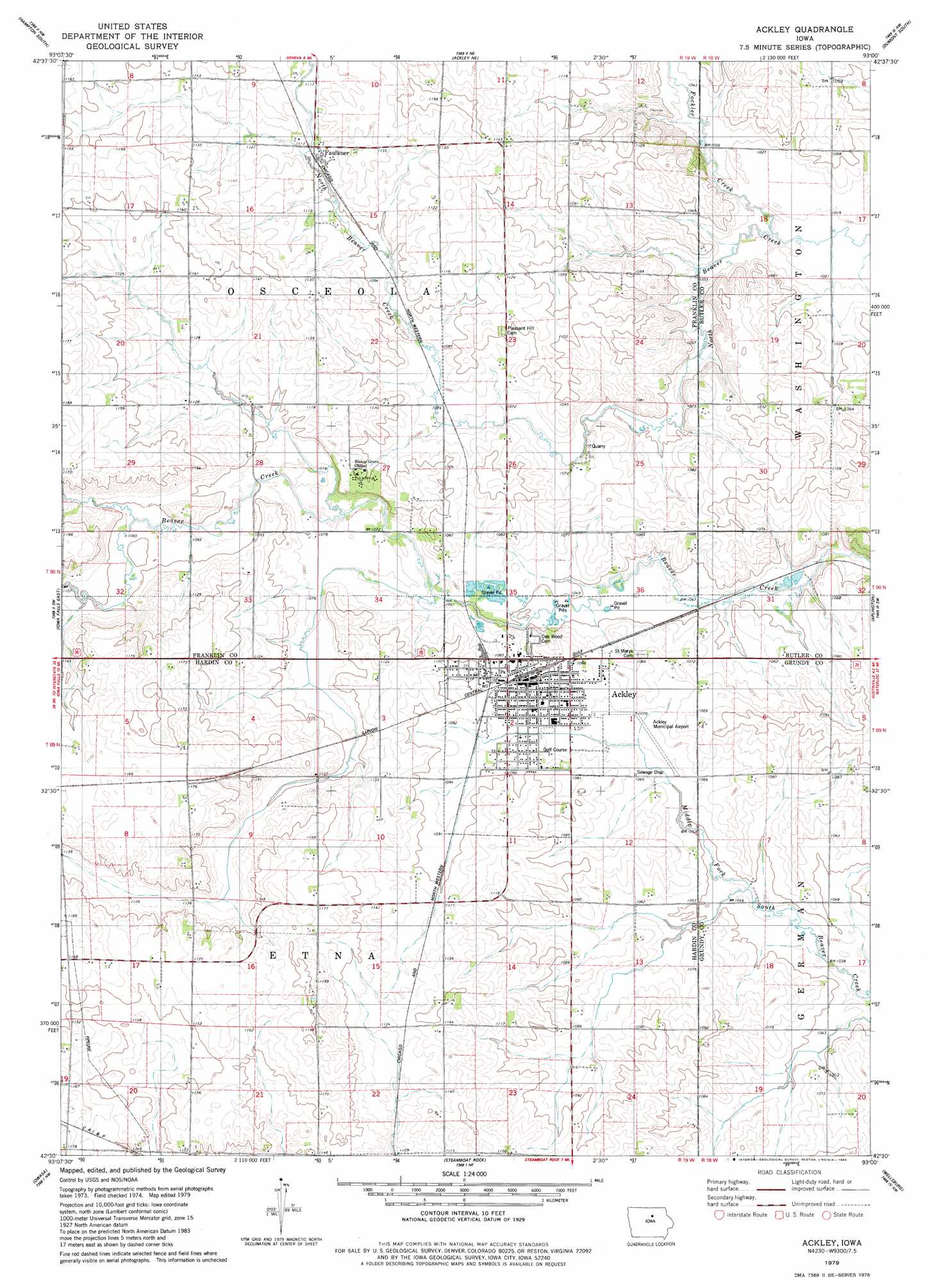
USGS Topo Quad 42093e1 - 1:24,000 scale
| Topo Map Name: | Ackley |
| USGS Topo Quad ID: | 42093e1 |
| Print Size: | ca. 21 1/4" wide x 27" high |
| Southeast Coordinates: | 42.5° N latitude / 93° W longitude |
| Map Center Coordinates: | 42.5625° N latitude / 93.0625° W longitude |
| U.S. State: | IA |
| Filename: | o42093e1.jpg |
| Download Map JPG Image: | Ackley topo map 1:24,000 scale |
| Map Type: | Topographic |
| Topo Series: | 7.5´ |
| Map Scale: | 1:24,000 |
| Source of Map Images: | United States Geological Survey (USGS) |
| Alternate Map Versions: |
Ackley IA 1979, updated 1980 Download PDF Buy paper map Ackley IA 2010 Download PDF Buy paper map Ackley IA 2013 Download PDF Buy paper map Ackley IA 2015 Download PDF Buy paper map |
1:24,000 Topo Quads surrounding Ackley
Latimer |
Hampton North |
Hansell |
Dumont North |
Allison |
Coulter |
Hampton South |
Ackley Ne |
Dumont South |
Butler Center |
Iowa Falls West |
Iowa Falls East |
Ackley |
Aplington |
Parkersburg |
Buckeye East |
Owasa |
Steamboat Rock |
Wellsburg |
Holland |
Hubbard |
New Providence |
Eldora |
Ivester |
Grundy Center |
> Back to 42093e1 at 1:100,000 scale
> Back to 42092a1 at 1:250,000 scale
> Back to U.S. Topo Maps home
Ackley topo map: Gazetteer
Ackley: Airports
Ackley Municipal Airport elevation 323m 1059′Ackley: Parks
Prairie Bridges Park elevation 321m 1053′Ackley: Populated Places
Ackley elevation 333m 1092′Faulkner elevation 339m 1112′
Ackley: Post Offices
Ackley Post Office elevation 333m 1092′Faulkner Post Office (historical) elevation 339m 1112′
Ackley: Streams
Fockler Creek elevation 310m 1017′Ackley digital topo map on disk
Buy this Ackley topo map showing relief, roads, GPS coordinates and other geographical features, as a high-resolution digital map file on DVD: