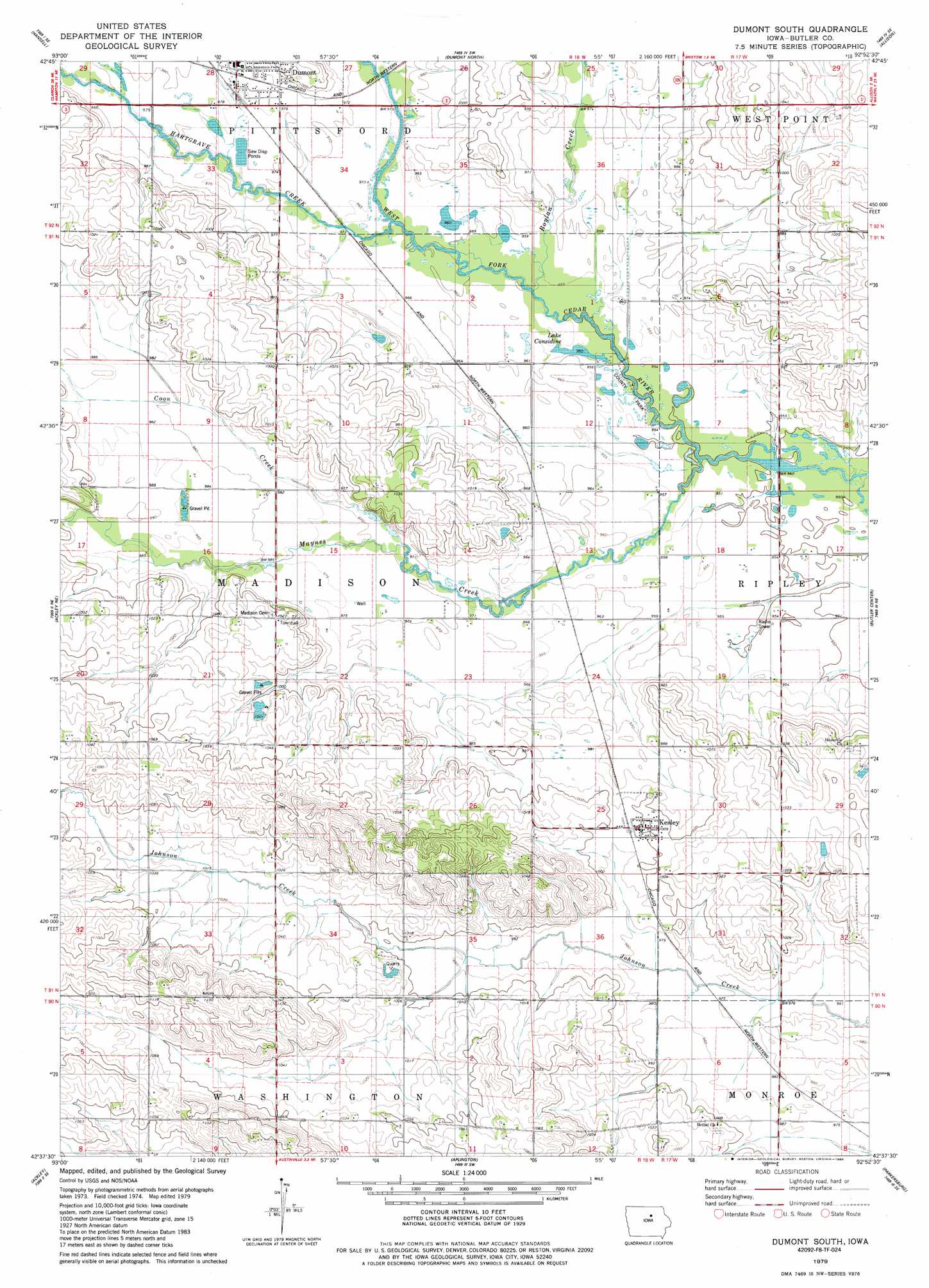
Dumont South Topo Map Iowa
To zoom in, hover over the map of Dumont South
USGS Topo Quad 42092f8 - 1:24,000 scale
| Topo Map Name: | Dumont South |
| USGS Topo Quad ID: | 42092f8 |
| Print Size: | ca. 21 1/4" wide x 27" high |
| Southeast Coordinates: | 42.625° N latitude / 92.875° W longitude |
| Map Center Coordinates: | 42.6875° N latitude / 92.9375° W longitude |
| U.S. State: | IA |
| Filename: | o42092f8.jpg |
| Download Map JPG Image: | Dumont South topo map 1:24,000 scale |
| Map Type: | Topographic |
| Topo Series: | 7.5´ |
| Map Scale: | 1:24,000 |
| Source of Map Images: | United States Geological Survey (USGS) |
| Alternate Map Versions: |
Dumont South IA 1979, updated 1980 Download PDF Buy paper map Dumont South IA 1979, updated 1986 Download PDF Buy paper map Dumont South IA 2010 Download PDF Buy paper map Dumont South IA 2013 Download PDF Buy paper map Dumont South IA 2015 Download PDF Buy paper map |
1:24,000 Topo Quads surrounding Dumont South
Sheffield |
Dougherty |
Aureola |
Greene |
Nashua Nw |
Hampton North |
Hansell |
Dumont North |
Allison |
Clarksville |
Hampton South |
Ackley Ne |
Dumont South |
Butler Center |
Coster |
Iowa Falls East |
Ackley |
Aplington |
Parkersburg |
Stout |
Owasa |
Steamboat Rock |
Wellsburg |
Holland |
Dike |
> Back to 42092e1 at 1:100,000 scale
> Back to 42092a1 at 1:250,000 scale
> Back to U.S. Topo Maps home
Dumont South topo map: Gazetteer
Dumont South: Lakes
Lake Considine elevation 290m 951′Dumont South: Parks
Boylan Creek Wildlife Area elevation 293m 961′Considene Lake Park elevation 290m 951′
South Fork Park elevation 298m 977′
Dumont South: Populated Places
Kesley elevation 305m 1000′Dumont South: Post Offices
Clutterville Post Office (historical) elevation 305m 1000′Hitesville Post Office (historical) elevation 308m 1010′
Island Grove Post Office (historical) elevation 304m 997′
Kesley Post Office elevation 305m 1000′
Dumont South: Streams
Boylan Creek elevation 291m 954′Coon Creek elevation 296m 971′
Hartgrave Creek elevation 293m 961′
Maynes Creek elevation 290m 951′
Dumont South: Summits
Fort Sumter Rock elevation 306m 1003′Dumont South digital topo map on disk
Buy this Dumont South topo map showing relief, roads, GPS coordinates and other geographical features, as a high-resolution digital map file on DVD: