Box Butte Ne Topo Map Nebraska
To zoom in, hover over the map of Box Butte Ne
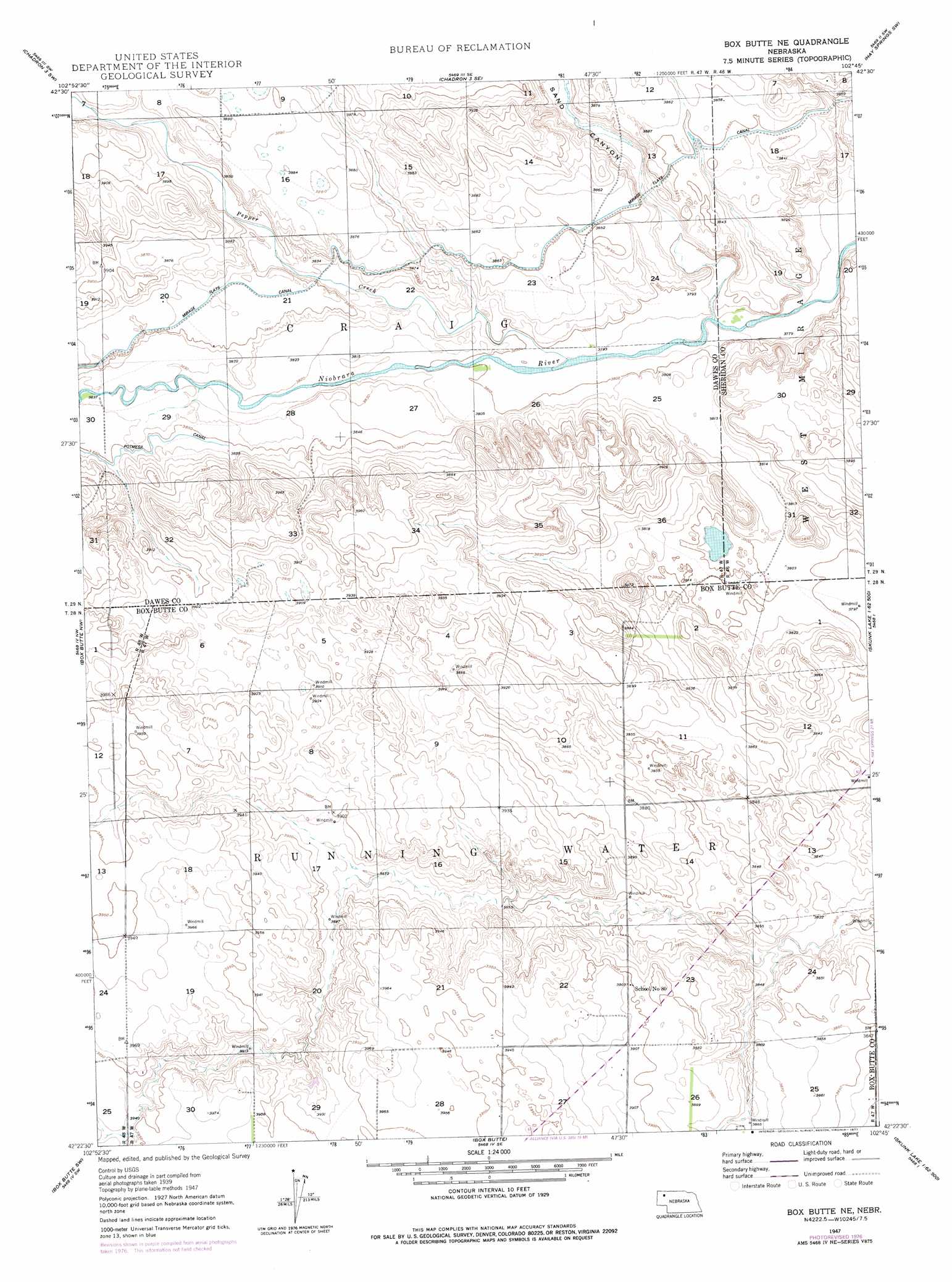
USGS Topo Quad 42102d7 - 1:24,000 scale
| Topo Map Name: | Box Butte Ne |
| USGS Topo Quad ID: | 42102d7 |
| Print Size: | ca. 21 1/4" wide x 27" high |
| Southeast Coordinates: | 42.375° N latitude / 102.75° W longitude |
| Map Center Coordinates: | 42.4375° N latitude / 102.8125° W longitude |
| U.S. State: | NE |
| Filename: | O42102D7.jpg |
| Download Map JPG Image: | Box Butte Ne topo map 1:24,000 scale |
| Map Type: | Topographic |
| Topo Series: | 7.5´ |
| Map Scale: | 1:24,000 |
| Source of Map Images: | United States Geological Survey (USGS) |
| Alternate Map Versions: |
Box Butte NE NE 1947, updated 1976 Download PDF Buy paper map Box Butte NE NE 1947, updated 1977 Download PDF Buy paper map Box Butte NE NE 1949, updated 1949 Download PDF Buy paper map Box Butte NE NE 2011 Download PDF Buy paper map Box Butte NE NE 2014 Download PDF Buy paper map |
1:24,000 Topo Quads surrounding Box Butte Ne
Coffee Mill Butte |
Chadron 3 Nw |
Chadron 3 Ne |
Hay Springs |
Hay Springs Ne |
Coffee Mill Butte Se |
Chadron 3 Sw |
Chadron 3 Se |
Hay Springs Sw |
Hay Springs Se |
Box Butte Reservoir East |
Box Butte Nw |
Box Butte Ne |
Skunk Lake Nw |
Skunk Lake Ne |
Hemingford |
Box Butte Sw |
Box Butte |
Skunk Lake Sw |
Skunk Lake |
Hemingford 4 Ne |
Berea Creek West |
Berea Creek East |
Krause Lake West |
Krause Lake East |
> Back to 42102a1 at 1:100,000 scale
> Back to 42102a1 at 1:250,000 scale
> Back to U.S. Topo Maps home
Box Butte Ne digital topo map on disk
Buy this Box Butte Ne topo map showing relief, roads, GPS coordinates and other geographical features, as a high-resolution digital map file on DVD:
Eastern Wyoming & Western South Dakota
Buy digital topo maps: Eastern Wyoming & Western South Dakota