American Falls Sw Topo Map Idaho
To zoom in, hover over the map of American Falls Sw
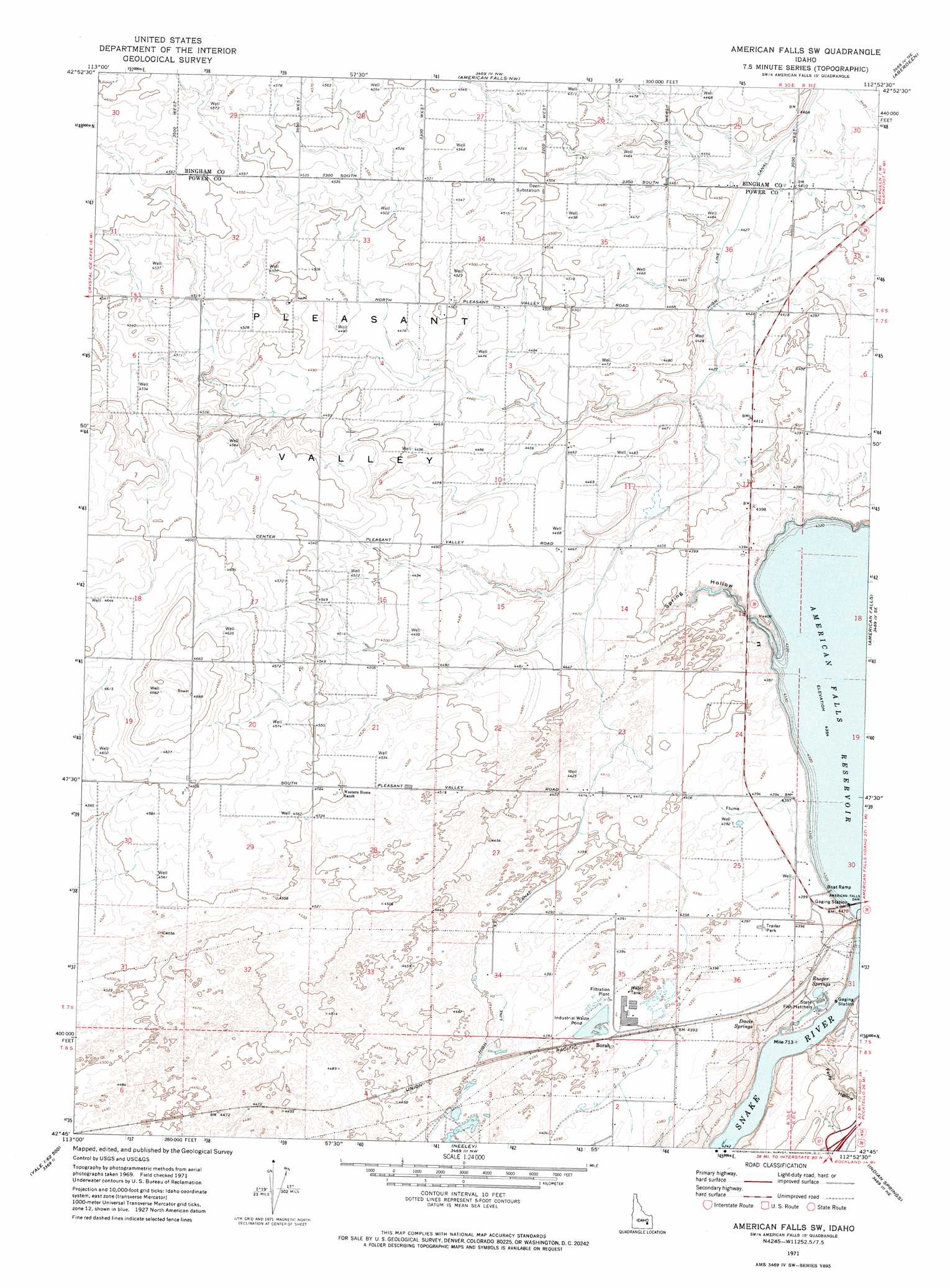
USGS Topo Quad 42112g8 - 1:24,000 scale
| Topo Map Name: | American Falls Sw |
| USGS Topo Quad ID: | 42112g8 |
| Print Size: | ca. 21 1/4" wide x 27" high |
| Southeast Coordinates: | 42.75° N latitude / 112.875° W longitude |
| Map Center Coordinates: | 42.8125° N latitude / 112.9375° W longitude |
| U.S. State: | ID |
| Filename: | o42112g8.jpg |
| Download Map JPG Image: | American Falls Sw topo map 1:24,000 scale |
| Map Type: | Topographic |
| Topo Series: | 7.5´ |
| Map Scale: | 1:24,000 |
| Source of Map Images: | United States Geological Survey (USGS) |
| Alternate Map Versions: |
American Falls SW ID 1971, updated 1974 Download PDF Buy paper map American Falls SW ID 2011 Download PDF Buy paper map American Falls SW ID 2013 Download PDF Buy paper map |
1:24,000 Topo Quads surrounding American Falls Sw
Mosby Butte |
Mosby Well |
Coffee Point Sw |
Big Fill Reservoir |
Springfield |
Pillar Butte |
Pillar Butte Ne |
American Falls Nw |
Aberdeen |
Schiller |
Rattlesnake Butte |
Pillar Butte Se |
American Falls Sw |
American Falls |
Wheatgrass Bench |
Gifford Spring |
Register Rock |
Neeley |
Indian Springs |
Sawmill Creek |
North Chapin Mountain |
Badger Peak |
Rockland West |
Rockland East |
Bannock Peak |
> Back to 42112e1 at 1:100,000 scale
> Back to 42112a1 at 1:250,000 scale
> Back to U.S. Topo Maps home
American Falls Sw topo map: Gazetteer
American Falls Sw: Canals
Lateral P elevation 1348m 4422′Lateral Q elevation 1341m 4399′
Lateral R elevation 1341m 4399′
Lateral S elevation 1341m 4399′
American Falls Sw: Dams
American Falls Dam elevation 1328m 4356′American Falls Sw: Reservoirs
American Falls Reservoir elevation 1328m 4356′American Falls Sw: Springs
Davis Springs elevation 1320m 4330′Rueger Springs elevation 1317m 4320′
American Falls Sw: Valleys
Ferry Hollow elevation 1294m 4245′Spring Hollow elevation 1338m 4389′
American Falls Sw digital topo map on disk
Buy this American Falls Sw topo map showing relief, roads, GPS coordinates and other geographical features, as a high-resolution digital map file on DVD: