Fields Topo Map Oregon
To zoom in, hover over the map of Fields
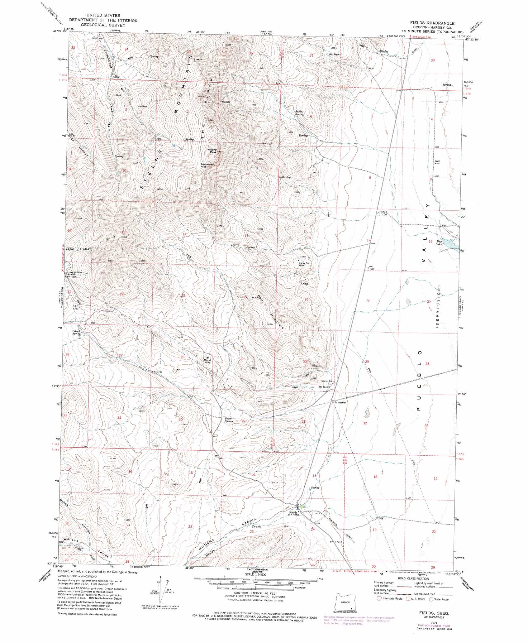
USGS Topo Quad 42118c6 - 1:24,000 scale
| Topo Map Name: | Fields |
| USGS Topo Quad ID: | 42118c6 |
| Print Size: | ca. 21 1/4" wide x 27" high |
| Southeast Coordinates: | 42.25° N latitude / 118.625° W longitude |
| Map Center Coordinates: | 42.3125° N latitude / 118.6875° W longitude |
| U.S. State: | OR |
| Filename: | o42118c6.jpg |
| Download Map JPG Image: | Fields topo map 1:24,000 scale |
| Map Type: | Topographic |
| Topo Series: | 7.5´ |
| Map Scale: | 1:24,000 |
| Source of Map Images: | United States Geological Survey (USGS) |
| Alternate Map Versions: |
Fields OR 1971, updated 1974 Download PDF Buy paper map Fields OR 1971, updated 1980 Download PDF Buy paper map Fields OR 1971, updated 1991 Download PDF Buy paper map Fields OR 2011 Download PDF Buy paper map Fields OR 2014 Download PDF Buy paper map |
1:24,000 Topo Quads surrounding Fields
Home Creek Butte |
Roaring Springs Se |
Ankle Creek |
Alvord Hot Springs |
Miranda Flat Sw |
Garrison Lake |
Skull Creek Butte |
V Lake |
Andrews |
Tule Springs |
Square Mountain |
Fields Basin |
Fields |
Borax Lake |
Red Lookout Butte |
Robbers Roost |
Rincon Flat |
Ladycomb Peak |
Tumtum Lake |
Trout Creek Canyon |
Black Rock Springs |
Oregon End Table |
Van Horn Basin |
Colony Ranch |
Windy Point |
> Back to 42118a1 at 1:100,000 scale
> Back to 42118a1 at 1:250,000 scale
> Back to U.S. Topo Maps home
Fields topo map: Gazetteer
Fields: Gaps
Buckwilder Pass elevation 1993m 6538′Fields: Lakes
Dry Lake elevation 1244m 4081′Fields: Mines
Lucky Star Mine elevation 1365m 4478′Mogul Mine elevation 1500m 4921′
Fields: Populated Places
Fields elevation 1291m 4235′Fields: Post Offices
Fields Post Office elevation 1291m 4235′Fields: Ridges
Red Mountain elevation 1604m 5262′Fields: Springs
Burks Spring elevation 1428m 4685′O'Keefe Spring elevation 1574m 5164′
Pedro Spring elevation 1373m 4504′
Fields: Streams
Fields Creek elevation 1261m 4137′Scoubes Creek elevation 1237m 4058′
Fields: Summits
Alvord Peak elevation 2165m 7103′Fields: Valleys
Babes Canyon elevation 1426m 4678′Williams Canyon elevation 1287m 4222′
Fields digital topo map on disk
Buy this Fields topo map showing relief, roads, GPS coordinates and other geographical features, as a high-resolution digital map file on DVD: