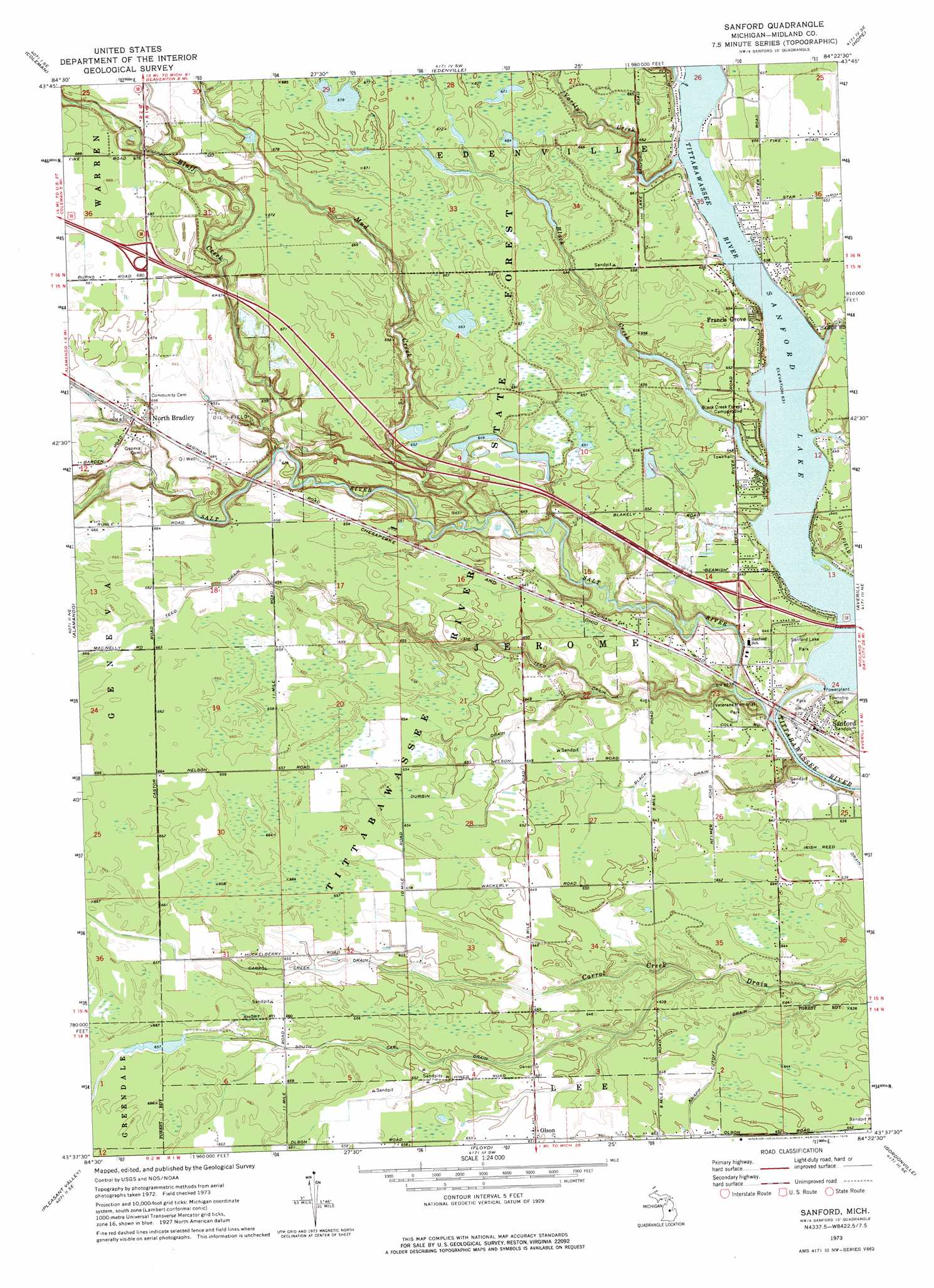
Sanford Topo Map Michigan
To zoom in, hover over the map of Sanford
USGS Topo Quad 43084f4 - 1:24,000 scale
| Topo Map Name: | Sanford |
| USGS Topo Quad ID: | 43084f4 |
| Print Size: | ca. 21 1/4" wide x 27" high |
| Southeast Coordinates: | 43.625° N latitude / 84.375° W longitude |
| Map Center Coordinates: | 43.6875° N latitude / 84.4375° W longitude |
| U.S. State: | MI |
| Filename: | o43084f4.jpg |
| Download Map JPG Image: | Sanford topo map 1:24,000 scale |
| Map Type: | Topographic |
| Topo Series: | 7.5´ |
| Map Scale: | 1:24,000 |
| Source of Map Images: | United States Geological Survey (USGS) |
| Alternate Map Versions: |
Sanford MI 1973, updated 1976 Download PDF Buy paper map Sanford MI 2011 Download PDF Buy paper map Sanford MI 2014 Download PDF Buy paper map Sanford MI 2016 Download PDF Buy paper map |
1:24,000 Topo Quads surrounding Sanford
Browns Corners |
Coleman Ne |
Gladwin |
Wooden Shoe Village |
Bentley |
Loomis |
Coleman |
Edenville |
Hope |
Estey |
Leaton |
Alamando |
Sanford |
Averill |
Midland North |
Shepherd |
Pleasant Valley |
Floyd |
Gordonville |
Midland South |
Alma North |
Saint Louis |
Breckenridge |
Merrill |
Hemlock |
> Back to 43084e1 at 1:100,000 scale
> Back to 43084a1 at 1:250,000 scale
> Back to U.S. Topo Maps home
Sanford topo map: Gazetteer
Sanford: Canals
Black Drain elevation 195m 639′Durbin Drain elevation 198m 649′
Sanford: Parks
Origins of the Salt Industry Historical Marker elevation 189m 620′Sanford Lake Park elevation 195m 639′
State Salt Well Number 1 Historical Marker elevation 189m 620′
Veterans Memorial Park elevation 191m 626′
Sanford: Populated Places
Francis Grove elevation 200m 656′North Bradley elevation 204m 669′
Olson elevation 198m 649′
Sanford elevation 191m 626′
Stockholm Forest Village Mobile Home Park elevation 198m 649′
Whispering Pines Housing Community elevation 195m 639′
Sanford: Post Offices
North Bradley Post Office (historical) elevation 204m 669′Olson Post Office (historical) elevation 198m 649′
Sanford Post Office elevation 190m 623′
Sanford: Reservoirs
Sanford Lake elevation 192m 629′Sanford: Streams
Black Creek elevation 192m 629′Bluff Creek elevation 193m 633′
Mud Creek elevation 189m 620′
Salt River elevation 187m 613′
Varity Creek elevation 194m 636′
Sanford digital topo map on disk
Buy this Sanford topo map showing relief, roads, GPS coordinates and other geographical features, as a high-resolution digital map file on DVD: