Waldorf Topo Map Minnesota
To zoom in, hover over the map of Waldorf
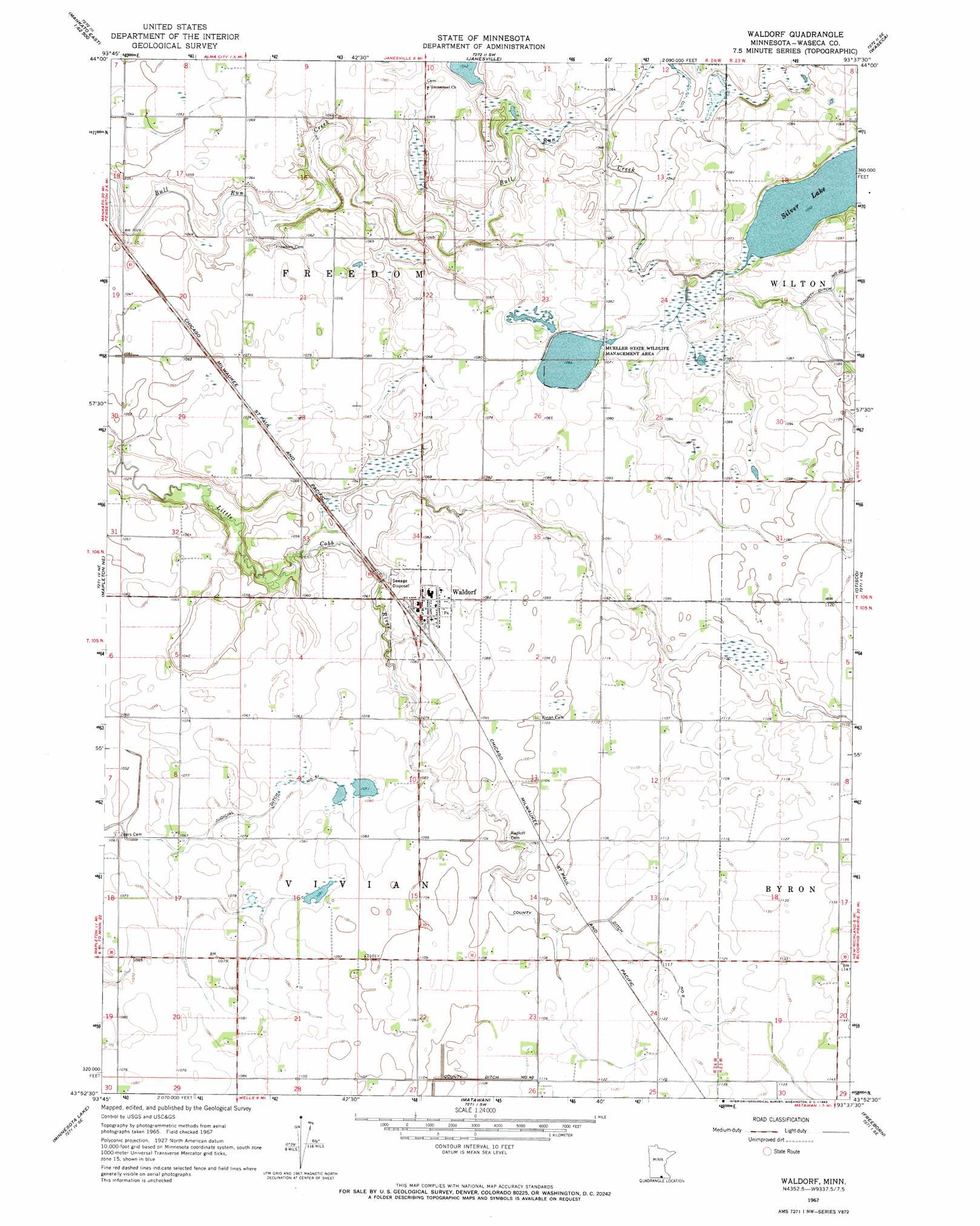
USGS Topo Quad 43093h6 - 1:24,000 scale
| Topo Map Name: | Waldorf |
| USGS Topo Quad ID: | 43093h6 |
| Print Size: | ca. 21 1/4" wide x 27" high |
| Southeast Coordinates: | 43.875° N latitude / 93.625° W longitude |
| Map Center Coordinates: | 43.9375° N latitude / 93.6875° W longitude |
| U.S. State: | MN |
| Filename: | o43093h6.jpg |
| Download Map JPG Image: | Waldorf topo map 1:24,000 scale |
| Map Type: | Topographic |
| Topo Series: | 7.5´ |
| Map Scale: | 1:24,000 |
| Source of Map Images: | United States Geological Survey (USGS) |
| Alternate Map Versions: |
Waldorf MN 1967, updated 1969 Download PDF Buy paper map Waldorf MN 2010 Download PDF Buy paper map Waldorf MN 2013 Download PDF Buy paper map Waldorf MN 2016 Download PDF Buy paper map |
1:24,000 Topo Quads surrounding Waldorf
Mankato East |
Madison Lake |
Elysian |
Waterville |
Morristown |
Beauford |
Saint Clair |
Janesville |
Waseca |
Meriden |
Mapleton |
Mapleton Ne |
Waldorf |
Otisco |
New Richland |
Easton |
Minnesota Lake |
Matawan |
Freeborn |
Hartland |
Oza Tanka Lakebed |
Brush Creek |
Wells |
Alden |
Albert Lea West |
> Back to 43093e1 at 1:100,000 scale
> Back to 43092a1 at 1:250,000 scale
> Back to U.S. Topo Maps home
Waldorf topo map: Gazetteer
Waldorf: Canals
County Ditch Number Forty elevation 335m 1099′Waldorf: Dams
Silver Lake Dam elevation 324m 1062′Waldorf: Lakes
Silver Lake elevation 321m 1053′Waldorf: Parks
Mueller State Wildlife Management Area elevation 324m 1062′Waldorf: Populated Places
Waldorf elevation 329m 1079′Waldorf: Post Offices
Waldorf Post Office elevation 329m 1079′Waldorf: Reservoirs
Silver Lake elevation 324m 1062′Waldorf digital topo map on disk
Buy this Waldorf topo map showing relief, roads, GPS coordinates and other geographical features, as a high-resolution digital map file on DVD: