Miller Nw Topo Map South Dakota
To zoom in, hover over the map of Miller Nw
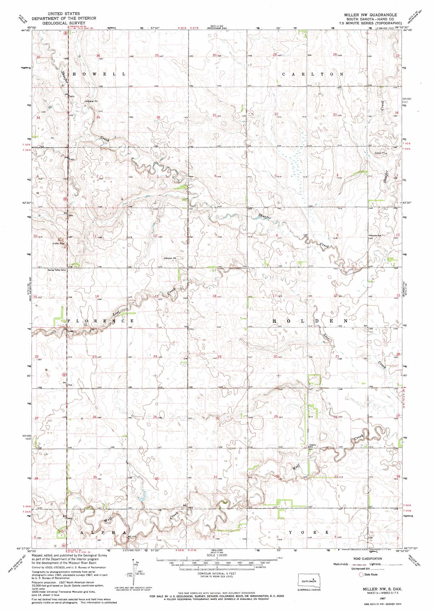
USGS Topo Quad 44098f8 - 1:24,000 scale
| Topo Map Name: | Miller Nw |
| USGS Topo Quad ID: | 44098f8 |
| Print Size: | ca. 21 1/4" wide x 27" high |
| Southeast Coordinates: | 44.625° N latitude / 98.875° W longitude |
| Map Center Coordinates: | 44.6875° N latitude / 98.9375° W longitude |
| U.S. State: | SD |
| Filename: | o44098f8.jpg |
| Download Map JPG Image: | Miller Nw topo map 1:24,000 scale |
| Map Type: | Topographic |
| Topo Series: | 7.5´ |
| Map Scale: | 1:24,000 |
| Source of Map Images: | United States Geological Survey (USGS) |
| Alternate Map Versions: |
Miller NW SD 1967, updated 1969 Download PDF Buy paper map Miller NW SD 1967, updated 1969 Download PDF Buy paper map Miller NW SD 2012 Download PDF Buy paper map Miller NW SD 2015 Download PDF Buy paper map |
1:24,000 Topo Quads surrounding Miller Nw
Orient Nw |
Orient |
Miranda |
Rockham |
Zell |
Orient Sw |
Polo |
Rockham Sw |
Rockham Se |
Redfield Sw |
Ree Heights Nw |
Ree Hieghts Ne |
Miller Nw |
Burdette |
Tulare Nw |
Ree Heights |
Ree Heights Se |
Miller |
Miller Se |
Tulare Sw |
Miller Dale Colony Nw |
Miller Dale Colony |
Vayland Nw |
Vayland |
Wessington |
> Back to 44098e1 at 1:100,000 scale
> Back to 44098a1 at 1:250,000 scale
> Back to U.S. Topo Maps home
Miller Nw topo map: Gazetteer
Miller Nw: Populated Places
Florence (historical) elevation 462m 1515′Miller Nw digital topo map on disk
Buy this Miller Nw topo map showing relief, roads, GPS coordinates and other geographical features, as a high-resolution digital map file on DVD:
Eastern North Dakota & Eastern South Dakota
Buy digital topo maps: Eastern North Dakota & Eastern South Dakota