Lacy Topo Map South Dakota
To zoom in, hover over the map of Lacy
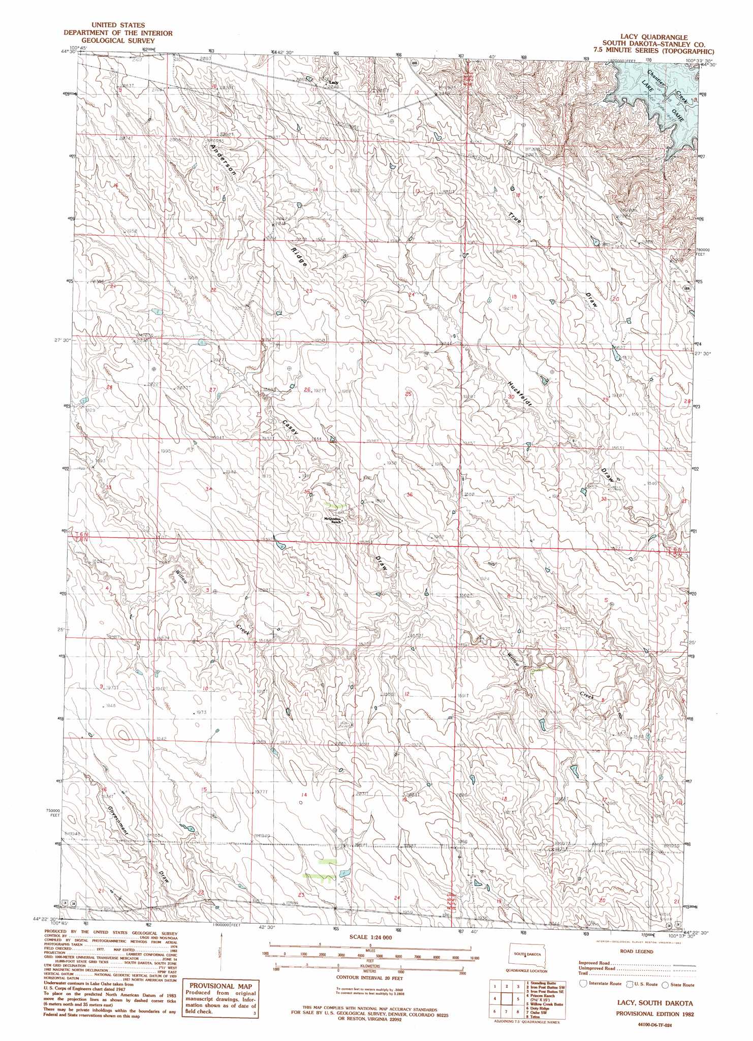
USGS Topo Quad 44100d6 - 1:24,000 scale
| Topo Map Name: | Lacy |
| USGS Topo Quad ID: | 44100d6 |
| Print Size: | ca. 21 1/4" wide x 27" high |
| Southeast Coordinates: | 44.375° N latitude / 100.625° W longitude |
| Map Center Coordinates: | 44.4375° N latitude / 100.6875° W longitude |
| U.S. State: | SD |
| Filename: | o44100d6.jpg |
| Download Map JPG Image: | Lacy topo map 1:24,000 scale |
| Map Type: | Topographic |
| Topo Series: | 7.5´ |
| Map Scale: | 1:24,000 |
| Source of Map Images: | United States Geological Survey (USGS) |
| Alternate Map Versions: |
Lacy SD 1982, updated 1983 Download PDF Buy paper map Lacy SD 2012 Download PDF Buy paper map Lacy SD 2015 Download PDF Buy paper map |
1:24,000 Topo Quads surrounding Lacy
Crokett Mountains |
Mission Ridge |
Iron Post Buttes |
Mail Shack Creek |
Okobojo |
Standing Butte Sw |
Standing Butte |
Iron Post Buttes Sw |
Iron Post Buttes Se |
Okobojo Sw |
Princes Ranch |
Lacy |
Willow Creek Butte |
Oahe Dam |
|
Hohrman Ranch |
Doty Ridge |
Oahe Sw |
Teton |
Pierre Sw |
Capa Nw |
Van Metre |
Wendte |
Wendte Ne |
Pierre 3 Nw |
> Back to 44100a1 at 1:100,000 scale
> Back to 44100a1 at 1:250,000 scale
> Back to U.S. Topo Maps home
Lacy topo map: Gazetteer
Lacy: Dams
Allen Stirling Number 1 Dam elevation 592m 1942′Charles Frazier Dam elevation 586m 1922′
Sonnenschein Number 1 Dam elevation 573m 1879′
Lacy: Populated Places
Lacy elevation 621m 2037′Lacy: Ridges
Anderson Ridge elevation 622m 2040′Lacy: Valleys
Casey Draw elevation 555m 1820′Lacy digital topo map on disk
Buy this Lacy topo map showing relief, roads, GPS coordinates and other geographical features, as a high-resolution digital map file on DVD:
Eastern North Dakota & Eastern South Dakota
Buy digital topo maps: Eastern North Dakota & Eastern South Dakota