Red Rock Topo Map Montana
To zoom in, hover over the map of Red Rock
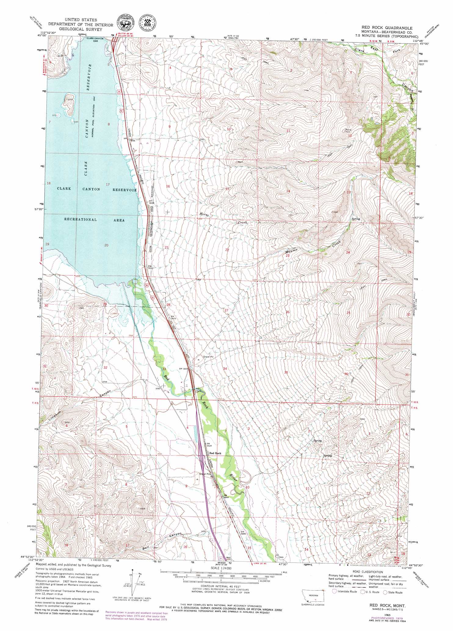
USGS Topo Quad 44112h7 - 1:24,000 scale
| Topo Map Name: | Red Rock |
| USGS Topo Quad ID: | 44112h7 |
| Print Size: | ca. 21 1/4" wide x 27" high |
| Southeast Coordinates: | 44.875° N latitude / 112.75° W longitude |
| Map Center Coordinates: | 44.9375° N latitude / 112.8125° W longitude |
| U.S. State: | MT |
| Filename: | o44112h7.jpg |
| Download Map JPG Image: | Red Rock topo map 1:24,000 scale |
| Map Type: | Topographic |
| Topo Series: | 7.5´ |
| Map Scale: | 1:24,000 |
| Source of Map Images: | United States Geological Survey (USGS) |
| Alternate Map Versions: |
Red Rock MT 1965, updated 1968 Download PDF Buy paper map Red Rock MT 1965, updated 1979 Download PDF Buy paper map Red Rock MT 2011 Download PDF Buy paper map Red Rock MT 2014 Download PDF Buy paper map |
1:24,000 Topo Quads surrounding Red Rock
Mill Point |
Bannack |
Burns Mountain |
Dillon West |
Dillon East |
Grant |
Eli Spring |
Dalys |
Gallagher Mountain |
Ashbough Canyon |
Hansen Ranch |
Garfield Canyon |
Red Rock |
Monument Hill |
Beech Creek |
Medicine Lodge Peak |
Deer Canyon |
Kidd |
Briggs Ranch |
Rock Island Ranch |
Tepee Mountain |
Graphite Mountain |
Dixon Mountain |
Dell |
Lima |
> Back to 44112e1 at 1:100,000 scale
> Back to 44112a1 at 1:250,000 scale
> Back to U.S. Topo Maps home
Red Rock topo map: Gazetteer
Red Rock: Crossings
Interchange 37 elevation 1717m 5633′Interchange 44 elevation 1699m 5574′
Red Rock: Dams
Clark Canyon Dam elevation 1683m 5521′Red Rock: Parks
Camp Fortunate Historical Marker (historical) elevation 1694m 5557′Red Rock: Populated Places
Armstead (historical) elevation 1690m 5544′Red Rock elevation 1716m 5629′
Red Rock: Post Offices
Armstead Post Office (historical) elevation 1690m 5544′Red Rock Post Office (historical) elevation 1707m 5600′
Red Rock: Reservoirs
Clark Canyon Reservoir elevation 1690m 5544′Red Rock: Streams
Horse Creek elevation 1690m 5544′Maurer Creek elevation 1720m 5643′
Red Rock River elevation 1690m 5544′
Red Rock: Valleys
Bell Canyon elevation 1750m 5741′East Fork Clark Canyon elevation 1874m 6148′
Limekiln Canyon elevation 1718m 5636′
Poison Gulch elevation 1985m 6512′
Red Rock: Wells
10S10W29DCCC01 Well elevation 1714m 5623′Red Rock digital topo map on disk
Buy this Red Rock topo map showing relief, roads, GPS coordinates and other geographical features, as a high-resolution digital map file on DVD: