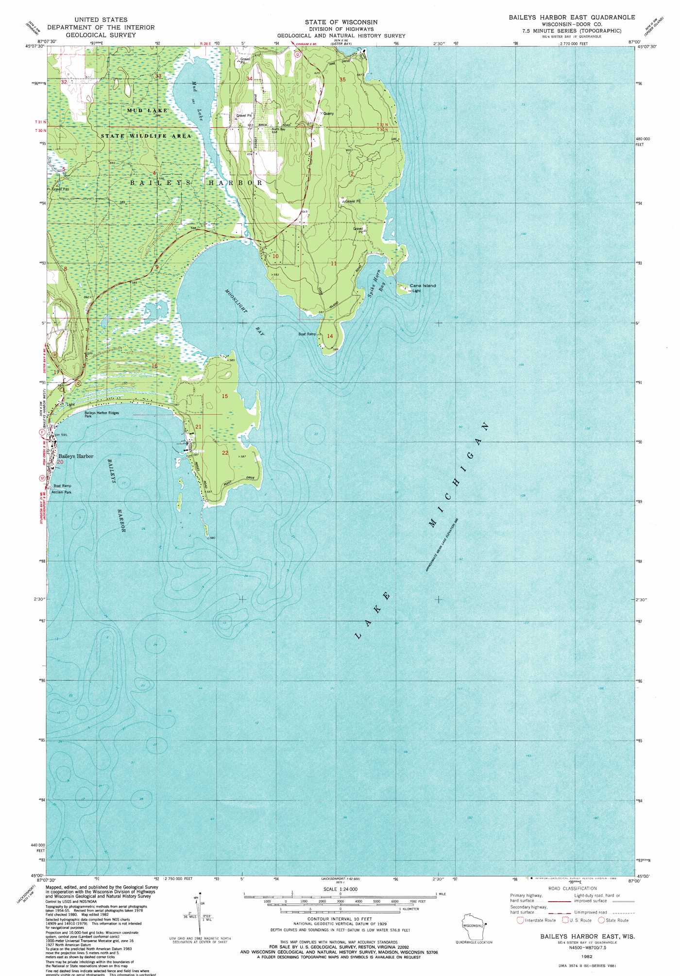
Baileys Harbor East Topo Map Wisconsin
To zoom in, hover over the map of Baileys Harbor East
USGS Topo Quad 45087a1 - 1:24,000 scale
| Topo Map Name: | Baileys Harbor East |
| USGS Topo Quad ID: | 45087a1 |
| Print Size: | ca. 21 1/4" wide x 27" high |
| Southeast Coordinates: | 45° N latitude / 87° W longitude |
| Map Center Coordinates: | 45.0625° N latitude / 87.0625° W longitude |
| U.S. State: | WI |
| Filename: | o45087a1.jpg |
| Download Map JPG Image: | Baileys Harbor East topo map 1:24,000 scale |
| Map Type: | Topographic |
| Topo Series: | 7.5´ |
| Map Scale: | 1:24,000 |
| Source of Map Images: | United States Geological Survey (USGS) |
| Alternate Map Versions: |
Baileys Harbor East WI 1982, updated 1983 Download PDF Buy paper map Baileys Harbor East WI 2010 Download PDF Buy paper map Baileys Harbor East WI 2013 Download PDF Buy paper map Baileys Harbor East WI 2016 Download PDF Buy paper map |
1:24,000 Topo Quads surrounding Baileys Harbor East
Ellison Bay |
Washington Island Sw |
Washington Island Se |
||
Chambers Island |
Ephraim |
Sister Bay |
Spider Island |
|
Egg Harbor |
Baileys Harbor West |
Baileys Harbor East |
||
Institute |
Jacksonport |
|||
Sturgeon Bay East |
Jacksonport Sw |
> Back to 45087a1 at 1:100,000 scale
> Back to 45086a1 at 1:250,000 scale
> Back to U.S. Topo Maps home
Baileys Harbor East topo map: Gazetteer
Baileys Harbor East: Bays
Baileys Harbor elevation 177m 580′Cana Cove elevation 177m 580′
Moonlight Bay elevation 177m 580′
Spike Horn Bay elevation 177m 580′
Baileys Harbor East: Islands
Cana Island elevation 177m 580′Baileys Harbor East: Lakes
Mud Lake elevation 178m 583′Baileys Harbor East: Parks
Anclam Park elevation 179m 587′Bailey's Harbor Boreal Forest And Wetlands State Natural Area elevation 178m 583′
Baileys Harbor Ridges Park elevation 178m 583′
Moonlight Bay Bedrock Beach State Natural Area elevation 181m 593′
Mud Lake State Natural Area elevation 178m 583′
Mud Lake State Wildlife Area elevation 178m 583′
The Ridges Sanctuary State Natural Area elevation 179m 587′
Toft Point State Natural Area elevation 179m 587′
Baileys Harbor East: Populated Places
Baileys Harbor elevation 182m 597′Baileys Harbor East digital topo map on disk
Buy this Baileys Harbor East topo map showing relief, roads, GPS coordinates and other geographical features, as a high-resolution digital map file on DVD: