Medford Topo Map Wisconsin
To zoom in, hover over the map of Medford
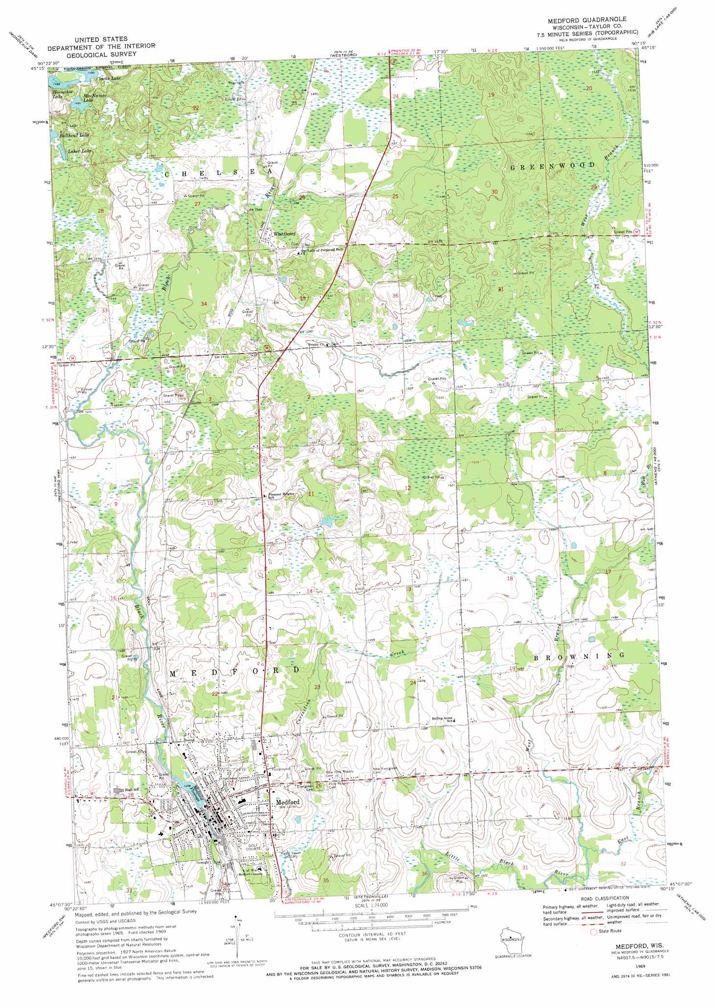
USGS Topo Quad 45090b3 - 1:24,000 scale
| Topo Map Name: | Medford |
| USGS Topo Quad ID: | 45090b3 |
| Print Size: | ca. 21 1/4" wide x 27" high |
| Southeast Coordinates: | 45.125° N latitude / 90.25° W longitude |
| Map Center Coordinates: | 45.1875° N latitude / 90.3125° W longitude |
| U.S. State: | WI |
| Filename: | o45090b3.jpg |
| Download Map JPG Image: | Medford topo map 1:24,000 scale |
| Map Type: | Topographic |
| Topo Series: | 7.5´ |
| Map Scale: | 1:24,000 |
| Source of Map Images: | United States Geological Survey (USGS) |
| Alternate Map Versions: |
Medford WI 1969, updated 1972 Download PDF Buy paper map Medford WI 2011 Download PDF Buy paper map Medford WI 2013 Download PDF Buy paper map Medford WI 2015 Download PDF Buy paper map |
1:24,000 Topo Quads surrounding Medford
Jump River Fire Tower Ne |
Ogema Nw |
Ogema |
Timms Hill |
Spirit |
Jump River Fire Tower |
Mondeaux Dam |
Westboro |
Rib Lake |
Wood Lake |
Perkinstown |
Medford Nw |
Medford |
Rib River Lookout Tower |
Goodrich |
Lublin Se |
Medford Sw |
Stetsonville |
Corinth |
Athens |
Owen |
Curtiss |
Abbotsford |
Milan |
Wien |
> Back to 45090a1 at 1:100,000 scale
> Back to 45090a1 at 1:250,000 scale
> Back to U.S. Topo Maps home
Medford topo map: Gazetteer
Medford: Dams
Kloth 3NW77811 Dam elevation 438m 1437′Medford Dam elevation 427m 1400′
Weathershield 3NW1536.238 Dam elevation 448m 1469′
Medford: Lakes
Bullhead Lake elevation 450m 1476′Clarke Lake elevation 455m 1492′
Horseshoe Lake elevation 454m 1489′
Laher Lake elevation 450m 1476′
McNamar Lake elevation 454m 1489′
Medford: Parks
Taylor County Fair Grounds elevation 448m 1469′Medford: Populated Places
Medford elevation 448m 1469′Whittlesey elevation 450m 1476′
Medford: Post Offices
Medford Post Office elevation 433m 1420′Medford: Reservoirs
Medford Flowage elevation 427m 1400′Medford Flowage 35.4 elevation 430m 1410′
Medford: Streams
East Branch Little Black River elevation 434m 1423′West Branch Little Black River elevation 434m 1423′
Medford digital topo map on disk
Buy this Medford topo map showing relief, roads, GPS coordinates and other geographical features, as a high-resolution digital map file on DVD: