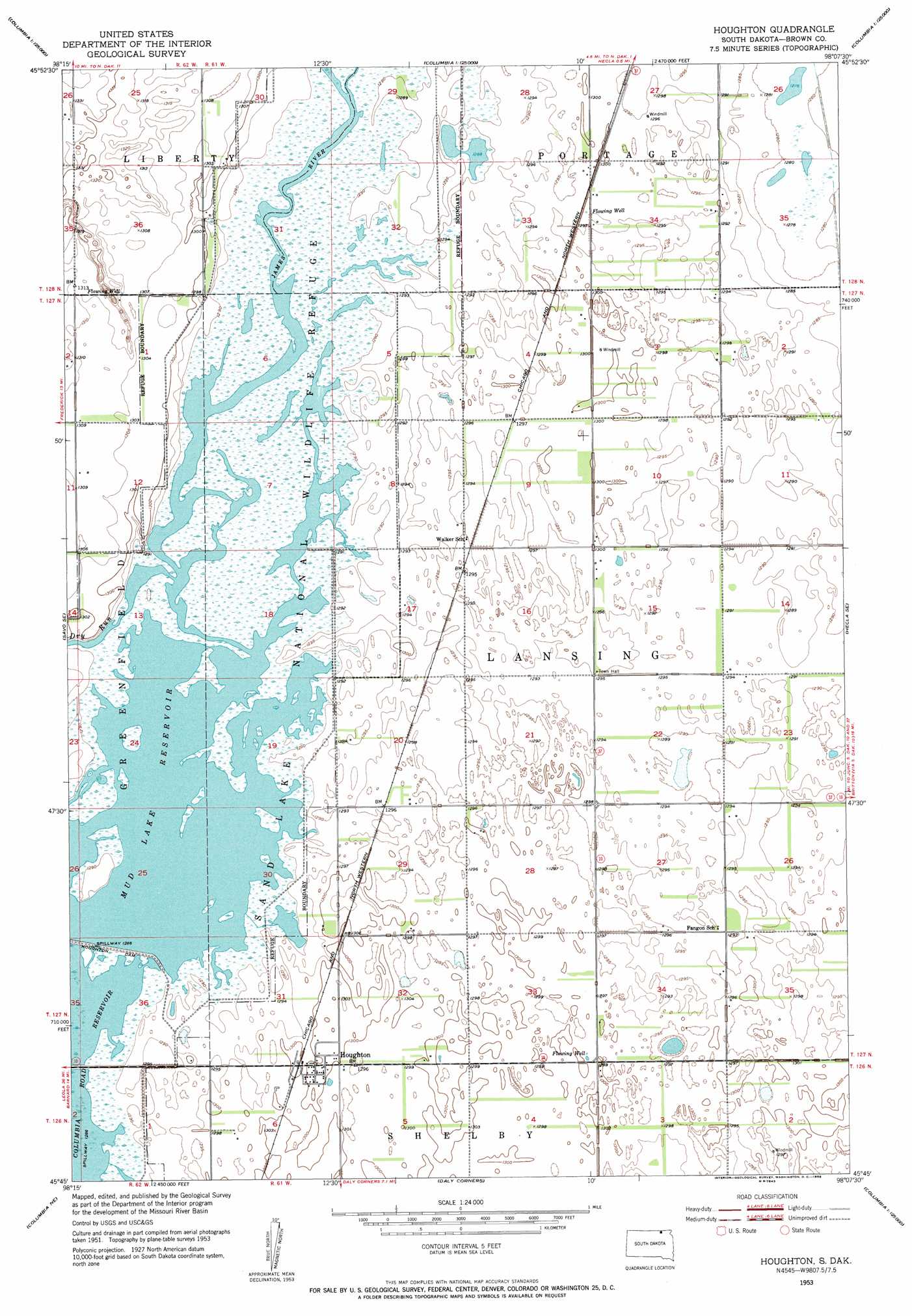
Houghton Topo Map South Dakota
To zoom in, hover over the map of Houghton
USGS Topo Quad 45098g2 - 1:24,000 scale
| Topo Map Name: | Houghton |
| USGS Topo Quad ID: | 45098g2 |
| Print Size: | ca. 21 1/4" wide x 27" high |
| Southeast Coordinates: | 45.75° N latitude / 98.125° W longitude |
| Map Center Coordinates: | 45.8125° N latitude / 98.1875° W longitude |
| U.S. State: | SD |
| Filename: | o45098g2.jpg |
| Download Map JPG Image: | Houghton topo map 1:24,000 scale |
| Map Type: | Topographic |
| Topo Series: | 7.5´ |
| Map Scale: | 1:24,000 |
| Source of Map Images: | United States Geological Survey (USGS) |
| Alternate Map Versions: |
Houghton SD 1953, updated 1955 Download PDF Buy paper map Houghton SD 1953, updated 1955 Download PDF Buy paper map Houghton SD 2012 Download PDF Buy paper map Houghton SD 2015 Download PDF Buy paper map |
1:24,000 Topo Quads surrounding Houghton
Silverleaf |
Fullerton Se |
Guelph |
Oakes Se |
Straubville |
Savo Nw |
Savo Ne |
Hecla |
Hecla Ne |
Newark Nw |
Savo Sw |
Savo Se |
Houghton |
Hecla Se |
Newark Sw |
Westport |
Columbia Ne |
Daly Corners |
Claremont |
Amherst |
Ordway |
Columbia |
Putney |
Huffton |
Langford Sw |
> Back to 45098e1 at 1:100,000 scale
> Back to 45098a1 at 1:250,000 scale
> Back to U.S. Topo Maps home
Houghton topo map: Gazetteer
Houghton: Dams
Houghton Dam elevation 392m 1286′Houghton: Parks
Sand Lake National Wildlife Refuge elevation 393m 1289′Houghton: Populated Places
Houghton elevation 397m 1302′Houghton: Post Offices
Merna Post Office (historical) elevation 395m 1295′Houghton: Reservoirs
Mud Lake Reservoir elevation 392m 1286′Houghton: Streams
Dry Run elevation 392m 1286′Houghton digital topo map on disk
Buy this Houghton topo map showing relief, roads, GPS coordinates and other geographical features, as a high-resolution digital map file on DVD:
Eastern North Dakota & Eastern South Dakota
Buy digital topo maps: Eastern North Dakota & Eastern South Dakota