Seneca Nw Topo Map South Dakota
To zoom in, hover over the map of Seneca Nw
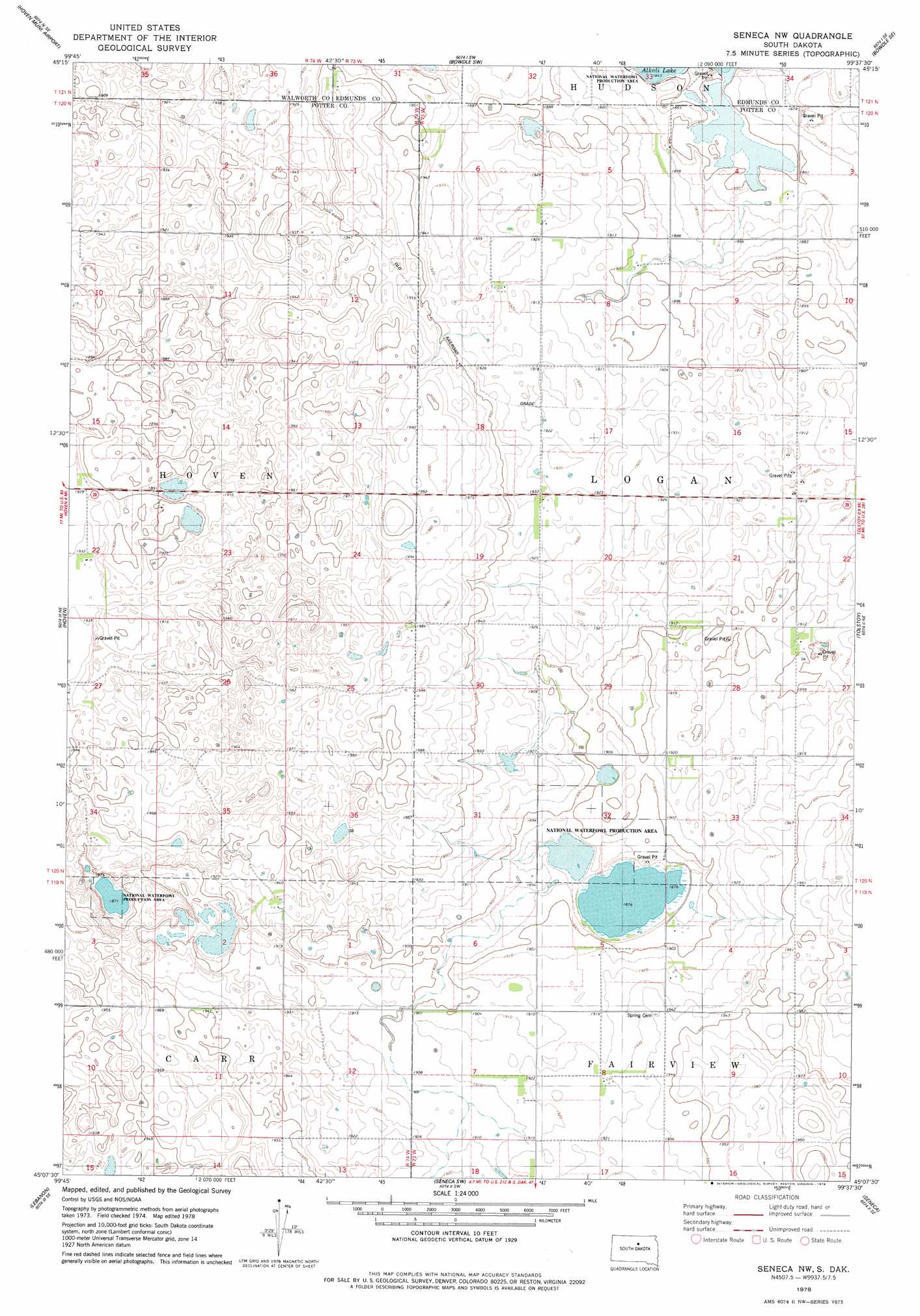
USGS Topo Quad 45099b6 - 1:24,000 scale
| Topo Map Name: | Seneca Nw |
| USGS Topo Quad ID: | 45099b6 |
| Print Size: | ca. 21 1/4" wide x 27" high |
| Southeast Coordinates: | 45.125° N latitude / 99.625° W longitude |
| Map Center Coordinates: | 45.1875° N latitude / 99.6875° W longitude |
| U.S. State: | SD |
| Filename: | o45099b6.jpg |
| Download Map JPG Image: | Seneca Nw topo map 1:24,000 scale |
| Map Type: | Topographic |
| Topo Series: | 7.5´ |
| Map Scale: | 1:24,000 |
| Source of Map Images: | United States Geological Survey (USGS) |
| Alternate Map Versions: |
Seneca NW SD 1978, updated 1978 Download PDF Buy paper map Seneca NW SD 2012 Download PDF Buy paper map Seneca NW SD 2015 Download PDF Buy paper map |
1:24,000 Topo Quads surrounding Seneca Nw
Lowry Nw |
Spring Lake |
Bowdle |
Gretna |
Roscoe Nw |
Lowry |
Hoven Municipal Airport |
Bowdle Sw |
Bowdle Se |
Roscoe Sw |
Flight Lake |
Hoven |
Seneca Nw |
Tolstoy |
Onaka |
Gettysburg |
Lebanon |
Seneca Sw |
Seneca |
Onaka Sw |
Gettysburg Muni Airport |
Gettysburg Muni Airport Ne |
Thomas Lake Nw |
Bald Hills |
Rezac Lake Nw |
> Back to 45099a1 at 1:100,000 scale
> Back to 45098a1 at 1:250,000 scale
> Back to U.S. Topo Maps home
Seneca Nw topo map: Gazetteer
Seneca Nw: Flats
Alkali Flat (historical) elevation 563m 1847′Seneca Nw: Lakes
Fresh Pond (historical) elevation 571m 1873′Seneca Nw: Post Offices
Springs Post Office (historical) elevation 577m 1893′Seneca Nw digital topo map on disk
Buy this Seneca Nw topo map showing relief, roads, GPS coordinates and other geographical features, as a high-resolution digital map file on DVD:
Eastern North Dakota & Eastern South Dakota
Buy digital topo maps: Eastern North Dakota & Eastern South Dakota