Elk Creek Topo Map Montana
To zoom in, hover over the map of Elk Creek
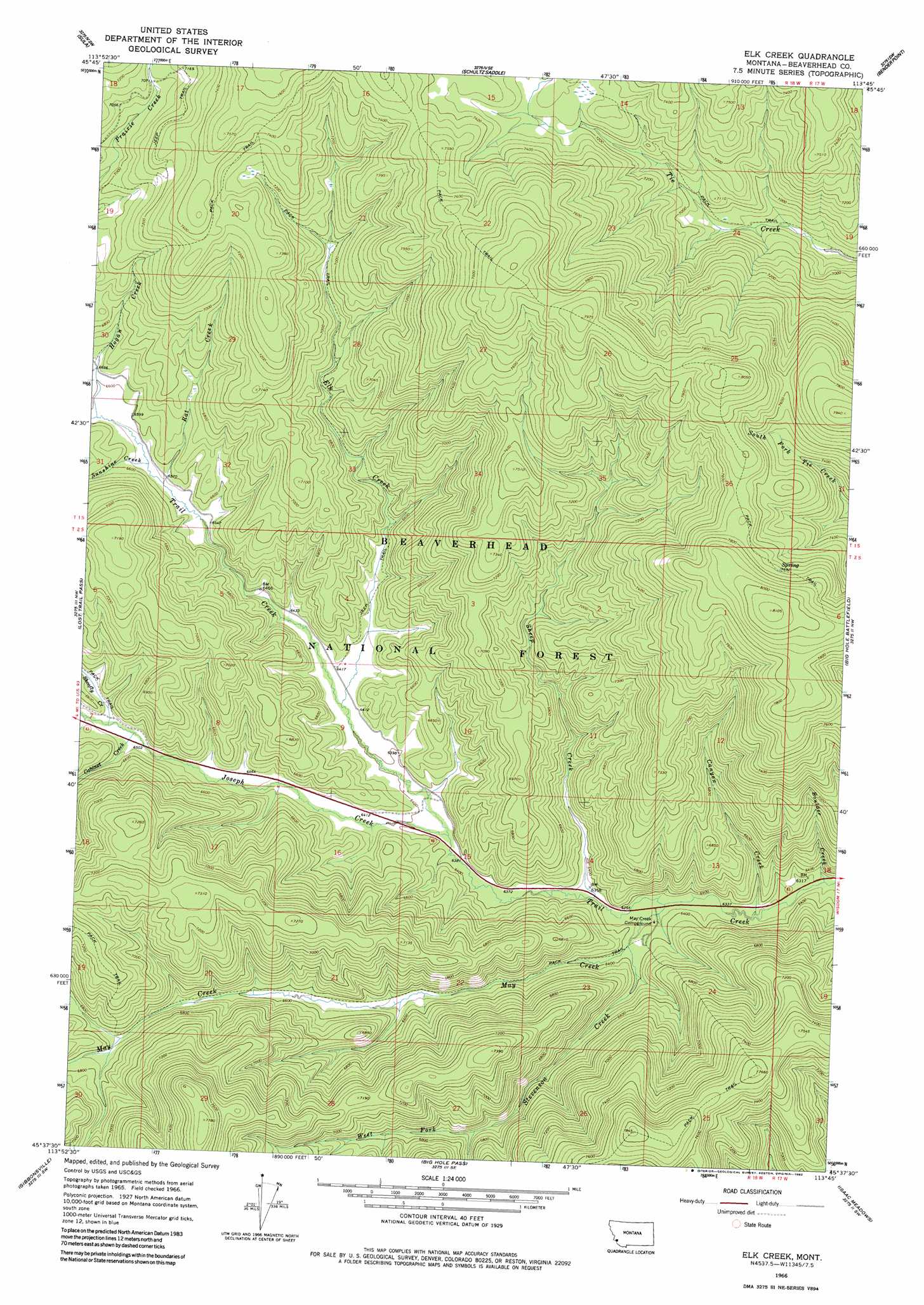
USGS Topo Quad 45113f7 - 1:24,000 scale
| Topo Map Name: | Elk Creek |
| USGS Topo Quad ID: | 45113f7 |
| Print Size: | ca. 21 1/4" wide x 27" high |
| Southeast Coordinates: | 45.625° N latitude / 113.75° W longitude |
| Map Center Coordinates: | 45.6875° N latitude / 113.8125° W longitude |
| U.S. State: | MT |
| Filename: | o45113f7.jpg |
| Download Map JPG Image: | Elk Creek topo map 1:24,000 scale |
| Map Type: | Topographic |
| Topo Series: | 7.5´ |
| Map Scale: | 1:24,000 |
| Source of Map Images: | United States Geological Survey (USGS) |
| Alternate Map Versions: |
Elk Creek MT 1966, updated 1970 Download PDF Buy paper map Elk Creek MT 1966, updated 1982 Download PDF Buy paper map Elk Creek MT 1997, updated 2002 Download PDF Buy paper map Elk Creek MT 2011 Download PDF Buy paper map Elk Creek MT 2014 Download PDF Buy paper map |
| FStopo: | US Forest Service topo Elk Creek is available: Download FStopo PDF Download FStopo TIF |
1:24,000 Topo Quads surrounding Elk Creek
Robbins Gulch |
French Basin |
Jennings Camp Creek |
Lick Creek |
Kelly Lake |
Medicine Hot Springs |
Sula |
Schultz Saddle |
Bender Point |
Mussigbrod Lake |
Overwhich Falls |
Lost Trail Pass |
Elk Creek |
Big Hole Battlefield |
Gibbons School |
Allan Mountain |
Gibbonsville |
Big Hole Pass |
Isaac Meadows |
Highland Ranch |
Ulysses Mountain |
North Fork |
Shewag Lake |
Jumbo Mountain |
Ajax Ranch |
> Back to 45113e1 at 1:100,000 scale
> Back to 45112a1 at 1:250,000 scale
> Back to U.S. Topo Maps home
Elk Creek topo map: Gazetteer
Elk Creek: Springs
02S18W23ADDB01 Spring elevation 1952m 6404′Elk Creek: Streams
Boulder Creek elevation 1922m 6305′Cabinet Creek elevation 1983m 6505′
Canyon Creek elevation 1927m 6322′
Elk Creek elevation 1957m 6420′
Hogan Creek elevation 2008m 6587′
Joseph Creek elevation 1950m 6397′
May Creek elevation 1939m 6361′
Rat Creek elevation 1998m 6555′
Sheep Creek elevation 1940m 6364′
Shoofly Creek elevation 1983m 6505′
Stevenson Creek elevation 1940m 6364′
Sunshine Creek elevation 1998m 6555′
West Fork Stevenson Creek elevation 2046m 6712′
Elk Creek digital topo map on disk
Buy this Elk Creek topo map showing relief, roads, GPS coordinates and other geographical features, as a high-resolution digital map file on DVD: