Betsy Lake Sw Topo Map Michigan
To zoom in, hover over the map of Betsy Lake Sw
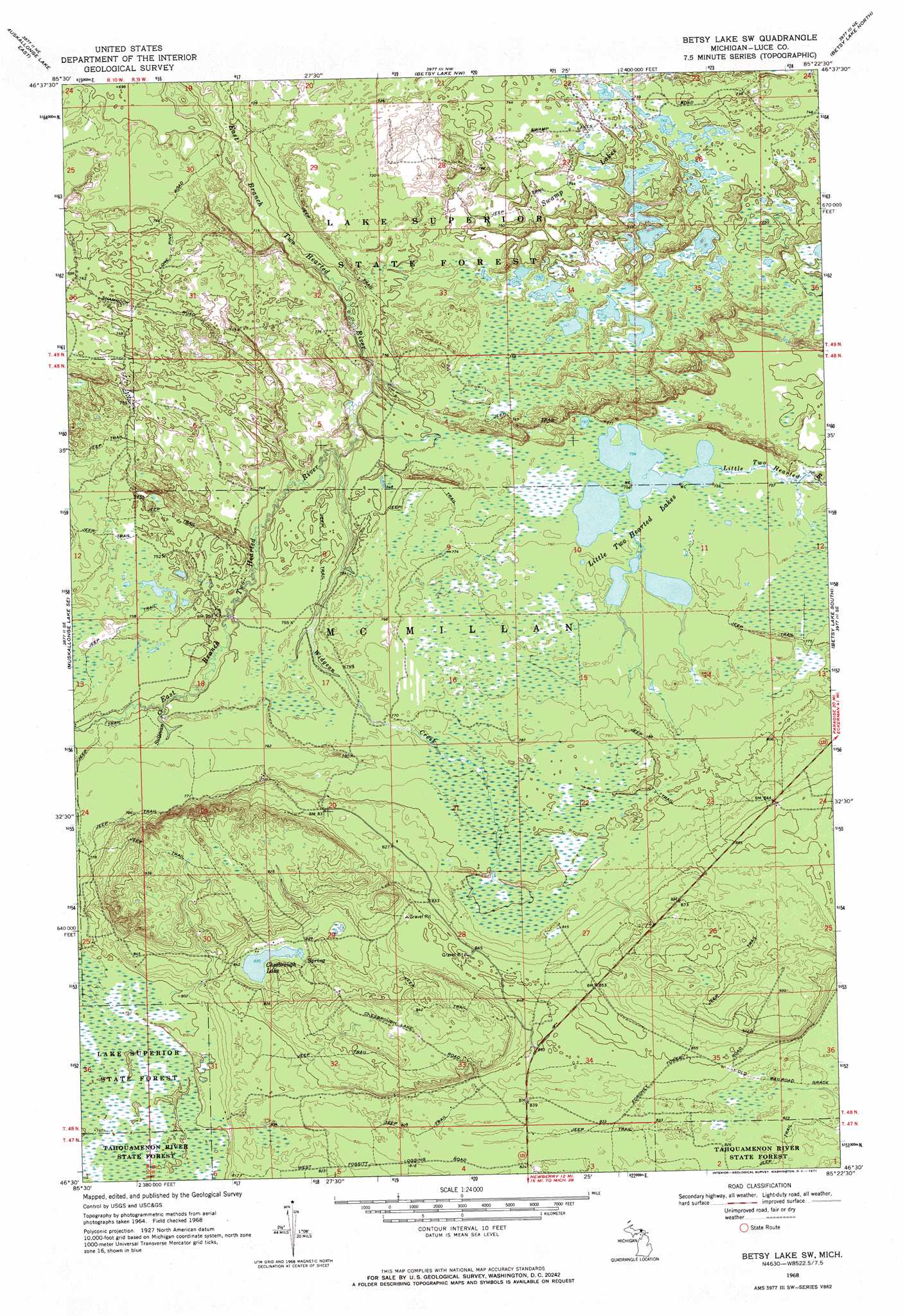
USGS Topo Quad 46085e4 - 1:24,000 scale
| Topo Map Name: | Betsy Lake Sw |
| USGS Topo Quad ID: | 46085e4 |
| Print Size: | ca. 21 1/4" wide x 27" high |
| Southeast Coordinates: | 46.5° N latitude / 85.375° W longitude |
| Map Center Coordinates: | 46.5625° N latitude / 85.4375° W longitude |
| U.S. State: | MI |
| Filename: | o46085e4.jpg |
| Download Map JPG Image: | Betsy Lake Sw topo map 1:24,000 scale |
| Map Type: | Topographic |
| Topo Series: | 7.5´ |
| Map Scale: | 1:24,000 |
| Source of Map Images: | United States Geological Survey (USGS) |
| Alternate Map Versions: |
Betsy Lake SW MI 1968, updated 1971 Download PDF Buy paper map Betsy Lake SW MI 1968, updated 1971 Download PDF Buy paper map Betsy Lake SW MI 2011 Download PDF Buy paper map Betsy Lake SW MI 2014 Download PDF Buy paper map Betsy Lake SW MI 2017 Download PDF Buy paper map |
1:24,000 Topo Quads surrounding Betsy Lake Sw
Vermilion |
||||
Muskallonge Lake West |
Muskallonge Lake East |
Betsy Lake Nw |
Betsy Lake North |
Sheephead Lake |
Muskallonge Lake Sw |
Muskallonge Lake Se |
Betsy Lake Sw |
Betsy Lake South |
Timberlost |
Buckeye Lake |
Auger Lake |
Roy Lake |
Gimlet Creek |
Big Beaver Creek |
Mcmillan |
Newberry |
Roberts Corner |
Soo Junction |
Hulbert |
> Back to 46085e1 at 1:100,000 scale
> Back to 46084a1 at 1:250,000 scale
> Back to U.S. Topo Maps home
Betsy Lake Sw topo map: Gazetteer
Betsy Lake Sw: Lakes
Chesbrough Lake elevation 250m 820′Little Two Hearted Lakes elevation 230m 754′
Swamp Lakes elevation 228m 748′
Betsy Lake Sw: Streams
Sullivan Creek elevation 226m 741′Widgeon Creek elevation 217m 711′
Betsy Lake Sw digital topo map on disk
Buy this Betsy Lake Sw topo map showing relief, roads, GPS coordinates and other geographical features, as a high-resolution digital map file on DVD: