Grand Forks Sw Topo Map North Dakota
To zoom in, hover over the map of Grand Forks Sw
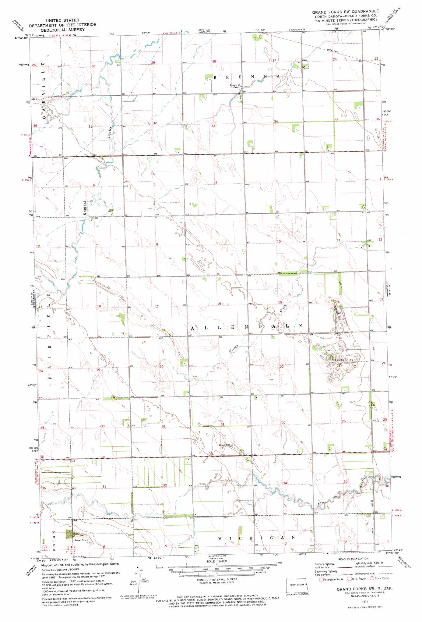
USGS Topo Quad 47097g2 - 1:24,000 scale
| Topo Map Name: | Grand Forks Sw |
| USGS Topo Quad ID: | 47097g2 |
| Print Size: | ca. 21 1/4" wide x 27" high |
| Southeast Coordinates: | 47.75° N latitude / 97.125° W longitude |
| Map Center Coordinates: | 47.8125° N latitude / 97.1875° W longitude |
| U.S. State: | ND |
| Filename: | O47097G2.jpg |
| Download Map JPG Image: | Grand Forks Sw topo map 1:24,000 scale |
| Map Type: | Topographic |
| Topo Series: | 7.5´ |
| Map Scale: | 1:24,000 |
| Source of Map Images: | United States Geological Survey (USGS) |
| Alternate Map Versions: |
Grand Forks SW ND 1971, updated 1973 Download PDF Buy paper map Grand Forks SW ND 2011 Download PDF Buy paper map Grand Forks SW ND 2014 Download PDF Buy paper map |
1:24,000 Topo Quads surrounding Grand Forks Sw
Gilby |
Mekinock |
Manvel |
Oslo Se |
Warren Sw |
Arvilla |
Emerado |
Kelly |
Grand Forks |
Mallory |
Emerado Sw |
Emerado Se |
Grand Forks Sw |
Thompson |
Bygland |
Hatton |
Holmes |
Buxton Nw |
Reynolds |
Climax Nw |
Hatton Sw |
Mayville North |
Buxton Sw |
Buxton |
Climax Sw |
> Back to 47097e1 at 1:100,000 scale
> Back to 47096a1 at 1:250,000 scale
> Back to U.S. Topo Maps home
Grand Forks Sw digital topo map on disk
Buy this Grand Forks Sw topo map showing relief, roads, GPS coordinates and other geographical features, as a high-resolution digital map file on DVD:
Eastern North Dakota & Eastern South Dakota
Buy digital topo maps: Eastern North Dakota & Eastern South Dakota