Rogers Topo Map North Dakota
To zoom in, hover over the map of Rogers
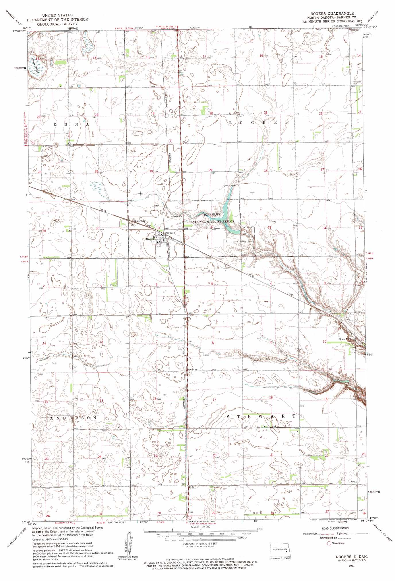
USGS Topo Quad 47098a2 - 1:24,000 scale
| Topo Map Name: | Rogers |
| USGS Topo Quad ID: | 47098a2 |
| Print Size: | ca. 21 1/4" wide x 27" high |
| Southeast Coordinates: | 47° N latitude / 98.125° W longitude |
| Map Center Coordinates: | 47.0625° N latitude / 98.1875° W longitude |
| U.S. State: | ND |
| Filename: | O47098A2.jpg |
| Download Map JPG Image: | Rogers topo map 1:24,000 scale |
| Map Type: | Topographic |
| Topo Series: | 7.5´ |
| Map Scale: | 1:24,000 |
| Source of Map Images: | United States Geological Survey (USGS) |
| Alternate Map Versions: |
Rogers ND 1961, updated 1963 Download PDF Buy paper map Rogers ND 2011 Download PDF Buy paper map Rogers ND 2014 Download PDF Buy paper map |
1:24,000 Topo Quads surrounding Rogers
Sutton Sw |
Revere |
Hannaford |
Karnak |
Luverne |
Wimbledon |
Wimbledon Ne |
Dazey |
Dazey Ne |
Sibley |
Clementsville |
Leal |
Rogers |
Baldhill Dam |
Pillsbury Sw |
Spiritwood |
Eckelson |
Sanborn |
Valley City West |
Valley City East |
Eckelson Sw |
Eckelson Se |
Moon Lake |
Sanborn Se |
Fingal Sw |
> Back to 47098a1 at 1:100,000 scale
> Back to 47098a1 at 1:250,000 scale
> Back to U.S. Topo Maps home
Rogers topo map: Gazetteer
Rogers: Dams
Tomahawk Dam elevation 427m 1400′Rogers: Parks
Tomahawk National Wildlife Refuge elevation 429m 1407′Rogers: Populated Places
Odell (historical) elevation 436m 1430′Rogers elevation 435m 1427′
Rogers: Reservoirs
Tomahawk Lake elevation 427m 1400′Rogers: Swamps
Orner Slough elevation 431m 1414′Rogers digital topo map on disk
Buy this Rogers topo map showing relief, roads, GPS coordinates and other geographical features, as a high-resolution digital map file on DVD:
Eastern North Dakota & Eastern South Dakota
Buy digital topo maps: Eastern North Dakota & Eastern South Dakota