Gibson Coulee Topo Map Montana
To zoom in, hover over the map of Gibson Coulee
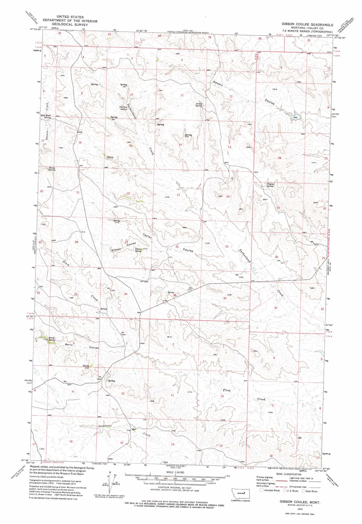
USGS Topo Quad 47107g2 - 1:24,000 scale
| Topo Map Name: | Gibson Coulee |
| USGS Topo Quad ID: | 47107g2 |
| Print Size: | ca. 21 1/4" wide x 27" high |
| Southeast Coordinates: | 47.75° N latitude / 107.125° W longitude |
| Map Center Coordinates: | 47.8125° N latitude / 107.1875° W longitude |
| U.S. State: | MT |
| Filename: | o47107g2.jpg |
| Download Map JPG Image: | Gibson Coulee topo map 1:24,000 scale |
| Map Type: | Topographic |
| Topo Series: | 7.5´ |
| Map Scale: | 1:24,000 |
| Source of Map Images: | United States Geological Survey (USGS) |
| Alternate Map Versions: |
Gibson Coulee MT 1973, updated 1977 Download PDF Buy paper map Gibson Coulee MT 2011 Download PDF Buy paper map Gibson Coulee MT 2014 Download PDF Buy paper map |
1:24,000 Topo Quads surrounding Gibson Coulee
Harb Sw |
Craig Reservoir |
Burnett Flats West |
Burnett Flats East |
Miller Coulee West |
White Horse Coulee |
Niles Coulee |
Triple Crossing Res. West |
Triple Crossing Res. East |
Collins Reservoir |
Whiskey Coulee |
Smith Coulee |
Gibson Coulee |
Murray Hill |
Brown Pass |
Swede Ridge |
Wolfe Coulee |
Wagon Coulee |
Harper Camp |
Peterson Point |
Sawmill Creek |
Chalk Butte |
Hell Hollow |
Trumbo Ranch |
Maloney Hill |
> Back to 47107e1 at 1:100,000 scale
> Back to 47106a1 at 1:250,000 scale
> Back to U.S. Topo Maps home
Gibson Coulee topo map: Gazetteer
Gibson Coulee: Dams
Willow Creek Upper South Fork Dam elevation 791m 2595′Gibson Coulee: Springs
23N35E10BCA_01 Spring elevation 846m 2775′Andys Spring elevation 857m 2811′
Berry Spring elevation 853m 2798′
Chittick Spring elevation 835m 2739′
Gibson Spring elevation 824m 2703′
Half Moon Spring elevation 865m 2837′
Haney Spring elevation 857m 2811′
Wagner Spring elevation 853m 2798′
Gibson Coulee: Valleys
Berry Coulee elevation 801m 2627′Gibson Coulee elevation 811m 2660′
Taylor Coulee elevation 767m 2516′
Gibson Coulee digital topo map on disk
Buy this Gibson Coulee topo map showing relief, roads, GPS coordinates and other geographical features, as a high-resolution digital map file on DVD:
Eastern Montana & Western North Dakota
Buy digital topo maps: Eastern Montana & Western North Dakota