Rocklyn Sw Topo Map Washington
To zoom in, hover over the map of Rocklyn Sw
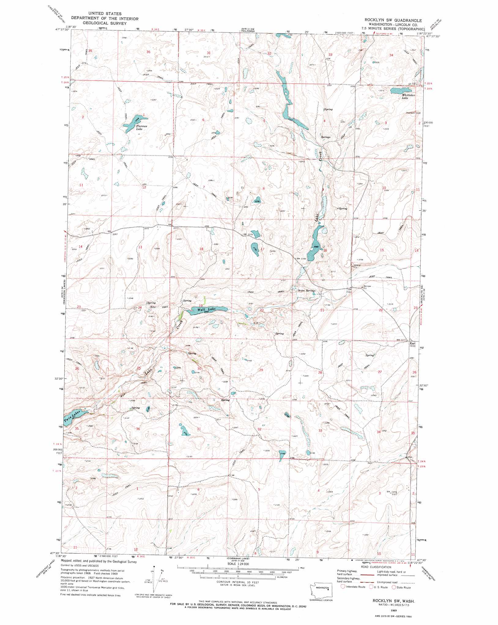
USGS Topo Quad 47118e4 - 1:24,000 scale
| Topo Map Name: | Rocklyn Sw |
| USGS Topo Quad ID: | 47118e4 |
| Print Size: | ca. 21 1/4" wide x 27" high |
| Southeast Coordinates: | 47.5° N latitude / 118.375° W longitude |
| Map Center Coordinates: | 47.5625° N latitude / 118.4375° W longitude |
| U.S. State: | WA |
| Filename: | o47118e4.jpg |
| Download Map JPG Image: | Rocklyn Sw topo map 1:24,000 scale |
| Map Type: | Topographic |
| Topo Series: | 7.5´ |
| Map Scale: | 1:24,000 |
| Source of Map Images: | United States Geological Survey (USGS) |
| Alternate Map Versions: |
Rocklyn SW WA 1969, updated 1972 Download PDF Buy paper map Rocklyn SW WA 2011 Download PDF Buy paper map Rocklyn SW WA 2013 Download PDF Buy paper map |
1:24,000 Topo Quads surrounding Rocklyn Sw
Wilbur |
Creston |
Lincoln |
Olsen Canyon |
Inkster Lake |
Wagner Lake |
Creston Butte |
Telford |
Rocklyn |
Davenport |
Draper Lake |
Swanson Lakes |
Rocklyn Sw |
Rocklyn Se |
Bluestem |
Pacific Lake |
Coffeepot Lake |
Cormana Lake |
Harrington |
Lords Valley |
Odessa |
Sylvan Lake |
Lamona |
Harrington Se |
Sprague Lake Sw |
> Back to 47118e1 at 1:100,000 scale
> Back to 47118a1 at 1:250,000 scale
> Back to U.S. Topo Maps home
Rocklyn Sw topo map: Gazetteer
Rocklyn Sw: Lakes
Florence Lake elevation 686m 2250′Wall Lake elevation 623m 2043′
Whittaker Lake elevation 695m 2280′
Rocklyn Sw: Populated Places
Earl elevation 693m 2273′Rocklyn Sw: Springs
Seven Springs elevation 637m 2089′Rocklyn Sw digital topo map on disk
Buy this Rocklyn Sw topo map showing relief, roads, GPS coordinates and other geographical features, as a high-resolution digital map file on DVD: