Oaks Corner Topo Map Minnesota
To zoom in, hover over the map of Oaks Corner
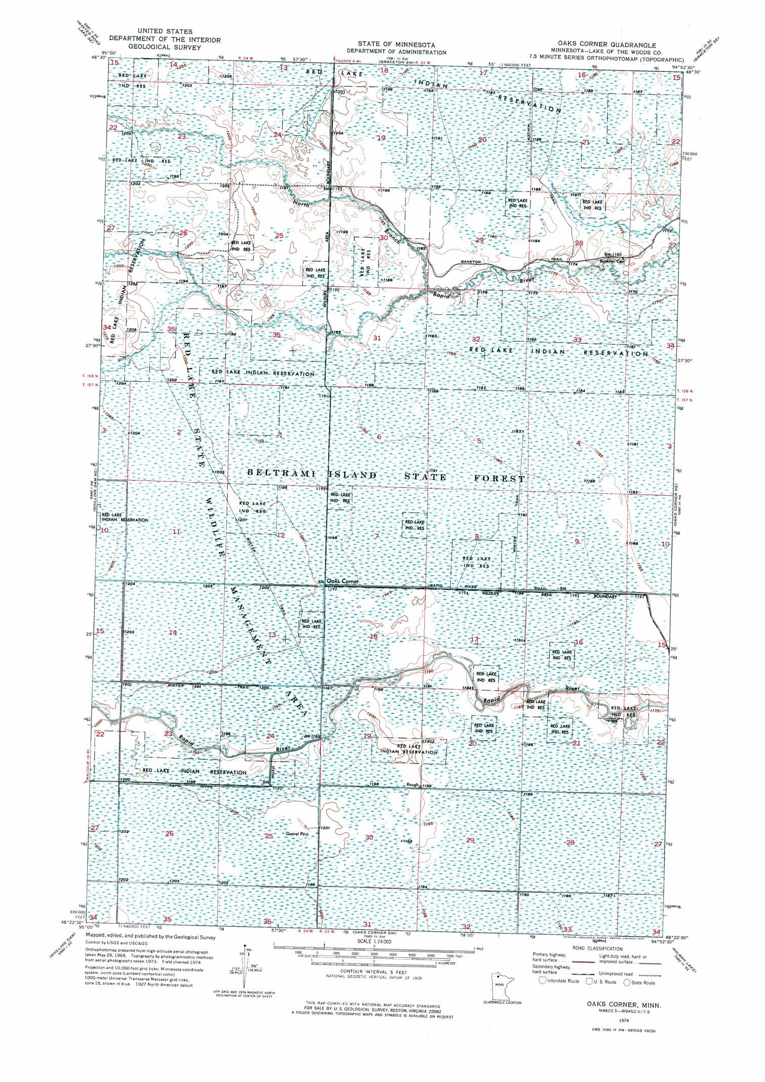
USGS Topo Quad 48094d8 - 1:24,000 scale
| Topo Map Name: | Oaks Corner |
| USGS Topo Quad ID: | 48094d8 |
| Print Size: | ca. 21 1/4" wide x 27" high |
| Southeast Coordinates: | 48.375° N latitude / 94.875° W longitude |
| Map Center Coordinates: | 48.4375° N latitude / 94.9375° W longitude |
| U.S. State: | MN |
| Filename: | p48094d8.jpg |
| Download Map JPG Image: | Oaks Corner topo map 1:24,000 scale |
| Map Type: | Orthophoto |
| Topo Series: | 7.5´ |
| Map Scale: | 1:24,000 |
| Source of Map Images: | United States Geological Survey (USGS) |
| Alternate Map Versions: |
Oaks Corner MN 1974, updated 1976 Download PDF Buy paper map Oaks Corner MN 2010 Download PDF Buy paper map Oaks Corner MN 2013 Download PDF Buy paper map Oaks Corner MN 2016 Download PDF Buy paper map |
1:24,000 Topo Quads surrounding Oaks Corner
Winter Road Lake Nw |
Winter Road Lake |
Graceton Nw |
Graceton |
Pitt |
Winter Road Lake Sw |
Winter Road Lake Se |
Graceton Sw |
Graceton Se |
Baudette Sw |
Shilling Dam Nw |
Shilling Dam Ne |
Oaks Corner |
Oaks Corner Ne |
Chase Brook |
Head Of Rapid River |
Shilling Dam |
Oaks Corner Sw |
Hilman Lake |
Chase Brook Sw |
Thorhult |
Manomin Creek |
Ponemah Nw |
Ponemah Ne |
Waskish Nw |
> Back to 48094a1 at 1:100,000 scale
> Back to 48094a1 at 1:250,000 scale
> Back to U.S. Topo Maps home
Oaks Corner topo map: Gazetteer
Oaks Corner: Bridges
Peet's Bridge elevation 363m 1190′Oaks Corner: Populated Places
Oaks Corner elevation 365m 1197′Oaks Corner: Post Offices
Bankton Post Office (historical) elevation 358m 1174′Oaks Corner digital topo map on disk
Buy this Oaks Corner topo map showing relief, roads, GPS coordinates and other geographical features, as a high-resolution digital map file on DVD: