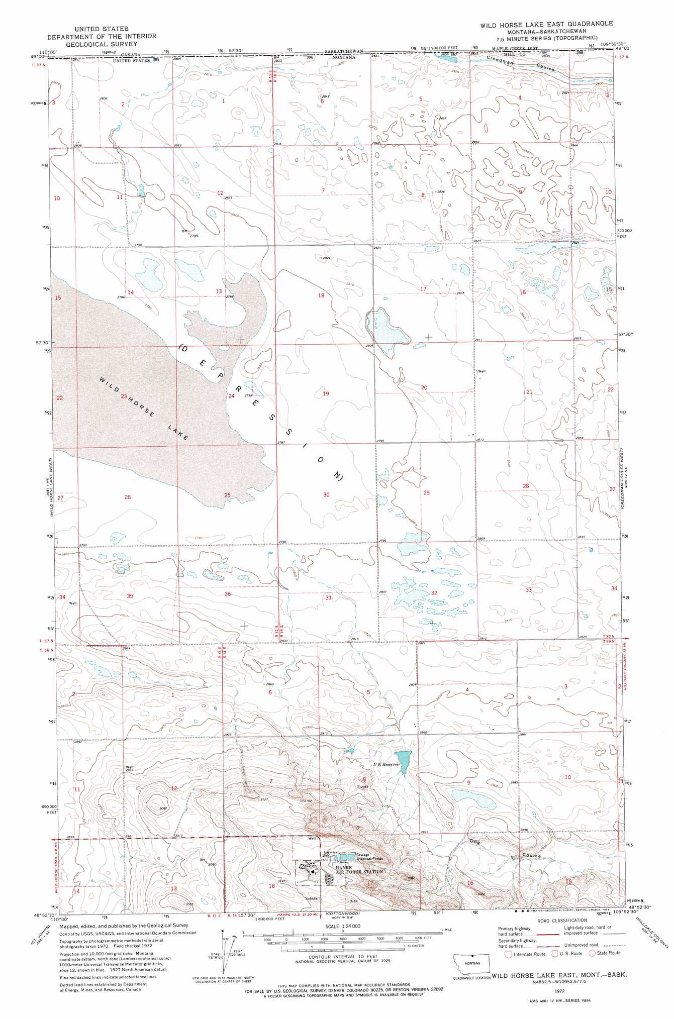
Wild Horse Lake East Topo Map Montana
To zoom in, hover over the map of Wild Horse Lake East
USGS Topo Quad 48109h8 - 1:24,000 scale
| Topo Map Name: | Wild Horse Lake East |
| USGS Topo Quad ID: | 48109h8 |
| Print Size: | ca. 21 1/4" wide x 27" high |
| Southeast Coordinates: | 48.875° N latitude / 109.875° W longitude |
| Map Center Coordinates: | 48.9375° N latitude / 109.9375° W longitude |
| U.S. State: | MT |
| Filename: | o48109h8.jpg |
| Download Map JPG Image: | Wild Horse Lake East topo map 1:24,000 scale |
| Map Type: | Topographic |
| Topo Series: | 7.5´ |
| Map Scale: | 1:24,000 |
| Source of Map Images: | United States Geological Survey (USGS) |
| Alternate Map Versions: |
Wild Horse Lake East MT 1972, updated 1975 Download PDF Buy paper map Wild Horse Lake East MT 2011 Download PDF Buy paper map Wild Horse Lake East MT 2014 Download PDF Buy paper map |
1:24,000 Topo Quads surrounding Wild Horse Lake East
Simpson |
Wild Horse Lake West |
Wild Horse Lake East |
Creedman Coulee West |
Creedman Coulee East |
Ninemile Coulee East |
Saint Johns |
Cottonwood |
Hilldale Colony |
Lake Thibadeau Sw |
Dry Lake |
Saddle Butte |
Kiehns Coulee |
Quigley Coulee |
Havre Nw |
> Back to 48109e1 at 1:100,000 scale
> Back to 48108a1 at 1:250,000 scale
> Back to U.S. Topo Maps home
Wild Horse Lake East topo map: Gazetteer
Wild Horse Lake East: Dams
Brown Paper Bag Dam elevation 853m 2798′U N Reservoir Dam elevation 875m 2870′
Wild Horse Lake East: Reservoirs
U N Reservoir elevation 871m 2857′Wild Horse Lake East: Wells
37N14E20DDDA01 Well elevation 858m 2814′37N14E20DDDD01 Well elevation 858m 2814′
Wild Horse Lake East digital topo map on disk
Buy this Wild Horse Lake East topo map showing relief, roads, GPS coordinates and other geographical features, as a high-resolution digital map file on DVD: