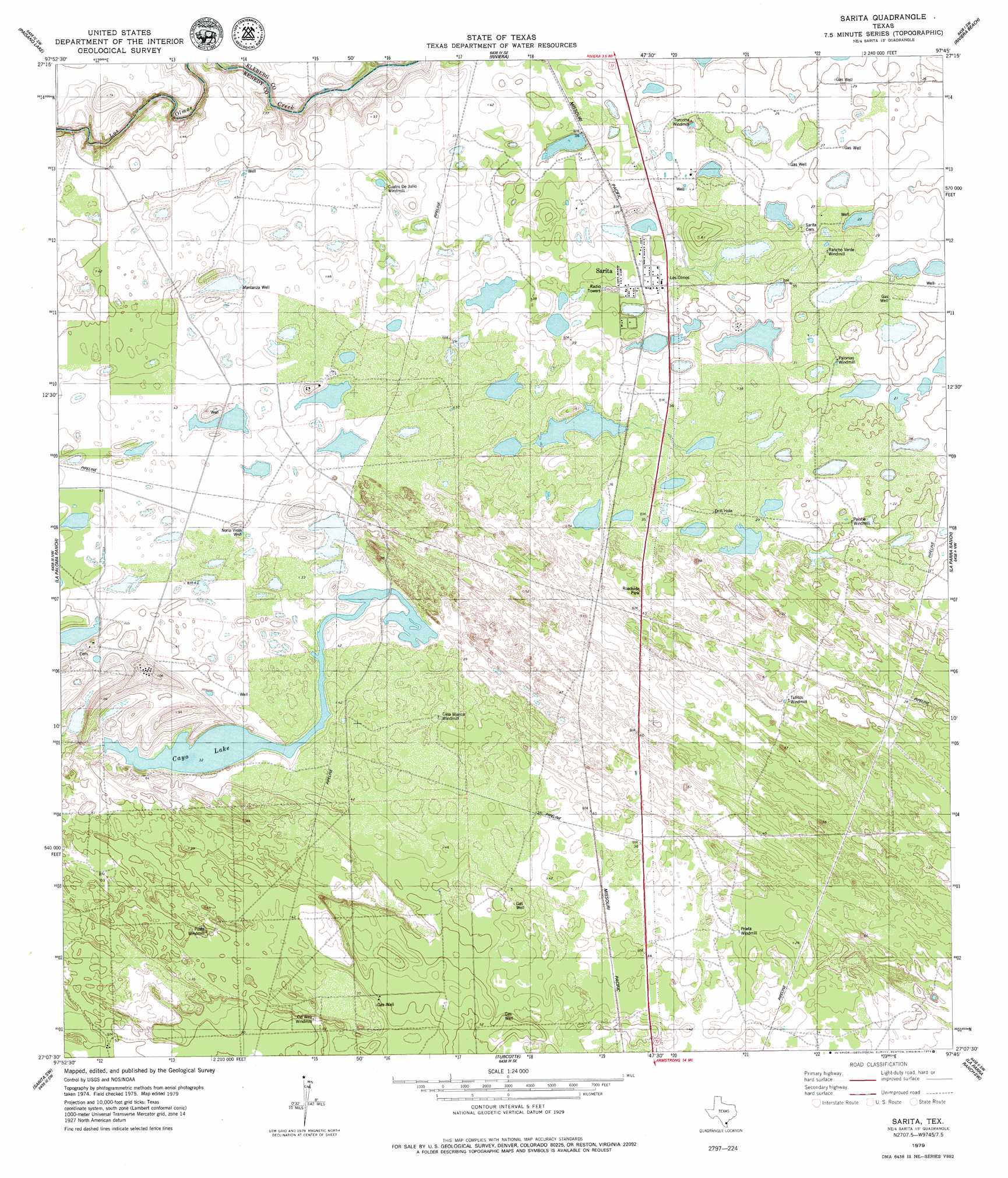
Sarita Topo Map Texas
To zoom in, hover over the map of Sarita
USGS Topo Quad 27097b7 - 1:24,000 scale
| Topo Map Name: | Sarita |
| USGS Topo Quad ID: | 27097b7 |
| Print Size: | ca. 21 1/4" wide x 27" high |
| Southeast Coordinates: | 27.125° N latitude / 97.75° W longitude |
| Map Center Coordinates: | 27.1875° N latitude / 97.8125° W longitude |
| U.S. State: | TX |
| Filename: | o27097b7.jpg |
| Download Map JPG Image: | Sarita topo map 1:24,000 scale |
| Map Type: | Topographic |
| Topo Series: | 7.5´ |
| Map Scale: | 1:24,000 |
| Source of Map Images: | United States Geological Survey (USGS) |
| Alternate Map Versions: |
Sarita TX 2010 Download PDF Buy paper map Sarita TX 2013 Download PDF Buy paper map Sarita TX 2016 Download PDF Buy paper map |
1:24,000 Topo Quads surrounding Sarita
Ella |
Escondido Lake |
Ricardo |
Riviera Beach Nw |
Riviera Beach Ne |
Premont East |
Paisano Lake |
Riviera |
Riviera Beach |
Kleberg Point |
Flowella |
La Paloma Ranch |
Sarita |
La Parra Ranch |
La Parra Ranch Ne |
Falfurrias Se |
Sarita Sw |
Turcotte |
La Parra Ranch Sw |
La Parra Ranch Se |
San Tomas Camp |
Pita Camp |
Armstrong |
San Pedro Ranch |
Maria Estella Well |
> Back to 27097a1 at 1:100,000 scale
> Back to 27096a1 at 1:250,000 scale
> Back to U.S. Topo Maps home
Sarita topo map: Gazetteer
Sarita: Lakes
Cayo Lake elevation 10m 32′Sarita: Populated Places
Sarita elevation 11m 36′Sarita: Streams
Palo Blanco Creek elevation 9m 29′Sarita: Wells
Mantanza Well elevation 11m 36′Noria Vieja Well elevation 12m 39′
Sarita digital topo map on disk
Buy this Sarita topo map showing relief, roads, GPS coordinates and other geographical features, as a high-resolution digital map file on DVD: