Driscoll East Topo Map Texas
To zoom in, hover over the map of Driscoll East
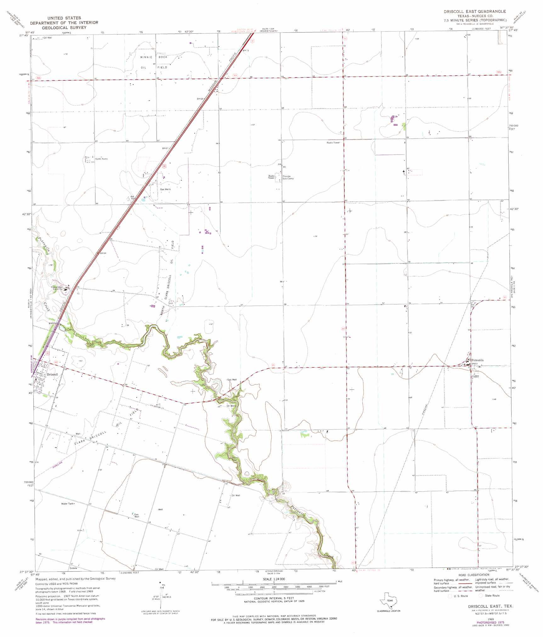
USGS Topo Quad 27097f6 - 1:24,000 scale
| Topo Map Name: | Driscoll East |
| USGS Topo Quad ID: | 27097f6 |
| Print Size: | ca. 21 1/4" wide x 27" high |
| Southeast Coordinates: | 27.625° N latitude / 97.625° W longitude |
| Map Center Coordinates: | 27.6875° N latitude / 97.6875° W longitude |
| U.S. State: | TX |
| Filename: | o27097f6.jpg |
| Download Map JPG Image: | Driscoll East topo map 1:24,000 scale |
| Map Type: | Topographic |
| Topo Series: | 7.5´ |
| Map Scale: | 1:24,000 |
| Source of Map Images: | United States Geological Survey (USGS) |
| Alternate Map Versions: |
Driscoll East TX 1969, updated 1972 Download PDF Buy paper map Driscoll East TX 1969, updated 1977 Download PDF Buy paper map Driscoll East TX 2010 Download PDF Buy paper map Driscoll East TX 2013 Download PDF Buy paper map Driscoll East TX 2016 Download PDF Buy paper map |
1:24,000 Topo Quads surrounding Driscoll East
Orange Grove |
San Patricio |
Edroy |
Odem |
Taft |
Agua Dulce |
Banquete |
Robstown |
Annaville |
Corpus Christi |
Kingsville Nw |
Driscoll West |
Driscoll East |
Petronila Ne |
Oso Creek Nw |
Kingsville West |
Kingsville East |
Concordia |
Laureles Ranch |
Chapman Ranch |
Escondido Lake |
Ricardo |
Riviera Beach Nw |
Riviera Beach Ne |
South Bird Island Nw |
> Back to 27097e1 at 1:100,000 scale
> Back to 27096a1 at 1:250,000 scale
> Back to U.S. Topo Maps home
Driscoll East topo map: Gazetteer
Driscoll East: Oilfields
Clara Driscoll Oil Field elevation 16m 52′Minnie Bock Oil Field elevation 21m 68′
North Clara Driscoll Oil Field elevation 17m 55′
Driscoll East: Populated Places
Driscoll elevation 19m 62′Petronila elevation 15m 49′
Driscoll East digital topo map on disk
Buy this Driscoll East topo map showing relief, roads, GPS coordinates and other geographical features, as a high-resolution digital map file on DVD: