Deer Park Se Topo Map Florida
To zoom in, hover over the map of Deer Park Se
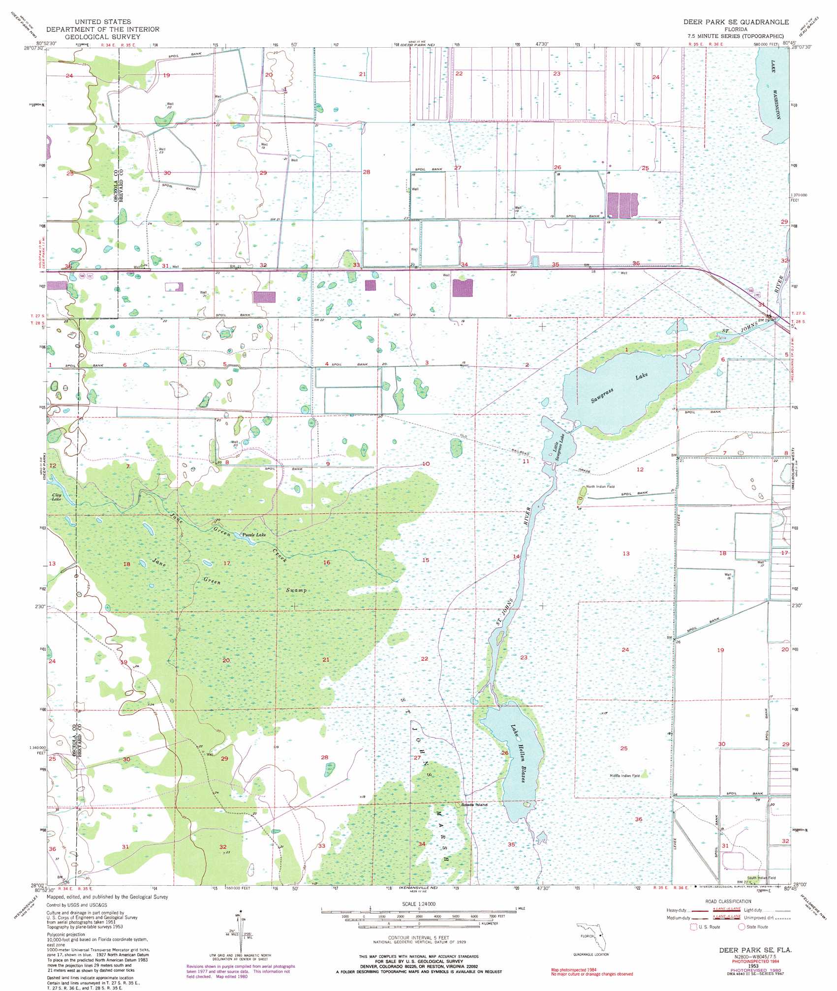
USGS Topo Quad 28080a7 - 1:24,000 scale
| Topo Map Name: | Deer Park Se |
| USGS Topo Quad ID: | 28080a7 |
| Print Size: | ca. 21 1/4" wide x 27" high |
| Southeast Coordinates: | 28° N latitude / 80.75° W longitude |
| Map Center Coordinates: | 28.0625° N latitude / 80.8125° W longitude |
| U.S. State: | FL |
| Filename: | O28080A7.jpg |
| Download Map JPG Image: | Deer Park Se topo map 1:24,000 scale |
| Map Type: | Topographic |
| Topo Series: | 7.5´ |
| Map Scale: | 1:24,000 |
| Source of Map Images: | United States Geological Survey (USGS) |
| Alternate Map Versions: |
Deer Park SE FL 1953, updated 1954 Download PDF Buy paper map Deer Park SE FL 1953, updated 1968 Download PDF Buy paper map Deer Park SE FL 1953, updated 1977 Download PDF Buy paper map Deer Park SE FL 1953, updated 1981 Download PDF Buy paper map Deer Park SE FL 1953, updated 1981 Download PDF Buy paper map Deer Park SE FL 2012 Download PDF Buy paper map Deer Park SE FL 2015 Download PDF Buy paper map |
1:24,000 Topo Quads surrounding Deer Park Se
Narcoossee Se |
Lake Poinsett Sw |
Lake Poinsett |
Cocoa |
Cocoa Beach |
Holopaw |
Deer Park Nw |
Deer Park Ne |
Eau Gallie |
Tropic |
Holopaw Se |
Deer Park |
Deer Park Se |
Melbourne West |
Melbourne East |
Lake Marian Ne |
Kenansville |
Kenansville Ne |
Fellsmere Nw |
Grant |
Lake Marian Se |
Kenansville Sw |
Kenansville Se |
Fellsmere Sw |
Fellsmere |
> Back to 28080a1 at 1:100,000 scale
> Back to 28080a1 at 1:250,000 scale
> Back to U.S. Topo Maps home
Deer Park Se topo map: Gazetteer
Deer Park Se: Islands
Middle Indian Field elevation 5m 16′North Indian Field elevation 6m 19′
South Indian Field elevation 4m 13′
Spade Island elevation 6m 19′
Deer Park Se: Lakes
Clay Lake elevation 7m 22′Lake Hellen Blazes elevation 5m 16′
Little Sawgrass Lake elevation 5m 16′
Puzzle Lake elevation 5m 16′
Sawgrass Lake elevation 5m 16′
Deer Park Se: Populated Places
Mayacas (historical) elevation 6m 19′Deer Park Se: Streams
Jane Green Creek elevation 5m 16′Deer Park Se: Swamps
Jane Green Swamp elevation 6m 19′Deer Park Se digital topo map on disk
Buy this Deer Park Se topo map showing relief, roads, GPS coordinates and other geographical features, as a high-resolution digital map file on DVD: