Holopaw Topo Map Florida
To zoom in, hover over the map of Holopaw
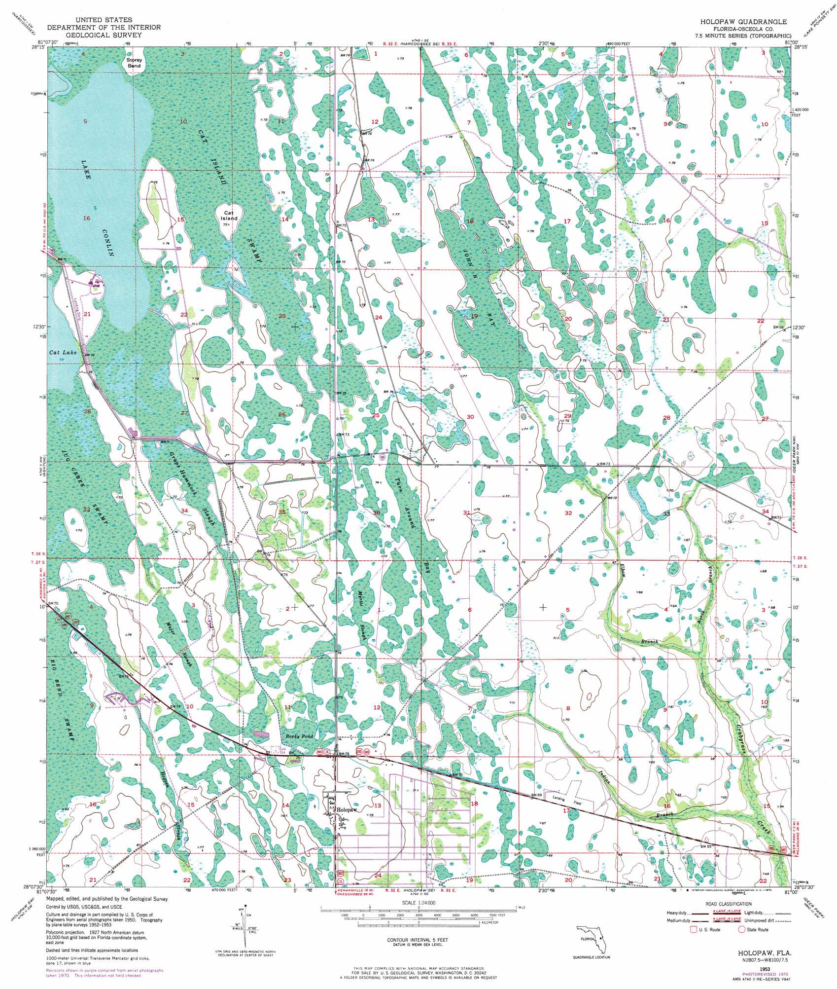
USGS Topo Quad 28081b1 - 1:24,000 scale
| Topo Map Name: | Holopaw |
| USGS Topo Quad ID: | 28081b1 |
| Print Size: | ca. 21 1/4" wide x 27" high |
| Southeast Coordinates: | 28.125° N latitude / 81° W longitude |
| Map Center Coordinates: | 28.1875° N latitude / 81.0625° W longitude |
| U.S. State: | FL |
| Filename: | O28081B1.jpg |
| Download Map JPG Image: | Holopaw topo map 1:24,000 scale |
| Map Type: | Topographic |
| Topo Series: | 7.5´ |
| Map Scale: | 1:24,000 |
| Source of Map Images: | United States Geological Survey (USGS) |
| Alternate Map Versions: |
Holopaw FL 1953, updated 1954 Download PDF Buy paper map Holopaw FL 1953, updated 1972 Download PDF Buy paper map Holopaw FL 2012 Download PDF Buy paper map Holopaw FL 2015 Download PDF Buy paper map |
1:24,000 Topo Quads surrounding Holopaw
Pine Castle |
Narcoossee Nw |
Narcoossee Ne |
Lake Poinsett Nw |
Sharpes |
Saint Cloud North |
Narcoossee |
Narcoossee Se |
Lake Poinsett Sw |
Lake Poinsett |
Saint Cloud South |
Ashton |
Holopaw |
Deer Park Nw |
Deer Park Ne |
Cypress Lake |
Holopaw Sw |
Holopaw Se |
Deer Park |
Deer Park Se |
Lake Weohyakapka Ne |
Lake Marian Nw |
Lake Marian Ne |
Kenansville |
Kenansville Ne |
> Back to 28081a1 at 1:100,000 scale
> Back to 28080a1 at 1:250,000 scale
> Back to U.S. Topo Maps home
Holopaw topo map: Gazetteer
Holopaw: Airports
Lake X Airport elevation 21m 68′Holopaw: Guts
Grape Hammock Slough elevation 21m 68′Hogpen Slough elevation 22m 72′
Major Slough elevation 21m 68′
Myrtle Slough elevation 21m 68′
Holopaw: Islands
Cat Island elevation 21m 68′Holopaw: Lakes
Lake Conlin elevation 21m 68′Major Slough Lake elevation 21m 68′
Holopaw: Populated Places
Holopaw elevation 23m 75′Holopaw: Streams
Elbow Branch elevation 16m 52′Indian Branch elevation 13m 42′
North Branch Crabgrass Creek elevation 16m 52′
Holopaw: Swamps
Cat Island Swamp elevation 21m 68′John H Bay elevation 22m 72′
Jug Creek Swamp elevation 21m 68′
Rocky Pond elevation 21m 68′
Turn Around Bay elevation 21m 68′
Holopaw digital topo map on disk
Buy this Holopaw topo map showing relief, roads, GPS coordinates and other geographical features, as a high-resolution digital map file on DVD: