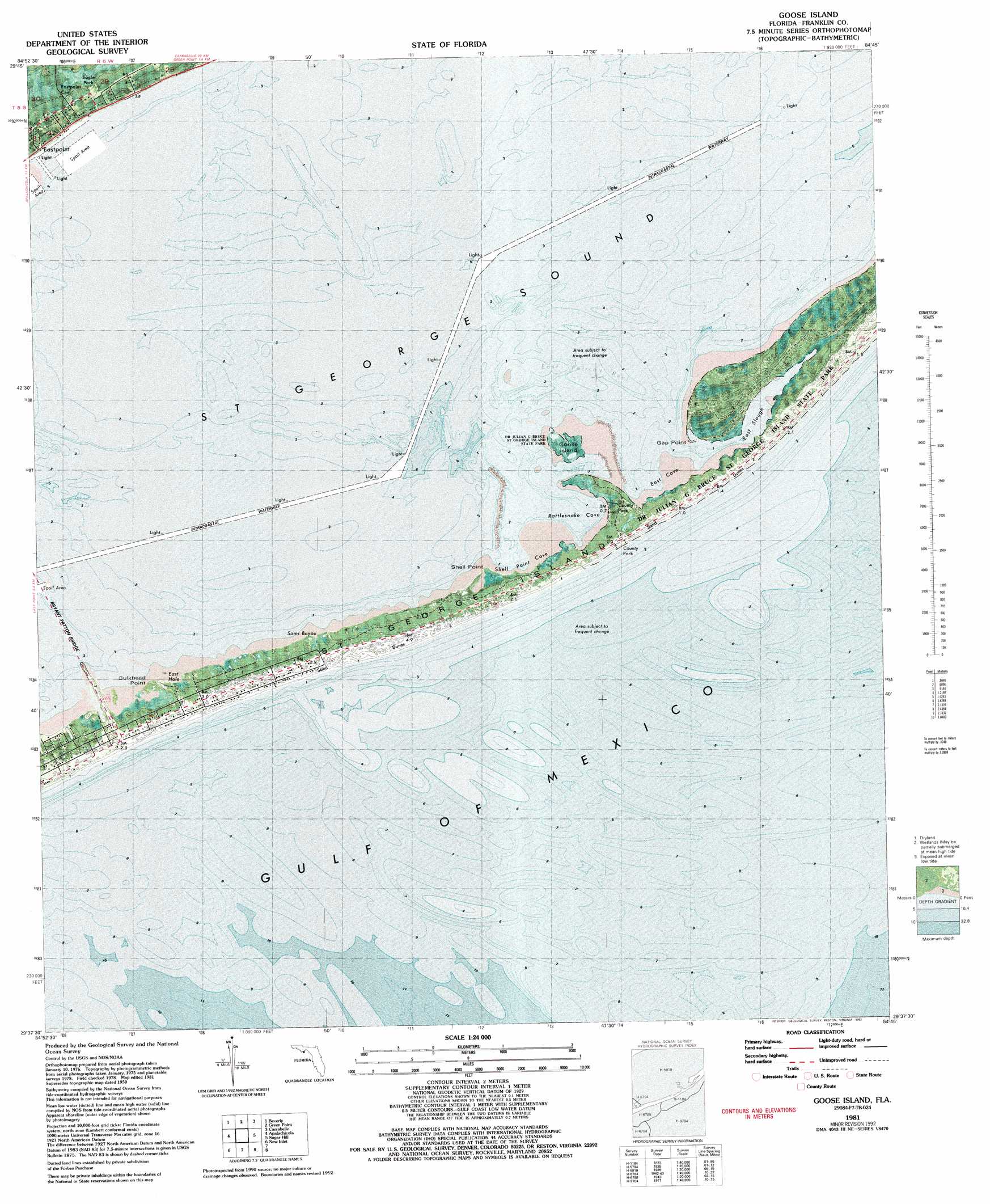
Goose Island Topo Map Florida
To zoom in, hover over the map of Goose Island
USGS Topo Quad 29084f7 - 1:24,000 scale
| Topo Map Name: | Goose Island |
| USGS Topo Quad ID: | 29084f7 |
| Print Size: | ca. 21 1/4" wide x 27" high |
| Southeast Coordinates: | 29.625° N latitude / 84.75° W longitude |
| Map Center Coordinates: | 29.6875° N latitude / 84.8125° W longitude |
| U.S. State: | FL |
| Filename: | P29084f7.jpg |
| Download Map JPG Image: | Goose Island topo map 1:24,000 scale |
| Map Type: | Orthophoto |
| Topo Series: | 7.5´ |
| Map Scale: | 1:24,000 |
| Source of Map Images: | United States Geological Survey (USGS) |
| Alternate Map Versions: |
Goose Island FL 1950, updated 1960 Download PDF Buy paper map Goose Island FL 1950, updated 1960 Download PDF Buy paper map Goose Island FL 1981, updated 1982 Download PDF Buy paper map Goose Island FL 1981, updated 1992 Download PDF Buy paper map Goose Island FL 2012 Download PDF Buy paper map Goose Island FL 2015 Download PDF Buy paper map |
1:24,000 Topo Quads surrounding Goose Island
Forbes Island |
Fort Gadsden |
Tates Hell Swamp |
Pickett Bay |
Mcintyre |
Jackson River |
Beverly |
Green Point |
Carrabelle |
Dog Island |
West Pass |
Apalachicola |
Goose Island |
Sugar Hill |
|
Cape Saint George |
New Inlet |
|||
> Back to 29084e1 at 1:100,000 scale
> Back to 29084a1 at 1:250,000 scale
> Back to U.S. Topo Maps home
Goose Island topo map: Gazetteer
Goose Island: Bars
East Pelican Reef elevation 0m 0′Goose Island: Bays
East Cove elevation 0m 0′East Hole elevation 1m 3′
Rattlesnake Cove elevation 0m 0′
Sams Bayou elevation 0m 0′
Shell Point Cove elevation 0m 0′
Goose Island: Capes
Bulkhead Point elevation 1m 3′Gap Point elevation 1m 3′
Shell Point elevation 0m 0′
Goose Island: Guts
East Slough elevation 0m 0′Goose Island: Islands
Goose Island elevation 0m 0′Goose Island: Streams
Porters Bar Creek elevation 0m 0′Goose Island digital topo map on disk
Buy this Goose Island topo map showing relief, roads, GPS coordinates and other geographical features, as a high-resolution digital map file on DVD:
Gulf Coast (LA, MS, AL, FL) & Southwestern Georgia
Buy digital topo maps: Gulf Coast (LA, MS, AL, FL) & Southwestern Georgia
 & Southwestern Georgia map DVD")