Point Chevreuil Topo Map Louisiana
To zoom in, hover over the map of Point Chevreuil
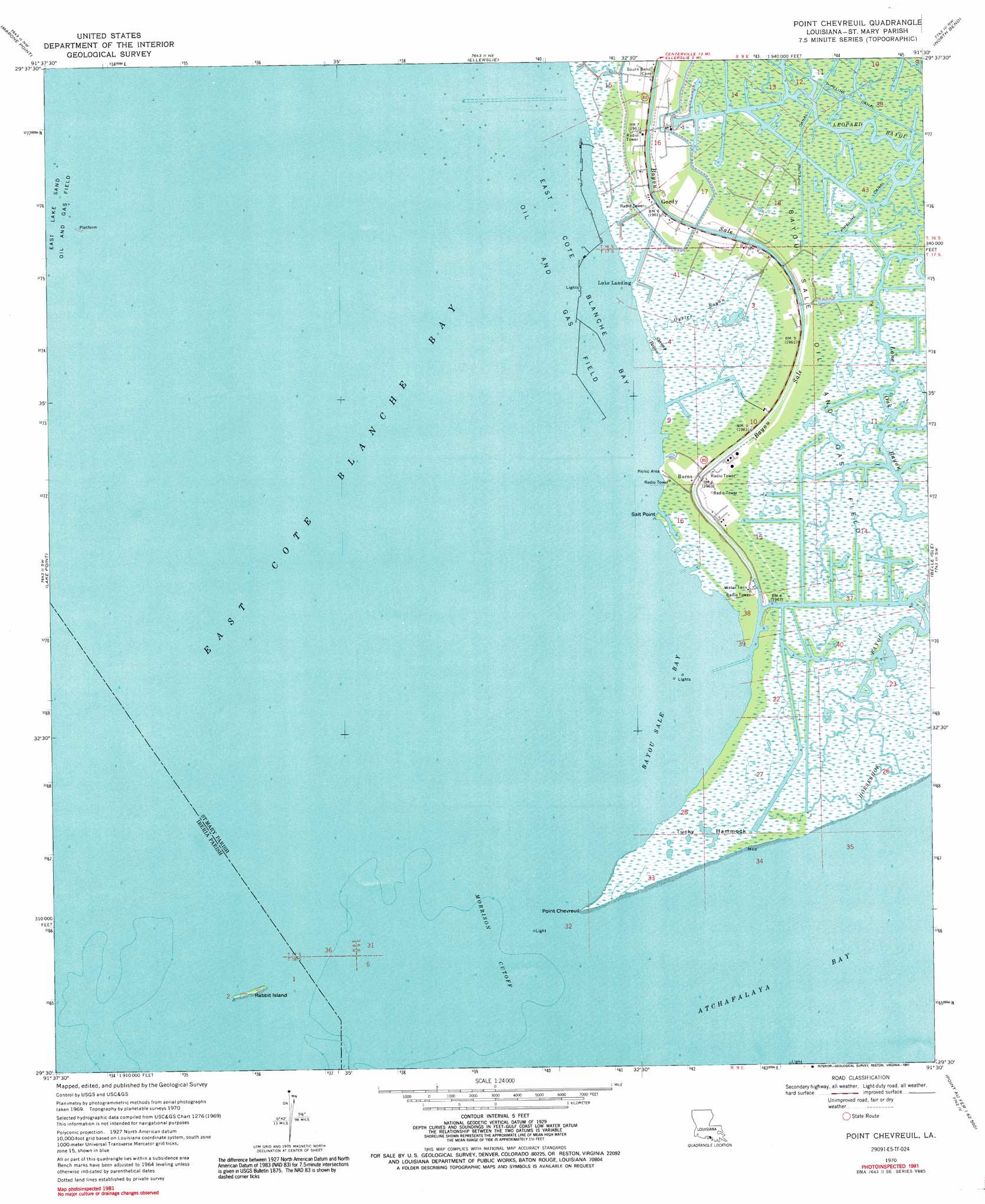
USGS Topo Quad 29091e5 - 1:24,000 scale
| Topo Map Name: | Point Chevreuil |
| USGS Topo Quad ID: | 29091e5 |
| Print Size: | ca. 21 1/4" wide x 27" high |
| Southeast Coordinates: | 29.5° N latitude / 91.5° W longitude |
| Map Center Coordinates: | 29.5625° N latitude / 91.5625° W longitude |
| U.S. State: | LA |
| Filename: | o29091e5.jpg |
| Download Map JPG Image: | Point Chevreuil topo map 1:24,000 scale |
| Map Type: | Topographic |
| Topo Series: | 7.5´ |
| Map Scale: | 1:24,000 |
| Source of Map Images: | United States Geological Survey (USGS) |
| Alternate Map Versions: |
Point Chevreuil LA 1970, updated 1972 Download PDF Buy paper map Point Chevreuil LA 1970, updated 1984 Download PDF Buy paper map Point Chevreuil LA 1970, updated 1991 Download PDF Buy paper map Point Chevreuil LA 1994, updated 1998 Download PDF Buy paper map Point Chevreuil LA 2012 Download PDF Buy paper map Point Chevreuil LA 2015 Download PDF Buy paper map |
1:24,000 Topo Quads surrounding Point Chevreuil
Weeks |
Kemper |
Franklin |
Centerville |
Tiger Island |
Hammock Lake |
Marone Point |
Ellerslie |
North Bend |
Patterson |
Bayou Blanc |
Lake Point |
Point Chevreuil |
Belle Isle |
Lake Salve |
Mound Point |
Point Au Fer Ne |
|||
Point Au Fer |
> Back to 29091e1 at 1:100,000 scale
> Back to 29090a1 at 1:250,000 scale
> Back to U.S. Topo Maps home
Point Chevreuil topo map: Gazetteer
Point Chevreuil: Airports
Burns Point Plant Heliport elevation 1m 3′Point Chevreuil: Bays
Bayou Sale Bay elevation 0m 0′Point Chevreuil: Capes
Point Chevreuil elevation 0m 0′Salt Point elevation 0m 0′
Point Chevreuil: Channels
Morrison Cutoff elevation 0m 0′Point Chevreuil: Islands
Rabbit Island elevation 0m 0′Tucky Hammock elevation 1m 3′
Point Chevreuil: Oilfields
Bayou Sale Oil and Gas Field elevation 0m 0′East Cote Blanche Bay Oil and Gas Field elevation 0m 0′
Point Chevreuil: Populated Places
Burns elevation 1m 3′Gordy elevation 1m 3′
Luke Landing elevation 0m 0′
Point Chevreuil: Streams
Bayou Sale elevation 0m 0′Lone Oak Bayou elevation 0m 0′
Oyster Bayou elevation 0m 0′
Shrimp Bayou elevation 0m 0′
Point Chevreuil digital topo map on disk
Buy this Point Chevreuil topo map showing relief, roads, GPS coordinates and other geographical features, as a high-resolution digital map file on DVD: