Cypremort Point Topo Map Louisiana
To zoom in, hover over the map of Cypremort Point
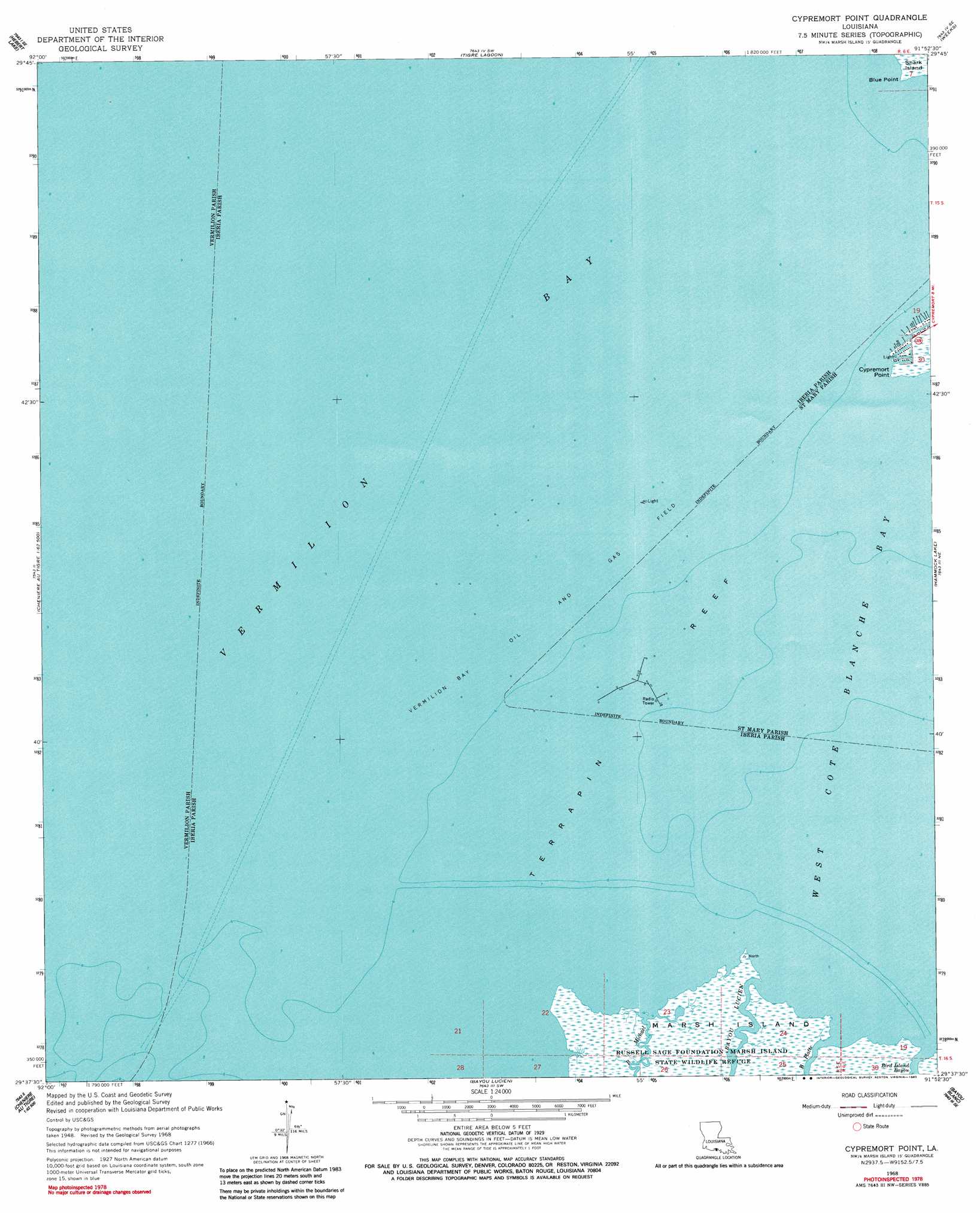
USGS Topo Quad 29091f8 - 1:24,000 scale
| Topo Map Name: | Cypremort Point |
| USGS Topo Quad ID: | 29091f8 |
| Print Size: | ca. 21 1/4" wide x 27" high |
| Southeast Coordinates: | 29.625° N latitude / 91.875° W longitude |
| Map Center Coordinates: | 29.6875° N latitude / 91.9375° W longitude |
| U.S. State: | LA |
| Filename: | o29091f8.jpg |
| Download Map JPG Image: | Cypremort Point topo map 1:24,000 scale |
| Map Type: | Topographic |
| Topo Series: | 7.5´ |
| Map Scale: | 1:24,000 |
| Source of Map Images: | United States Geological Survey (USGS) |
| Alternate Map Versions: |
Cypremort Point LA 1948, updated 1952 Download PDF Buy paper map Cypremort Point LA 1948, updated 1964 Download PDF Buy paper map Cypremort Point LA 1968, updated 1970 Download PDF Buy paper map Cypremort Point LA 1968, updated 1983 Download PDF Buy paper map Cypremort Point LA 1994, updated 1998 Download PDF Buy paper map Cypremort Point LA 2012 Download PDF Buy paper map Cypremort Point LA 2015 Download PDF Buy paper map |
1:24,000 Topo Quads surrounding Cypremort Point
Abbeville West |
Abbeville East |
Delcambre |
New Iberia South |
Jeanerette |
Intracoastal City |
Hebert Lake |
Tigre Lagoon |
Weeks |
Kemper |
Fearman Lake |
Redfish Point |
Cypremort Point |
Hammock Lake |
Marone Point |
Cheniere Au Tigre |
Hell Hole Bayou |
Bayou Lucien |
Bayou Blanc |
Lake Point |
Mound Point |
> Back to 29091e1 at 1:100,000 scale
> Back to 29090a1 at 1:250,000 scale
> Back to U.S. Topo Maps home
Cypremort Point topo map: Gazetteer
Cypremort Point: Bars
Terrapin Reef elevation 0m 0′Cypremort Point: Bays
Vermilion Bay elevation 0m 0′Cypremort Point: Capes
Blue Point elevation 0m 0′Cypremort Point: Channels
Acadiana Navigation Channel elevation 0m 0′Cypremort Point: Oilfields
Vermilion Bay Oil and Gas Field elevation 0m 0′Cypremort Point: Streams
Bayou Cypremort elevation 0m 0′Cypremort Point digital topo map on disk
Buy this Cypremort Point topo map showing relief, roads, GPS coordinates and other geographical features, as a high-resolution digital map file on DVD: