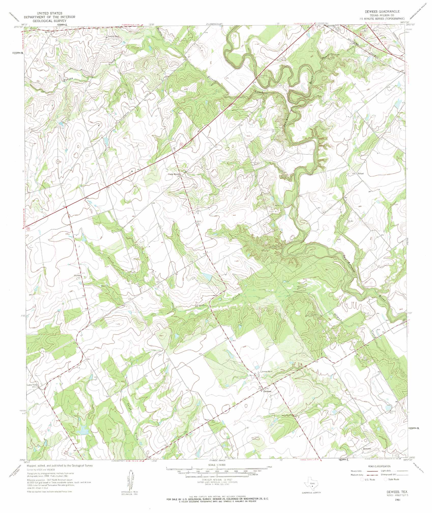
Dewees Topo Map Texas
To zoom in, hover over the map of Dewees
USGS Topo Quad 29098a2 - 1:24,000 scale
| Topo Map Name: | Dewees |
| USGS Topo Quad ID: | 29098a2 |
| Print Size: | ca. 21 1/4" wide x 27" high |
| Southeast Coordinates: | 29° N latitude / 98.125° W longitude |
| Map Center Coordinates: | 29.0625° N latitude / 98.1875° W longitude |
| U.S. State: | TX |
| Filename: | o29098a2.jpg |
| Download Map JPG Image: | Dewees topo map 1:24,000 scale |
| Map Type: | Topographic |
| Topo Series: | 7.5´ |
| Map Scale: | 1:24,000 |
| Source of Map Images: | United States Geological Survey (USGS) |
| Alternate Map Versions: |
Dewees TX 1961, updated 1963 Download PDF Buy paper map Dewees TX 1961, updated 1984 Download PDF Buy paper map Dewees TX 2010 Download PDF Buy paper map Dewees TX 2013 Download PDF Buy paper map Dewees TX 2016 Download PDF Buy paper map |
1:24,000 Topo Quads surrounding Dewees
Southton |
Elmendorf |
La Vernia Sw |
La Vernia |
Alum |
Losoya |
Saspamco |
Floresville |
Marcelinas Hills |
Stockdale |
Leming |
Saspamco Se |
Dewees |
Poth |
Kosciusko |
Pleasanton |
Leal |
Three Oaks |
Falls City |
Karnes City |
Christine East |
Mccoy |
Fashing |
Coy City |
Lenz |
> Back to 29098a1 at 1:100,000 scale
> Back to 29098a1 at 1:250,000 scale
> Back to U.S. Topo Maps home
Dewees topo map: Gazetteer
Dewees: Airports
Wall Flying Service Airport elevation 130m 426′Dewees: Dams
Connally Lake Dam Number 1 elevation 119m 390′Kilgore Lake Dam elevation 120m 393′
Seale Ranch Lake Dam elevation 123m 403′
Dewees: Populated Places
Darilek elevation 147m 482′Dewees elevation 131m 429′
Loma Vista elevation 137m 449′
Ridout elevation 121m 396′
Dewees: Reservoirs
Connally Lake Dam 2 elevation 119m 390′Kilgore Lake elevation 120m 393′
Seale Ranch Lake elevation 123m 403′
Dewees: Streams
Mariana Creek elevation 114m 374′Pajarito Creek elevation 106m 347′
Picosa Creek elevation 100m 328′
Dewees digital topo map on disk
Buy this Dewees topo map showing relief, roads, GPS coordinates and other geographical features, as a high-resolution digital map file on DVD: