Bigfoot Topo Map Texas
To zoom in, hover over the map of Bigfoot
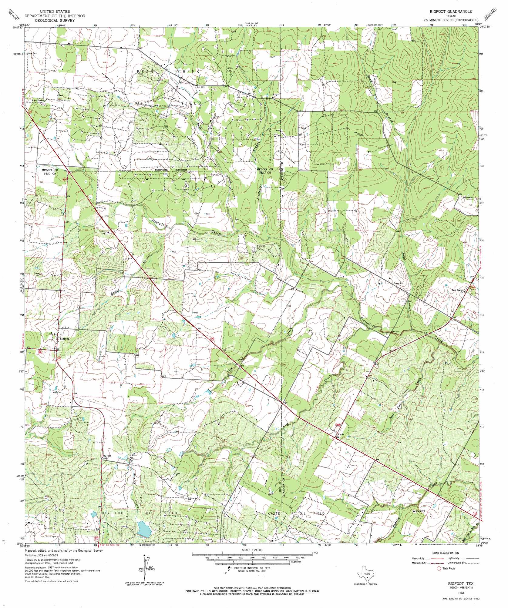
USGS Topo Quad 29098a7 - 1:24,000 scale
| Topo Map Name: | Bigfoot |
| USGS Topo Quad ID: | 29098a7 |
| Print Size: | ca. 21 1/4" wide x 27" high |
| Southeast Coordinates: | 29° N latitude / 98.75° W longitude |
| Map Center Coordinates: | 29.0625° N latitude / 98.8125° W longitude |
| U.S. State: | TX |
| Filename: | o29098a7.jpg |
| Download Map JPG Image: | Bigfoot topo map 1:24,000 scale |
| Map Type: | Topographic |
| Topo Series: | 7.5´ |
| Map Scale: | 1:24,000 |
| Source of Map Images: | United States Geological Survey (USGS) |
| Alternate Map Versions: |
Bigfoot TX 1964, updated 1967 Download PDF Buy paper map Bigfoot TX 2010 Download PDF Buy paper map Bigfoot TX 2013 Download PDF Buy paper map Bigfoot TX 2016 Download PDF Buy paper map |
1:24,000 Topo Quads surrounding Bigfoot
Murphy School |
Castroville |
Lacoste |
Macdona |
Terrell Wells |
Biry |
Devine |
Lytle |
Somerset |
Thelma |
Moore |
Ghost Hill |
Bigfoot |
Rossville |
Poteet |
Pearsall North |
Schattel Nw |
Schattel |
Dobrowolski |
Jourdanton |
Pearsall South |
Keystone Ranch |
Goldfinch |
Charlotte |
Christine West |
> Back to 29098a1 at 1:100,000 scale
> Back to 29098a1 at 1:250,000 scale
> Back to U.S. Topo Maps home
Bigfoot topo map: Gazetteer
Bigfoot: Airports
Ranch-Aero Airport elevation 168m 551′Bigfoot: Dams
Vincent Lake Dam elevation 185m 606′Bigfoot: Oilfields
Bear Creek Oil Field elevation 190m 623′Bigfoot: Populated Places
Big Foot Colonia elevation 192m 629′Bigfoot elevation 198m 649′
Kyote elevation 181m 593′
Bigfoot: Reservoirs
Vincent Lake elevation 185m 606′Bigfoot: Streams
Bear Creek elevation 165m 541′Elm Creek elevation 156m 511′
Live Oak Creek elevation 156m 511′
Post Oak Creek elevation 152m 498′
Sand Branch elevation 152m 498′
Siestedero Branch Creek elevation 164m 538′
Smith Branch elevation 171m 561′
Bigfoot digital topo map on disk
Buy this Bigfoot topo map showing relief, roads, GPS coordinates and other geographical features, as a high-resolution digital map file on DVD: