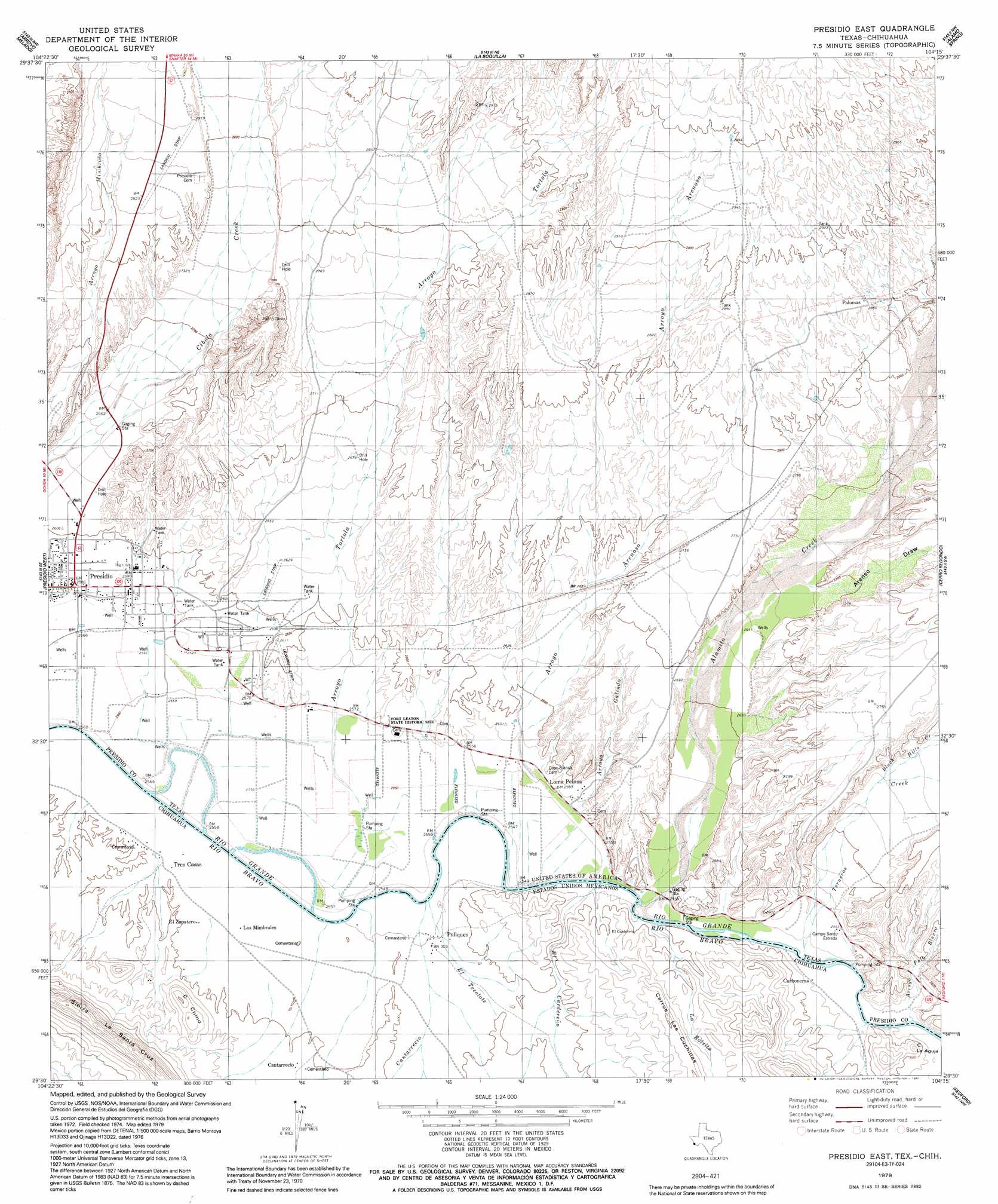
Presidio East Topo Map Texas
To zoom in, hover over the map of Presidio East
USGS Topo Quad 29104e3 - 1:24,000 scale
| Topo Map Name: | Presidio East |
| USGS Topo Quad ID: | 29104e3 |
| Print Size: | ca. 21 1/4" wide x 27" high |
| Southeast Coordinates: | 29.5° N latitude / 104.25° W longitude |
| Map Center Coordinates: | 29.5625° N latitude / 104.3125° W longitude |
| U.S. State: | TX |
| Filename: | o29104e3.jpg |
| Download Map JPG Image: | Presidio East topo map 1:24,000 scale |
| Map Type: | Topographic |
| Topo Series: | 7.5´ |
| Map Scale: | 1:24,000 |
| Source of Map Images: | United States Geological Survey (USGS) |
| Alternate Map Versions: |
Presidio East TX 1979, updated 1979 Download PDF Buy paper map Presidio East TX 1979, updated 1991 Download PDF Buy paper map Presidio East TX 2010 Download PDF Buy paper map Presidio East TX 2012 Download PDF Buy paper map Presidio East TX 2016 Download PDF Buy paper map |
1:24,000 Topo Quads surrounding Presidio East
Adobes |
Cerro Orona |
Shafter |
Cienaga Mountains |
Plata |
Indio |
Arroyo Melado |
La Boquilla |
Alamo Spring |
Casa Piedra |
Presidio West |
Presidio East |
Cerro Redondo |
Manzanillo Canyon |
|
Redford |
Agua Adentro Mountain |
|||
Redford Se |
> Back to 29104e1 at 1:100,000 scale
> Back to 29104a1 at 1:250,000 scale
> Back to U.S. Topo Maps home
Presidio East topo map: Gazetteer
Presidio East: Parks
Fort Leaton State Historic Site elevation 782m 2565′Presidio East: Populated Places
Fort Leaton (historical) elevation 784m 2572′Loma Pelona elevation 781m 2562′
Presidio elevation 787m 2582′
Presidio East: Streams
Alamito Creek elevation 775m 2542′Black Hills Creek elevation 803m 2634′
Terneros Creek elevation 773m 2536′
Presidio East: Trails
Fort Leaton State Historic Site Nature Trail elevation 782m 2565′Presidio East: Valleys
Arroyo Arenoso elevation 785m 2575′Arroyo Galindo elevation 781m 2562′
Arroyo Palo Blanco elevation 774m 2539′
Arroyo Tortola elevation 778m 2552′
Presidio East digital topo map on disk
Buy this Presidio East topo map showing relief, roads, GPS coordinates and other geographical features, as a high-resolution digital map file on DVD: