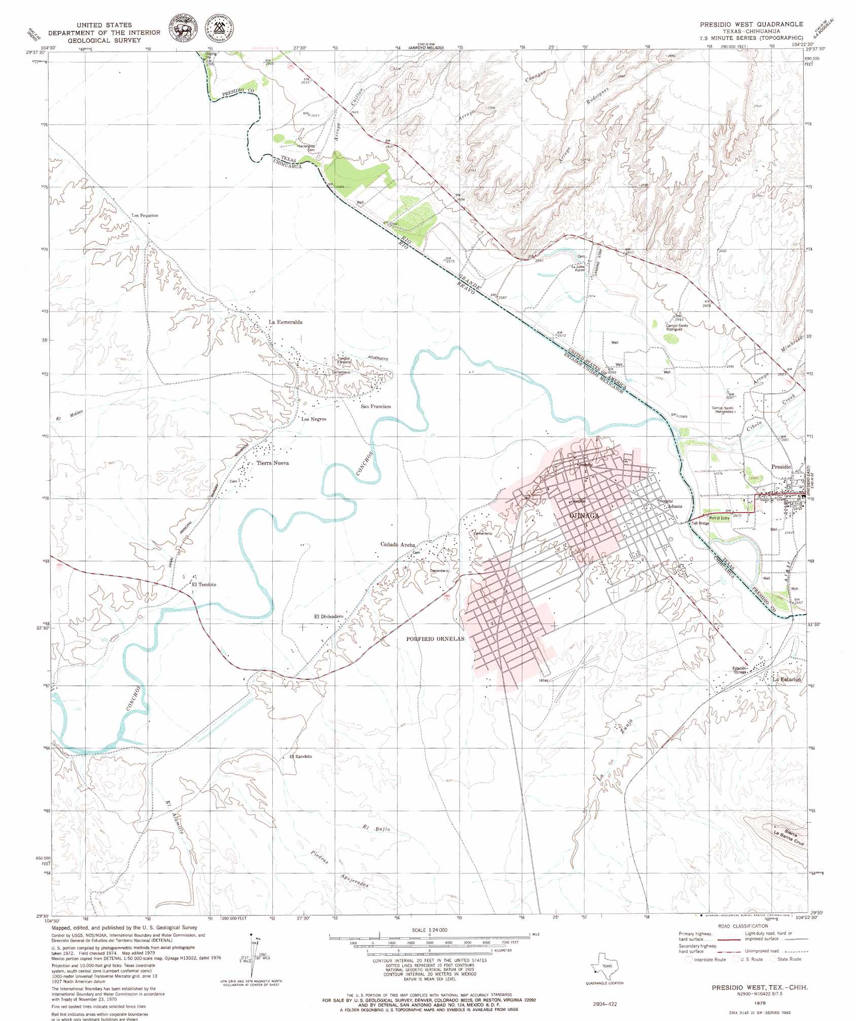
Presidio West Topo Map Texas
To zoom in, hover over the map of Presidio West
USGS Topo Quad 29104e4 - 1:24,000 scale
| Topo Map Name: | Presidio West |
| USGS Topo Quad ID: | 29104e4 |
| Print Size: | ca. 21 1/4" wide x 27" high |
| Southeast Coordinates: | 29.5° N latitude / 104.375° W longitude |
| Map Center Coordinates: | 29.5625° N latitude / 104.4375° W longitude |
| U.S. State: | TX |
| Filename: | o29104e4.jpg |
| Download Map JPG Image: | Presidio West topo map 1:24,000 scale |
| Map Type: | Topographic |
| Topo Series: | 7.5´ |
| Map Scale: | 1:24,000 |
| Source of Map Images: | United States Geological Survey (USGS) |
| Alternate Map Versions: |
Presidio West TX 1979, updated 1979 Download PDF Buy paper map Presidio West TX 2010 Download PDF Buy paper map Presidio West TX 2012 Download PDF Buy paper map Presidio West TX 2016 Download PDF Buy paper map |
1:24,000 Topo Quads surrounding Presidio West
Vado De Piedra |
Adobes |
Cerro Orona |
Shafter |
Cienaga Mountains |
Indio |
Arroyo Melado |
La Boquilla |
Alamo Spring |
|
Presidio West |
Presidio East |
Cerro Redondo |
||
Redford |
||||
> Back to 29104e1 at 1:100,000 scale
> Back to 29104a1 at 1:250,000 scale
> Back to U.S. Topo Maps home
Presidio West topo map: Gazetteer
Presidio West: Populated Places
Haciendito elevation 796m 2611′La Junta elevation 788m 2585′
Presidio West: Streams
Cibolo Creek elevation 780m 2559′Presidio West: Valleys
Arroyo Chillon elevation 789m 2588′Arroyo Cnangas elevation 789m 2588′
Arroyo Melado elevation 791m 2595′
Arroyo Mimbroso elevation 786m 2578′
Rodriguez Arroyo elevation 792m 2598′
Presidio West digital topo map on disk
Buy this Presidio West topo map showing relief, roads, GPS coordinates and other geographical features, as a high-resolution digital map file on DVD: