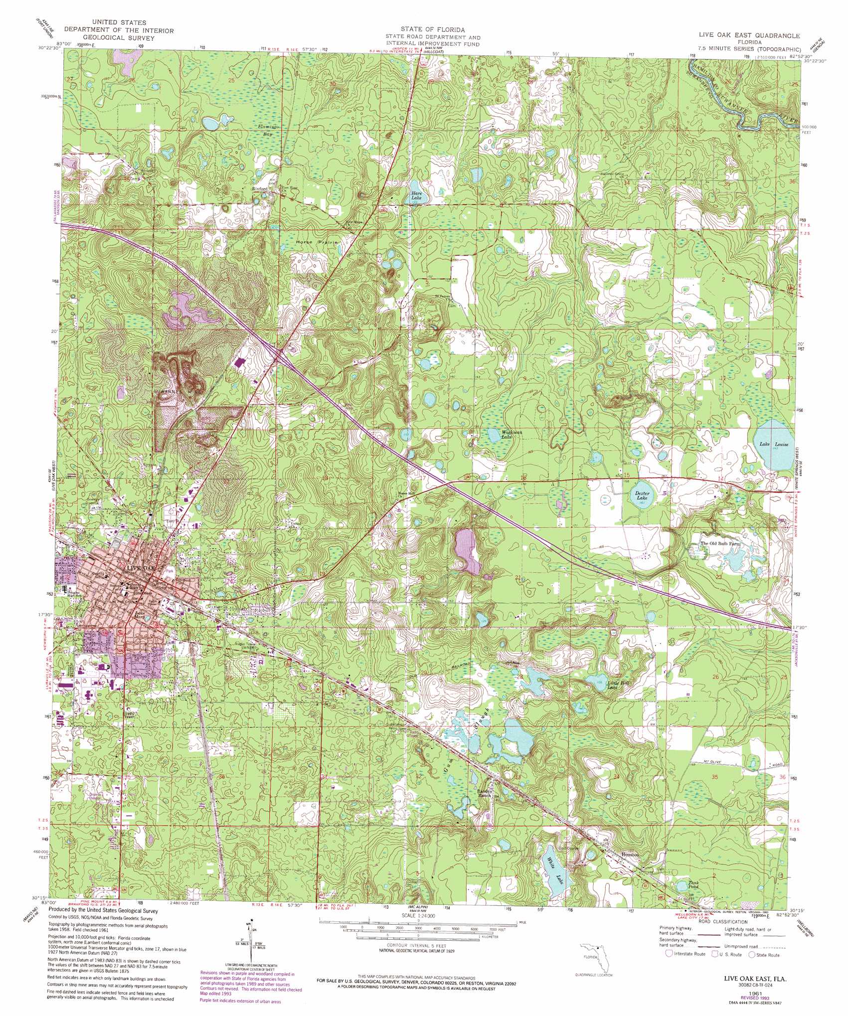
Live Oak East Topo Map Florida
To zoom in, hover over the map of Live Oak East
USGS Topo Quad 30082c8 - 1:24,000 scale
| Topo Map Name: | Live Oak East |
| USGS Topo Quad ID: | 30082c8 |
| Print Size: | ca. 21 1/4" wide x 27" high |
| Southeast Coordinates: | 30.25° N latitude / 82.875° W longitude |
| Map Center Coordinates: | 30.3125° N latitude / 82.9375° W longitude |
| U.S. State: | FL |
| Filename: | O30082C8.jpg |
| Download Map JPG Image: | Live Oak East topo map 1:24,000 scale |
| Map Type: | Topographic |
| Topo Series: | 7.5´ |
| Map Scale: | 1:24,000 |
| Source of Map Images: | United States Geological Survey (USGS) |
| Alternate Map Versions: |
Live Oak East FL 1961, updated 1962 Download PDF Buy paper map Live Oak East FL 1961, updated 1993 Download PDF Buy paper map Live Oak East FL 2012 Download PDF Buy paper map Live Oak East FL 2015 Download PDF Buy paper map |
1:24,000 Topo Quads surrounding Live Oak East
Octahatchee |
Jennings |
Jasper |
Cypress Creek |
Fargo Sw |
Ellaville |
Fort Union |
Hillcoat |
Genoa |
Benton |
Falmouth |
Live Oak West |
Live Oak East |
White Springs West |
White Springs East |
Dowling Park |
Mayo Ne |
Mcalpin |
Wellborn |
Lake City West |
Mayo |
Mayo Se |
O'Brien |
O'Brien Se |
Columbia |
> Back to 30082a1 at 1:100,000 scale
> Back to 30082a1 at 1:250,000 scale
> Back to U.S. Topo Maps home
Live Oak East topo map: Gazetteer
Live Oak East: Airports
Wings N Sunsets Airport elevation 52m 170′Live Oak East: Flats
Horse Prairie elevation 35m 114′Live Oak East: Lakes
Hare Lake elevation 37m 121′Lake Louise elevation 43m 141′
Lake Mary elevation 29m 95′
Little Hell Lake elevation 32m 104′
Tank Pond elevation 54m 177′
Workman Lake elevation 44m 144′
Live Oak East: Mines
Suwannee Mine elevation 35m 114′Live Oak East: Populated Places
Houston elevation 52m 170′Live Oak elevation 32m 104′
Live Oak Pines Mobile Home Park elevation 37m 121′
Live Oak Trailer Park elevation 32m 104′
Pleasant View Mobile Home Park elevation 42m 137′
Rixford elevation 42m 137′
Slade elevation 33m 108′
Sunset Manor Mobile Home Park elevation 55m 180′
Trailer Harbor Mobile Home Park elevation 33m 108′
Live Oak East: Streams
Camp Branch elevation 22m 72′Live Oak East: Swamps
Flamingo Bay elevation 39m 127′Gum Slough elevation 31m 101′
Live Oak East digital topo map on disk
Buy this Live Oak East topo map showing relief, roads, GPS coordinates and other geographical features, as a high-resolution digital map file on DVD: