Secotan Topo Map Florida
To zoom in, hover over the map of Secotan
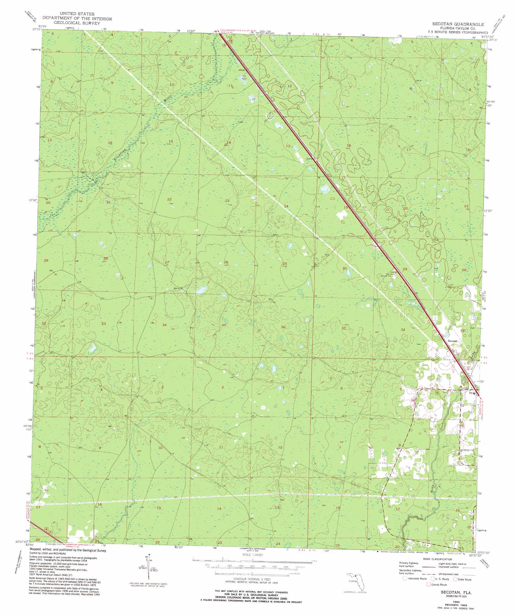
USGS Topo Quad 30083b6 - 1:24,000 scale
| Topo Map Name: | Secotan |
| USGS Topo Quad ID: | 30083b6 |
| Print Size: | ca. 21 1/4" wide x 27" high |
| Southeast Coordinates: | 30.125° N latitude / 83.625° W longitude |
| Map Center Coordinates: | 30.1875° N latitude / 83.6875° W longitude |
| U.S. State: | FL |
| Filename: | O30083B6.jpg |
| Download Map JPG Image: | Secotan topo map 1:24,000 scale |
| Map Type: | Topographic |
| Topo Series: | 7.5´ |
| Map Scale: | 1:24,000 |
| Source of Map Images: | United States Geological Survey (USGS) |
| Alternate Map Versions: |
Secotan FL 1952, updated 1973 Download PDF Buy paper map Secotan FL 1954, updated 1955 Download PDF Buy paper map Secotan FL 1954, updated 1972 Download PDF Buy paper map Secotan FL 1954, updated 1993 Download PDF Buy paper map Secotan FL 2012 Download PDF Buy paper map Secotan FL 2015 Download PDF Buy paper map |
1:24,000 Topo Quads surrounding Secotan
Waukeenah |
Lamont |
Greenville |
Greenville Ne |
Madison |
Wacissa |
Lamont Se |
Shady Grove |
Greenville Se |
Madison Sw |
Nutall Rise |
Johnson Hammock |
Secotan |
Boyd |
Day Nw |
Snipe Island |
Manlin Hammock |
Hampton Springs |
Perry |
Fenholloway |
Rock Islands |
Okefenokee Slough |
Warrior Swamp |
Salem |
> Back to 30083a1 at 1:100,000 scale
> Back to 30082a1 at 1:250,000 scale
> Back to U.S. Topo Maps home
Secotan topo map: Gazetteer
Secotan: Populated Places
Box Canyon Mobile Home Park elevation 12m 39′Secotan elevation 14m 45′
Secotan digital topo map on disk
Buy this Secotan topo map showing relief, roads, GPS coordinates and other geographical features, as a high-resolution digital map file on DVD: