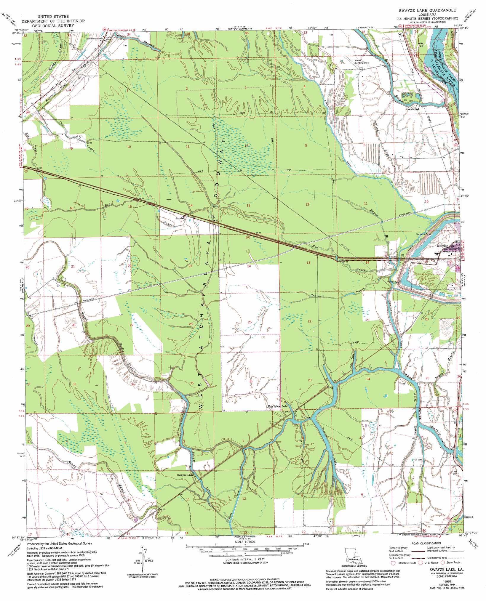
Swayze Lake Topo Map Louisiana
To zoom in, hover over the map of Swayze Lake
USGS Topo Quad 30091f7 - 1:24,000 scale
| Topo Map Name: | Swayze Lake |
| USGS Topo Quad ID: | 30091f7 |
| Print Size: | ca. 21 1/4" wide x 27" high |
| Southeast Coordinates: | 30.625° N latitude / 91.75° W longitude |
| Map Center Coordinates: | 30.6875° N latitude / 91.8125° W longitude |
| U.S. State: | LA |
| Filename: | o30091f7.jpg |
| Download Map JPG Image: | Swayze Lake topo map 1:24,000 scale |
| Map Type: | Topographic |
| Topo Series: | 7.5´ |
| Map Scale: | 1:24,000 |
| Source of Map Images: | United States Geological Survey (USGS) |
| Alternate Map Versions: |
Swayze Lake LA 1968, updated 1970 Download PDF Buy paper map Swayze Lake LA 1968, updated 1994 Download PDF Buy paper map Swayze Lake LA 2012 Download PDF Buy paper map Swayze Lake LA 2015 Download PDF Buy paper map |
1:24,000 Topo Quads surrounding Swayze Lake
Cottonport |
Plaucheville |
Simmesport |
Innis |
Tunica |
Morrow |
Bayou Jack |
Bayou Current |
Batchelor |
Lacour |
Beggs |
Palmetto |
Swayze Lake |
Melville |
Morganza |
Opelousas |
Port Barre |
Krotz Springs |
Lottie |
Fordoche |
Sunset |
Arnaudville |
Portage |
Maringouin Nw |
Maringouin |
> Back to 30091e1 at 1:100,000 scale
> Back to 30090a1 at 1:250,000 scale
> Back to U.S. Topo Maps home
Swayze Lake topo map: Gazetteer
Swayze Lake: Guts
Bad Bayou elevation 7m 22′Bayou Misery elevation 7m 22′
Candy Bayou elevation 9m 29′
Loggy Bayou elevation 9m 29′
Swayze Lake: Lakes
Burtons Lake elevation 6m 19′Half Moon Lake elevation 6m 19′
Keith Lake elevation 6m 19′
Second Lake elevation 6m 19′
Side Lake elevation 6m 19′
Swayze Lake elevation 6m 19′
Swayze Lake: Oilfields
Latenache Oil Field elevation 9m 29′Melville Gas Field elevation 8m 26′
Sambo Gas Field elevation 7m 22′
Swayze Lake: Populated Places
Goodwood elevation 9m 29′Hallf Moon elevation 9m 29′
Purvis (historical) elevation 8m 26′
Sambo elevation 8m 26′
Second Lake (historical) elevation 8m 26′
Swayze Lake elevation 7m 22′
Williamson (historical) elevation 7m 22′
Swayze Lake: Streams
Bad Bayou elevation 6m 19′Bayou Ha Ha elevation 6m 19′
Bayou Petite Prairie elevation 6m 19′
Bayou Rouge elevation 7m 22′
Big Bayou elevation 8m 26′
Blind Bayou elevation 6m 19′
Cow Bayou elevation 7m 22′
Hog Bayou elevation 6m 19′
Negro Foot Bayou elevation 8m 26′
Swayze Lake digital topo map on disk
Buy this Swayze Lake topo map showing relief, roads, GPS coordinates and other geographical features, as a high-resolution digital map file on DVD: