White Draw Topo Map Texas
To zoom in, hover over the map of White Draw
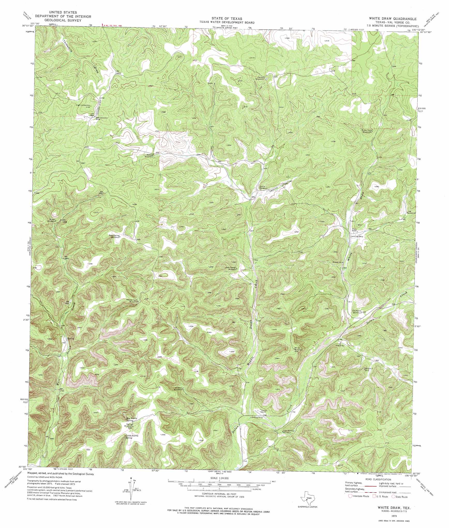
USGS Topo Quad 30100a8 - 1:24,000 scale
| Topo Map Name: | White Draw |
| USGS Topo Quad ID: | 30100a8 |
| Print Size: | ca. 21 1/4" wide x 27" high |
| Southeast Coordinates: | 30° N latitude / 100.875° W longitude |
| Map Center Coordinates: | 30.0625° N latitude / 100.9375° W longitude |
| U.S. State: | TX |
| Filename: | o30100a8.jpg |
| Download Map JPG Image: | White Draw topo map 1:24,000 scale |
| Map Type: | Topographic |
| Topo Series: | 7.5´ |
| Map Scale: | 1:24,000 |
| Source of Map Images: | United States Geological Survey (USGS) |
| Alternate Map Versions: |
White Draw TX 1973, updated 1976 Download PDF Buy paper map White Draw TX 2010 Download PDF Buy paper map White Draw TX 2012 Download PDF Buy paper map White Draw TX 2016 Download PDF Buy paper map |
1:24,000 Topo Quads surrounding White Draw
Indian Draw |
Brushy Draw |
Flat Rock Draw Sw |
Flat Rock Draw Se |
Dunbar Draw Sw |
Bee Canyon |
Juno |
White Draw Nw |
White Draw Ne |
Turney Draw Nw |
Sycamore Canyon |
Deaton Draw |
White Draw |
Robinson Draw |
Four Mills |
Bakers Crossing |
Telephone Canyon |
Dolan Springs |
Open Hollow |
Holcomb Draw |
Dead Mans Pass |
Lechuguilla Creek |
Clark Waterhole |
Carruthers Draw |
Carta Valley |
> Back to 30100a1 at 1:100,000 scale
> Back to 30100a1 at 1:250,000 scale
> Back to U.S. Topo Maps home
White Draw topo map: Gazetteer
White Draw: Springs
Big Norris Spring elevation 600m 1968′Little Norris Spring elevation 604m 1981′
White Draw: Streams
Middle Dolan Creek elevation 528m 1732′White Draw: Valleys
White Draw elevation 546m 1791′White Draw digital topo map on disk
Buy this White Draw topo map showing relief, roads, GPS coordinates and other geographical features, as a high-resolution digital map file on DVD: