Sonora Topo Map Texas
To zoom in, hover over the map of Sonora
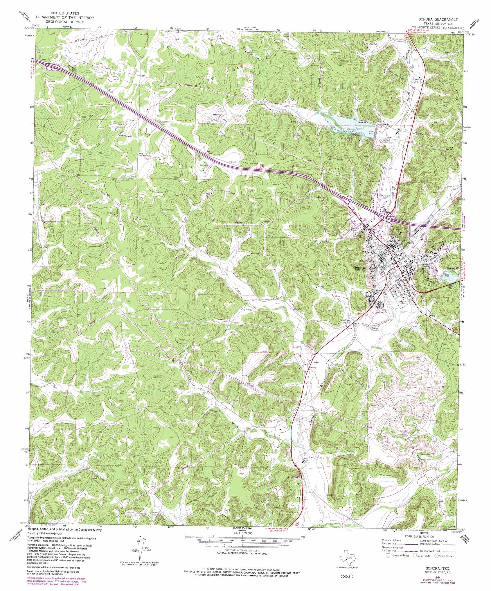
USGS Topo Quad 30100e6 - 1:24,000 scale
| Topo Map Name: | Sonora |
| USGS Topo Quad ID: | 30100e6 |
| Print Size: | ca. 21 1/4" wide x 27" high |
| Southeast Coordinates: | 30.5° N latitude / 100.625° W longitude |
| Map Center Coordinates: | 30.5625° N latitude / 100.6875° W longitude |
| U.S. State: | TX |
| Filename: | o30100e6.jpg |
| Download Map JPG Image: | Sonora topo map 1:24,000 scale |
| Map Type: | Topographic |
| Topo Series: | 7.5´ |
| Map Scale: | 1:24,000 |
| Source of Map Images: | United States Geological Survey (USGS) |
| Alternate Map Versions: |
Sonora TX 1964, updated 1966 Download PDF Buy paper map Sonora TX 1964, updated 1983 Download PDF Buy paper map Sonora TX 2010 Download PDF Buy paper map Sonora TX 2012 Download PDF Buy paper map Sonora TX 2016 Download PDF Buy paper map |
1:24,000 Topo Quads surrounding Sonora
Bailey Draw |
Coupe Ranch |
Eldorado Sw |
Eldorado |
Adams Sw |
Nolen Draw |
Savell Ranch |
Sonora Nw |
Sonora Ne |
Buffalo Well Nw |
Hospital Ranch |
Caverns Of Sonora |
Sonora |
Sonora Se |
Buffalo Well Sw |
Shafter Draw |
Hudspeth Draw |
Dunbar Draw Nw |
Dunbar Draw Ne |
Steen Lake |
Flat Rock Draw Sw |
Flat Rock Draw Se |
Dunbar Draw Sw |
Dunbar Draw Se |
Harrison Ranch |
> Back to 30100e1 at 1:100,000 scale
> Back to 30100a1 at 1:250,000 scale
> Back to U.S. Topo Maps home
Sonora topo map: Gazetteer
Sonora: Airports
Sonora Municipal Airport elevation 652m 2139′Sonora: Dams
Soil Conservation Service Site 13 Dam elevation 658m 2158′Soil Conservation Service Site 8 Dam elevation 656m 2152′
Sonora: Oilfields
Meckel Gas Field elevation 691m 2267′Sonora: Parks
Liberty Park elevation 647m 2122′Sutton County Park elevation 655m 2148′
Sonora: Populated Places
Sonora elevation 649m 2129′Sonora: Reservoirs
Site Number Eight elevation 665m 2181′Site Number Thirteen elevation 665m 2181′
Soil Conservation Service Site 13 Reservoir elevation 658m 2158′
Soil Conservation Service Site 8 Reservoir elevation 656m 2152′
Sonora: Valleys
Lowrey Draw elevation 643m 2109′Shurley Draw elevation 639m 2096′
Sonora digital topo map on disk
Buy this Sonora topo map showing relief, roads, GPS coordinates and other geographical features, as a high-resolution digital map file on DVD: