Oasis Ranch Topo Map Texas
To zoom in, hover over the map of Oasis Ranch
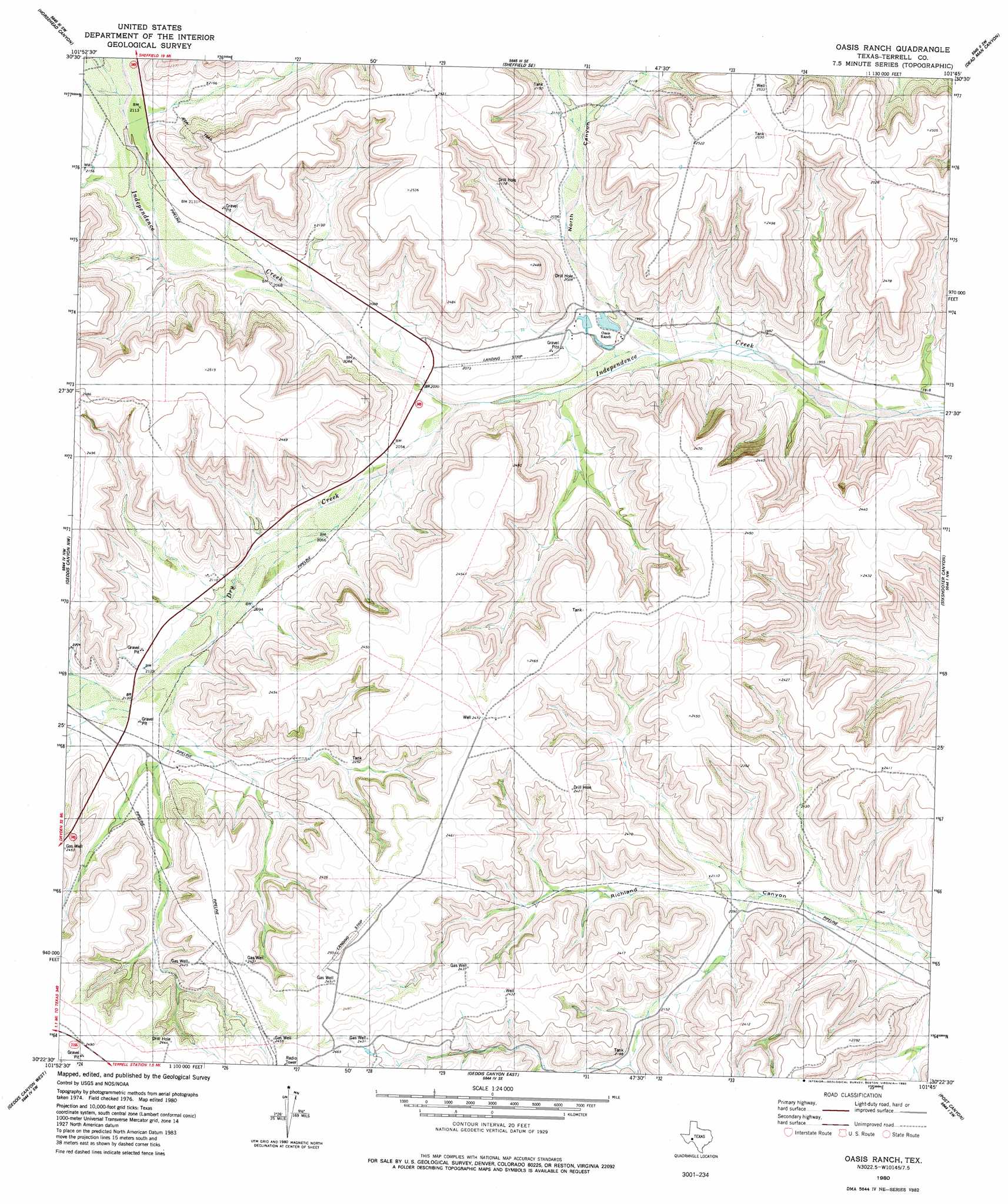
USGS Topo Quad 30101d7 - 1:24,000 scale
| Topo Map Name: | Oasis Ranch |
| USGS Topo Quad ID: | 30101d7 |
| Print Size: | ca. 21 1/4" wide x 27" high |
| Southeast Coordinates: | 30.375° N latitude / 101.75° W longitude |
| Map Center Coordinates: | 30.4375° N latitude / 101.8125° W longitude |
| U.S. State: | TX |
| Filename: | o30101d7.jpg |
| Download Map JPG Image: | Oasis Ranch topo map 1:24,000 scale |
| Map Type: | Topographic |
| Topo Series: | 7.5´ |
| Map Scale: | 1:24,000 |
| Source of Map Images: | United States Geological Survey (USGS) |
| Alternate Map Versions: |
Oasis Ranch TX 1980, updated 1980 Download PDF Buy paper map Oasis Ranch TX 2010 Download PDF Buy paper map Oasis Ranch TX 2012 Download PDF Buy paper map Oasis Ranch TX 2016 Download PDF Buy paper map |
1:24,000 Topo Quads surrounding Oasis Ranch
Smokey Mountain Ranch |
Sheffield Nw |
Sheffield |
Fort Lancaster |
Bachelor Hill |
Mitchell Draw |
Horsehead Canyon |
Sheffield Se |
Dead Man Canyon |
Burnt Canyon |
Circle Dot Ranch Ne |
Geddis Canyon Nw |
Oasis Ranch |
Sixshooter Canyon |
Prince Albert Draw |
Continental Ranch |
Geddis Canyon West |
Geddis Canyon East |
Post Canyon |
Antone Canyon |
Dryden Ne |
Meyers Canyon Nw |
Meyers Canyon Ne |
Hackberry Crossing |
Pandale |
> Back to 30101a1 at 1:100,000 scale
> Back to 30100a1 at 1:250,000 scale
> Back to U.S. Topo Maps home
Oasis Ranch topo map: Gazetteer
Oasis Ranch: Dams
Roden Lake Dam elevation 645m 2116′Oasis Ranch: Reservoirs
Roden Lake elevation 645m 2116′Oasis Ranch: Springs
T-5 Springs elevation 752m 2467′Oasis Ranch: Streams
Dry Creek elevation 614m 2014′Oasis Ranch: Valleys
North Canyon elevation 601m 1971′Oasis Ranch digital topo map on disk
Buy this Oasis Ranch topo map showing relief, roads, GPS coordinates and other geographical features, as a high-resolution digital map file on DVD: