Horsehead Canyon Topo Map Texas
To zoom in, hover over the map of Horsehead Canyon
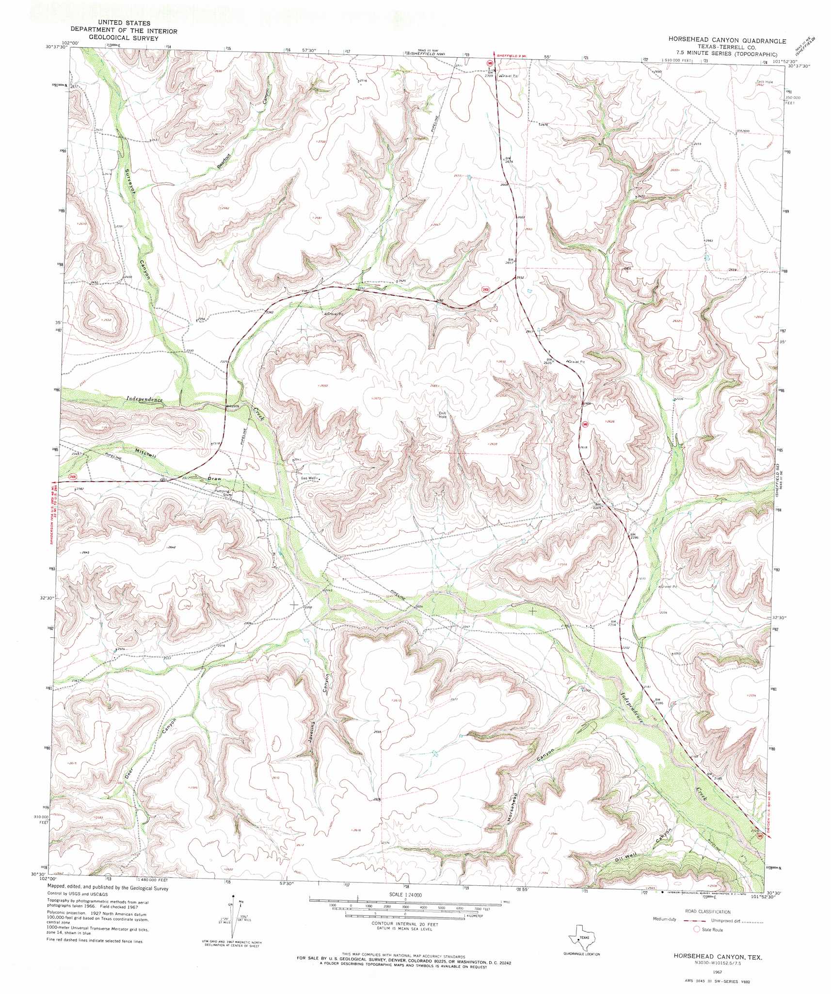
USGS Topo Quad 30101e8 - 1:24,000 scale
| Topo Map Name: | Horsehead Canyon |
| USGS Topo Quad ID: | 30101e8 |
| Print Size: | ca. 21 1/4" wide x 27" high |
| Southeast Coordinates: | 30.5° N latitude / 101.875° W longitude |
| Map Center Coordinates: | 30.5625° N latitude / 101.9375° W longitude |
| U.S. State: | TX |
| Filename: | o30101e8.jpg |
| Download Map JPG Image: | Horsehead Canyon topo map 1:24,000 scale |
| Map Type: | Topographic |
| Topo Series: | 7.5´ |
| Map Scale: | 1:24,000 |
| Source of Map Images: | United States Geological Survey (USGS) |
| Alternate Map Versions: |
Horsehead Canyon TX 1967, updated 1970 Download PDF Buy paper map Horsehead Canyon TX 2010 Download PDF Buy paper map Horsehead Canyon TX 2012 Download PDF Buy paper map Horsehead Canyon TX 2016 Download PDF Buy paper map |
1:24,000 Topo Quads surrounding Horsehead Canyon
Sherbino Ranch |
Indian Mesa Se |
Divide Country |
Deer Canyon |
Owens Creek Sw |
Hat-A Ranch |
Smokey Mountain Ranch |
Sheffield Nw |
Sheffield |
Fort Lancaster |
Seventeen Ranch |
Mitchell Draw |
Horsehead Canyon |
Sheffield Se |
Dead Man Canyon |
Circle Dot Ranch |
Circle Dot Ranch Ne |
Geddis Canyon Nw |
Oasis Ranch |
Sixshooter Canyon |
Allen Ranch |
Continental Ranch |
Geddis Canyon West |
Geddis Canyon East |
Post Canyon |
> Back to 30101e1 at 1:100,000 scale
> Back to 30100a1 at 1:250,000 scale
> Back to U.S. Topo Maps home
Horsehead Canyon topo map: Gazetteer
Horsehead Canyon: Valleys
Bearfoot Canyon elevation 729m 2391′Deer Canyon elevation 687m 2253′
Horsehead Canyon elevation 662m 2171′
Javelina Canyon elevation 686m 2250′
Mitchell Draw elevation 693m 2273′
Oil Well Canyon elevation 656m 2152′
Surveyor Canyon elevation 702m 2303′
Horsehead Canyon digital topo map on disk
Buy this Horsehead Canyon topo map showing relief, roads, GPS coordinates and other geographical features, as a high-resolution digital map file on DVD: