Geddis Canyon Nw Topo Map Texas
To zoom in, hover over the map of Geddis Canyon Nw
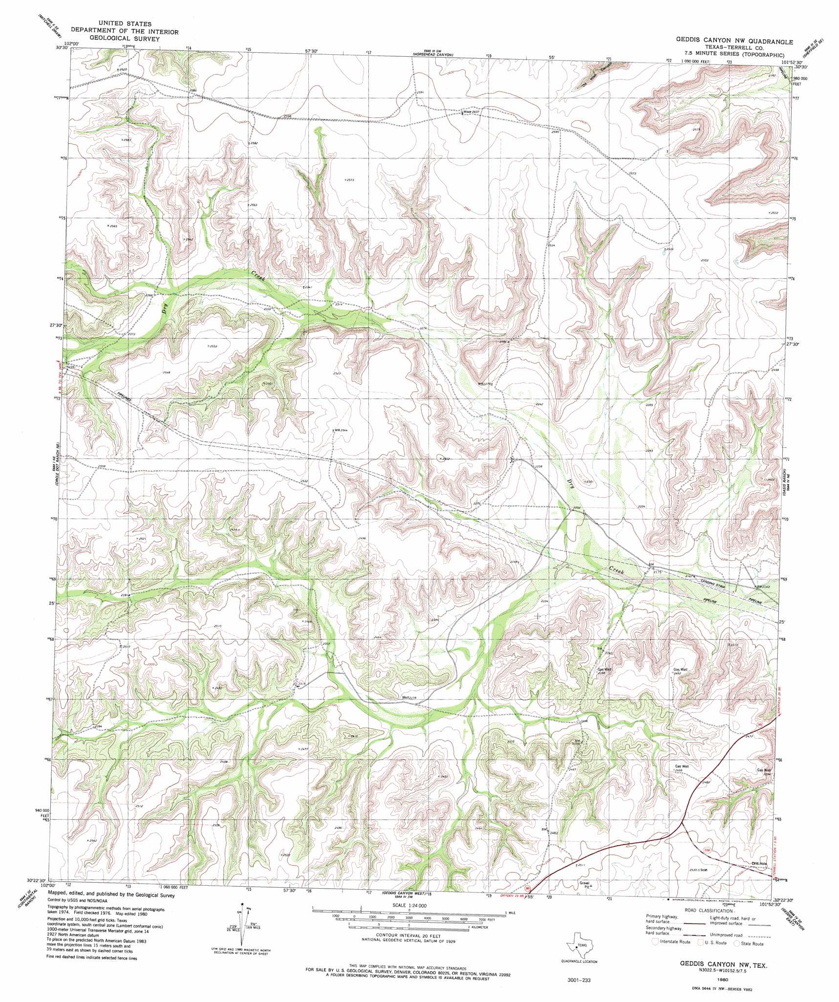
USGS Topo Quad 30101d8 - 1:24,000 scale
| Topo Map Name: | Geddis Canyon Nw |
| USGS Topo Quad ID: | 30101d8 |
| Print Size: | ca. 21 1/4" wide x 27" high |
| Southeast Coordinates: | 30.375° N latitude / 101.875° W longitude |
| Map Center Coordinates: | 30.4375° N latitude / 101.9375° W longitude |
| U.S. State: | TX |
| Filename: | o30101d8.jpg |
| Download Map JPG Image: | Geddis Canyon Nw topo map 1:24,000 scale |
| Map Type: | Topographic |
| Topo Series: | 7.5´ |
| Map Scale: | 1:24,000 |
| Source of Map Images: | United States Geological Survey (USGS) |
| Alternate Map Versions: |
Geddis Canyon NW TX 1980, updated 1980 Download PDF Buy paper map Geddis Canyon NW TX 2010 Download PDF Buy paper map Geddis Canyon NW TX 2012 Download PDF Buy paper map Geddis Canyon NW TX 2016 Download PDF Buy paper map |
1:24,000 Topo Quads surrounding Geddis Canyon Nw
Hat-A Ranch |
Smokey Mountain Ranch |
Sheffield Nw |
Sheffield |
Fort Lancaster |
Seventeen Ranch |
Mitchell Draw |
Horsehead Canyon |
Sheffield Se |
Dead Man Canyon |
Circle Dot Ranch |
Circle Dot Ranch Ne |
Geddis Canyon Nw |
Oasis Ranch |
Sixshooter Canyon |
Allen Ranch |
Continental Ranch |
Geddis Canyon West |
Geddis Canyon East |
Post Canyon |
Dryden Nw |
Dryden Ne |
Meyers Canyon Nw |
Meyers Canyon Ne |
Hackberry Crossing |
> Back to 30101a1 at 1:100,000 scale
> Back to 30100a1 at 1:250,000 scale
> Back to U.S. Topo Maps home
Geddis Canyon Nw digital topo map on disk
Buy this Geddis Canyon Nw topo map showing relief, roads, GPS coordinates and other geographical features, as a high-resolution digital map file on DVD: