Lightening Hills Topo Map Texas
To zoom in, hover over the map of Lightening Hills
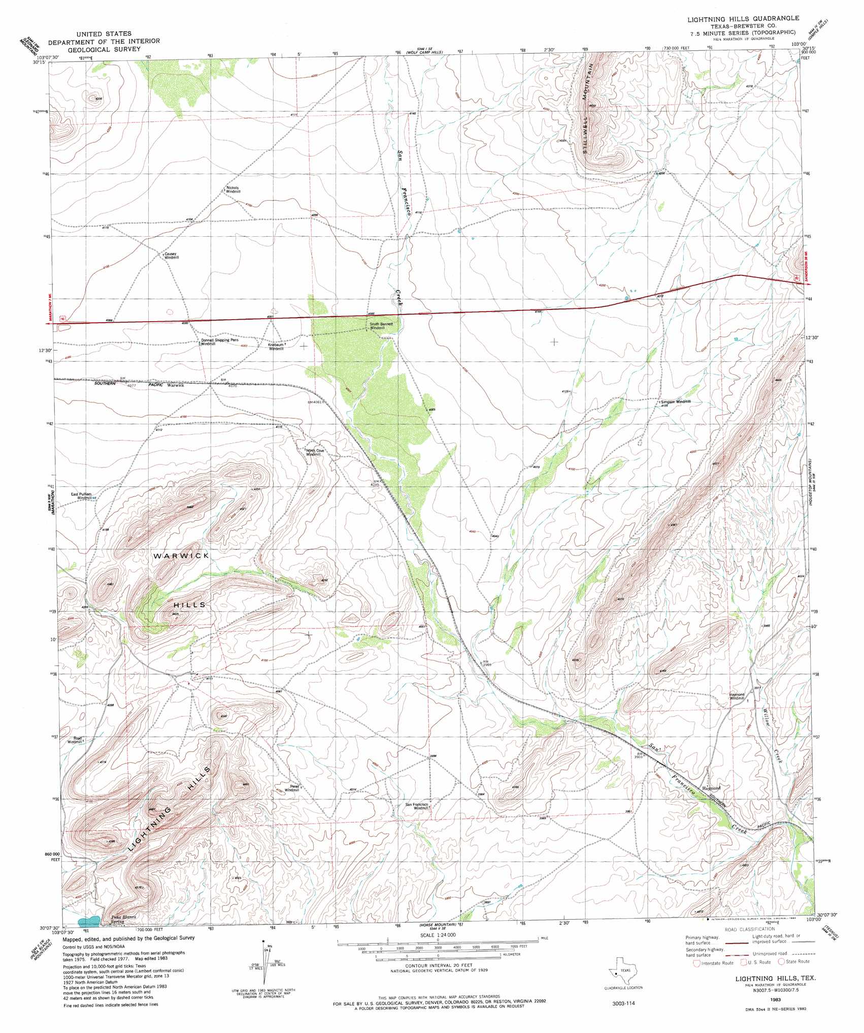
USGS Topo Quad 30103b1 - 1:24,000 scale
| Topo Map Name: | Lightening Hills |
| USGS Topo Quad ID: | 30103b1 |
| Print Size: | ca. 21 1/4" wide x 27" high |
| Southeast Coordinates: | 30.125° N latitude / 103° W longitude |
| Map Center Coordinates: | 30.1875° N latitude / 103.0625° W longitude |
| U.S. State: | TX |
| Filename: | o30103b1.jpg |
| Download Map JPG Image: | Lightening Hills topo map 1:24,000 scale |
| Map Type: | Topographic |
| Topo Series: | 7.5´ |
| Map Scale: | 1:24,000 |
| Source of Map Images: | United States Geological Survey (USGS) |
| Alternate Map Versions: |
Lightning Hills TX 1983, updated 1984 Download PDF Buy paper map Lightning Hills TX 2010 Download PDF Buy paper map Lightning Hills TX 2012 Download PDF Buy paper map Lightning Hills TX 2016 Download PDF Buy paper map |
1:24,000 Topo Quads surrounding Lightening Hills
Old Blue Mountain |
Hess Canyon |
Glass Mountain Ranch |
Marathon Gap |
Reininger Draw |
Gilliland Peak |
Leonard Mountain |
Wolf Camp Hills |
Dimple Hills |
Cap Rock Butte |
Beckwith Hills |
Marathon |
Lightening Hills |
Housetop Mountains |
Tesnus Ne |
Simpson Springs Mountain |
Pena Blanca Mountains |
Horse Mountain |
Tesnus |
Tesnus Se |
Maravillas Gap |
Heart Mountain |
Hood Spring |
Pine Mountain West |
Pine Mountain East |
> Back to 30103a1 at 1:100,000 scale
> Back to 30102a1 at 1:250,000 scale
> Back to U.S. Topo Maps home
Lightening Hills topo map: Gazetteer
Lightening Hills: Populated Places
Bennett Place (historical) elevation 1252m 4107′Causey Place elevation 1248m 4094′
Haymond elevation 1186m 3891′
Kriebaum Place elevation 1238m 4061′
Matthews Place elevation 1298m 4258′
McFarland Place elevation 1248m 4094′
Lightening Hills: Springs
Peña Blanca Spring elevation 1204m 3950′Lightening Hills: Streams
Frog Creek elevation 1290m 4232′Willow Creek elevation 1169m 3835′
Lightening Hills: Summits
Lightning Hills elevation 1344m 4409′Warwick Hills elevation 1272m 4173′
Lightening Hills digital topo map on disk
Buy this Lightening Hills topo map showing relief, roads, GPS coordinates and other geographical features, as a high-resolution digital map file on DVD: