Marathon Gap Topo Map Texas
To zoom in, hover over the map of Marathon Gap
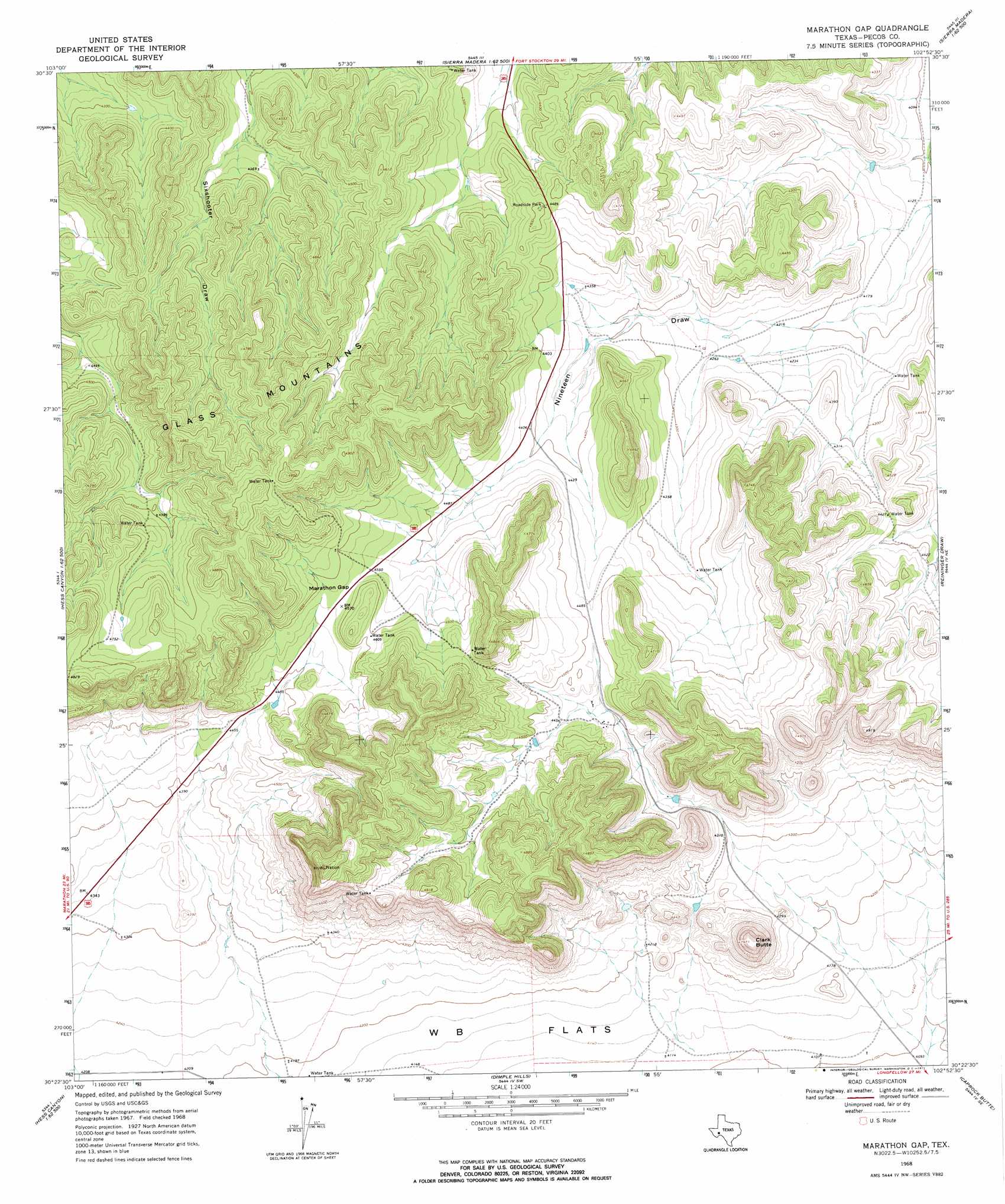
USGS Topo Quad 30102d8 - 1:24,000 scale
| Topo Map Name: | Marathon Gap |
| USGS Topo Quad ID: | 30102d8 |
| Print Size: | ca. 21 1/4" wide x 27" high |
| Southeast Coordinates: | 30.375° N latitude / 102.875° W longitude |
| Map Center Coordinates: | 30.4375° N latitude / 102.9375° W longitude |
| U.S. State: | TX |
| Filename: | o30102d8.jpg |
| Download Map JPG Image: | Marathon Gap topo map 1:24,000 scale |
| Map Type: | Topographic |
| Topo Series: | 7.5´ |
| Map Scale: | 1:24,000 |
| Source of Map Images: | United States Geological Survey (USGS) |
| Alternate Map Versions: |
Marathon Gap TX 1968, updated 1971 Download PDF Buy paper map Marathon Gap TX 2010 Download PDF Buy paper map Marathon Gap TX 2012 Download PDF Buy paper map Marathon Gap TX 2016 Download PDF Buy paper map |
1:24,000 Topo Quads surrounding Marathon Gap
Chancellor |
Cave Mesa Ne |
Sierra Madera Nw |
Sierra Madera Ne |
Rock House Draw Nw |
Cave Mesa |
Cave Mesa Se |
Sierra Madera |
Sierra Madera Se |
Panther Tank |
Hess Canyon |
Glass Mountain Ranch |
Marathon Gap |
Reininger Draw |
Ebers Camp |
Leonard Mountain |
Wolf Camp Hills |
Dimple Hills |
Cap Rock Butte |
F C Ranch |
Marathon |
Lightening Hills |
Housetop Mountains |
Tesnus Ne |
Longfellow |
> Back to 30102a1 at 1:100,000 scale
> Back to 30102a1 at 1:250,000 scale
> Back to U.S. Topo Maps home
Marathon Gap topo map: Gazetteer
Marathon Gap: Airports
Allison Ranch Airport elevation 1341m 4399′Marathon Gap: Gaps
Marathon Gap elevation 1395m 4576′Marathon Gap: Summits
Clark Butte elevation 1460m 4790′Marathon Gap digital topo map on disk
Buy this Marathon Gap topo map showing relief, roads, GPS coordinates and other geographical features, as a high-resolution digital map file on DVD: