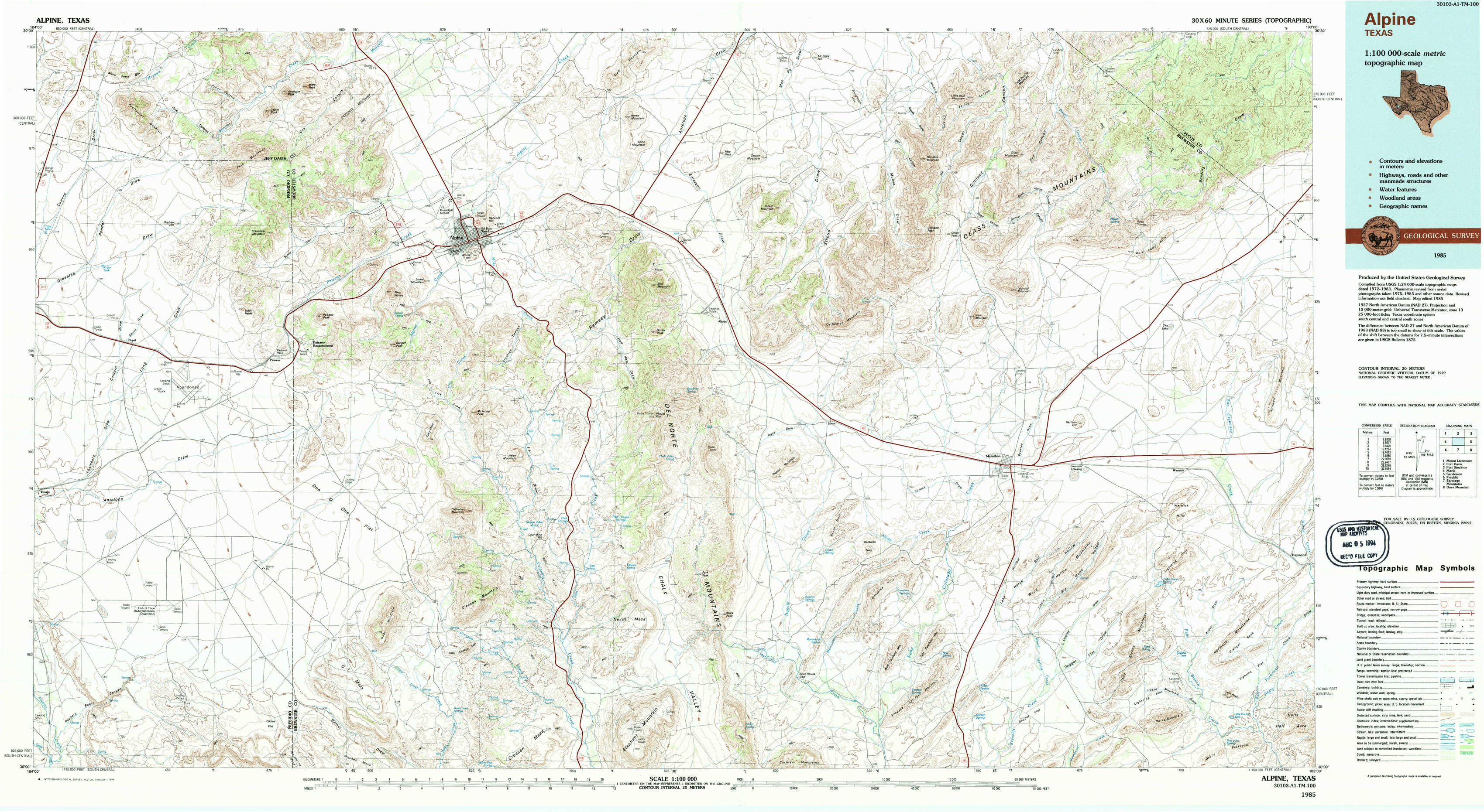
Alpine Topo Map Texas
To zoom in, hover over the map of Alpine
USGS Topo Map 30103a1 - 1:100,000 scale
| Topo Map Name: | Alpine |
| USGS Topo Quad ID: | 30103a1 |
| Print Size: | ca. 39" wide x 24" high |
| Southeast Coordinates: | 30° N latitude / 103° W longitude |
| Map Center Coordinates: | 30.25° N latitude / 103.5° W longitude |
| U.S. State: | TX |
| Filename: | 30103a1.jpg |
| Download Map JPG Image: | Alpine topo map 1:100,000 scale |
| Map Type: | Topographic |
| Topo Series: | 30´x60´ |
| Map Scale: | 1:100,000 |
| Source of Map Images: | United States Geological Survey (USGS) |
| Alternate Map Versions: |
Alpine TX 1985, updated 1985 Download PDF Buy paper map Alpine TX 1985, updated 1994 Download PDF Buy paper map |
1:100,000 Topos surrounding Alpine
Mount Livermore |
Fort Davis |
Fort Stockton |
Marfa |
Alpine |
Sanderson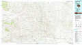 |
Presidio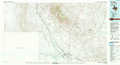 |
Santiago Mountains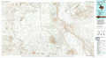 |
Dove Mountain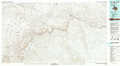 |
> Back to 30102a1 at 1:250,000 scale
> Back to U.S. Topo Maps home
1:24,000 Topo Quads covered by the spatial extent of this 100k map (Alpine)
|
Mano Prieto Mountain 
|
Mitre Peak 
|
Alpine North 
|
Elam Mountain 
|
Bissett Mountain 
|
Old Blue Mountain 
|
Hess Canyon 
|
Glass Mountain Ranch 
|
|
Nopal 
|
Paisano 
|
Alpine South 
|
Bird Mountain 
|
Altuda 
|
Gilliland Peak 
|
Leonard Mountain 
|
Wolf Camp Hills 
|
|
Tinaja 
|
Tinaja Ne 
|
Cathedral Mountain 
|
Mount Ord 
|
Dugout Mountain 
|
Beckwith Hills 
|
Marathon 
|
Lightening Hills 
|
|
Devils Den 
|
Cactus Flat 
|
Goat Mountain 
|
Elephant Mountain 
|
Rock House Gap 
|
Simpson Springs Mountain 
|
Pena Blanca Mountains 
|
Horse Mountain 
|