Walthourville Topo Map Georgia
To zoom in, hover over the map of Walthourville
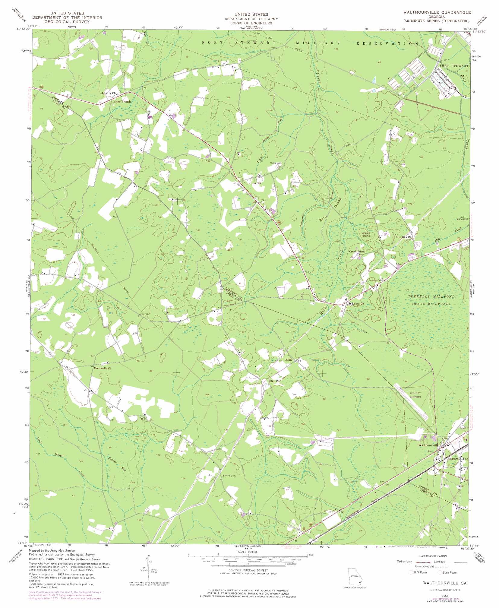
USGS Topo Quad 31081g6 - 1:24,000 scale
| Topo Map Name: | Walthourville |
| USGS Topo Quad ID: | 31081g6 |
| Print Size: | ca. 21 1/4" wide x 27" high |
| Southeast Coordinates: | 31.75° N latitude / 81.625° W longitude |
| Map Center Coordinates: | 31.8125° N latitude / 81.6875° W longitude |
| U.S. State: | GA |
| Filename: | o31081g6.jpg |
| Download Map JPG Image: | Walthourville topo map 1:24,000 scale |
| Map Type: | Topographic |
| Topo Series: | 7.5´ |
| Map Scale: | 1:24,000 |
| Source of Map Images: | United States Geological Survey (USGS) |
| Alternate Map Versions: |
Walthourville GA 1958, updated 1961 Download PDF Buy paper map Walthourville GA 1958, updated 1976 Download PDF Buy paper map Walthourville GA 2011 Download PDF Buy paper map Walthourville GA 2014 Download PDF Buy paper map |
1:24,000 Topo Quads surrounding Walthourville
Deans Crossing |
Glissons Millpond |
Willie |
Letford |
Meldrim Sw |
Glennville |
Glennville Ne |
Taylors Creek |
Trinity |
Limerick Nw |
Glennville Sw |
Glennville Se |
Walthourville |
Hinesville |
Dorchester |
Jesup Nw |
Doctortown |
Ludowici |
East Of Ludowici |
Riceboro |
Jesup West |
Jesup East |
Bug Island |
Townsend |
Eulonia |
> Back to 31081e1 at 1:100,000 scale
> Back to 31080a1 at 1:250,000 scale
> Back to U.S. Topo Maps home
Walthourville topo map: Gazetteer
Walthourville: Airports
Liberty County Airport elevation 28m 91′Walthourville: Islands
Creek Island elevation 24m 78′Zorn Island elevation 22m 72′
Walthourville: Populated Places
Aimar elevation 23m 75′Alsennias Trailer Park elevation 24m 78′
Creek Island elevation 24m 78′
Elim elevation 27m 88′
Gum Branch elevation 24m 78′
Oakview Mobile Home Park elevation 24m 78′
Pipkin Mobile Home Park elevation 22m 72′
Roberts Mobile Home Park elevation 24m 78′
Salter Mobile Home Park elevation 27m 88′
Victory Manor Mobile Home Court elevation 24m 78′
Walthourville elevation 27m 88′
Walthourville: Post Offices
Walthourville Post Office elevation 27m 88′Walthourville: Streams
Little Horse Creek elevation 18m 59′Tennessee Branch elevation 19m 62′
Walthourville: Swamps
Brewert Bay elevation 20m 65′Milkhouse Bay elevation 26m 85′
Murrays Bay elevation 21m 68′
Terrells Millpond elevation 24m 78′
Walthourville digital topo map on disk
Buy this Walthourville topo map showing relief, roads, GPS coordinates and other geographical features, as a high-resolution digital map file on DVD: