Trinity Topo Map Georgia
To zoom in, hover over the map of Trinity
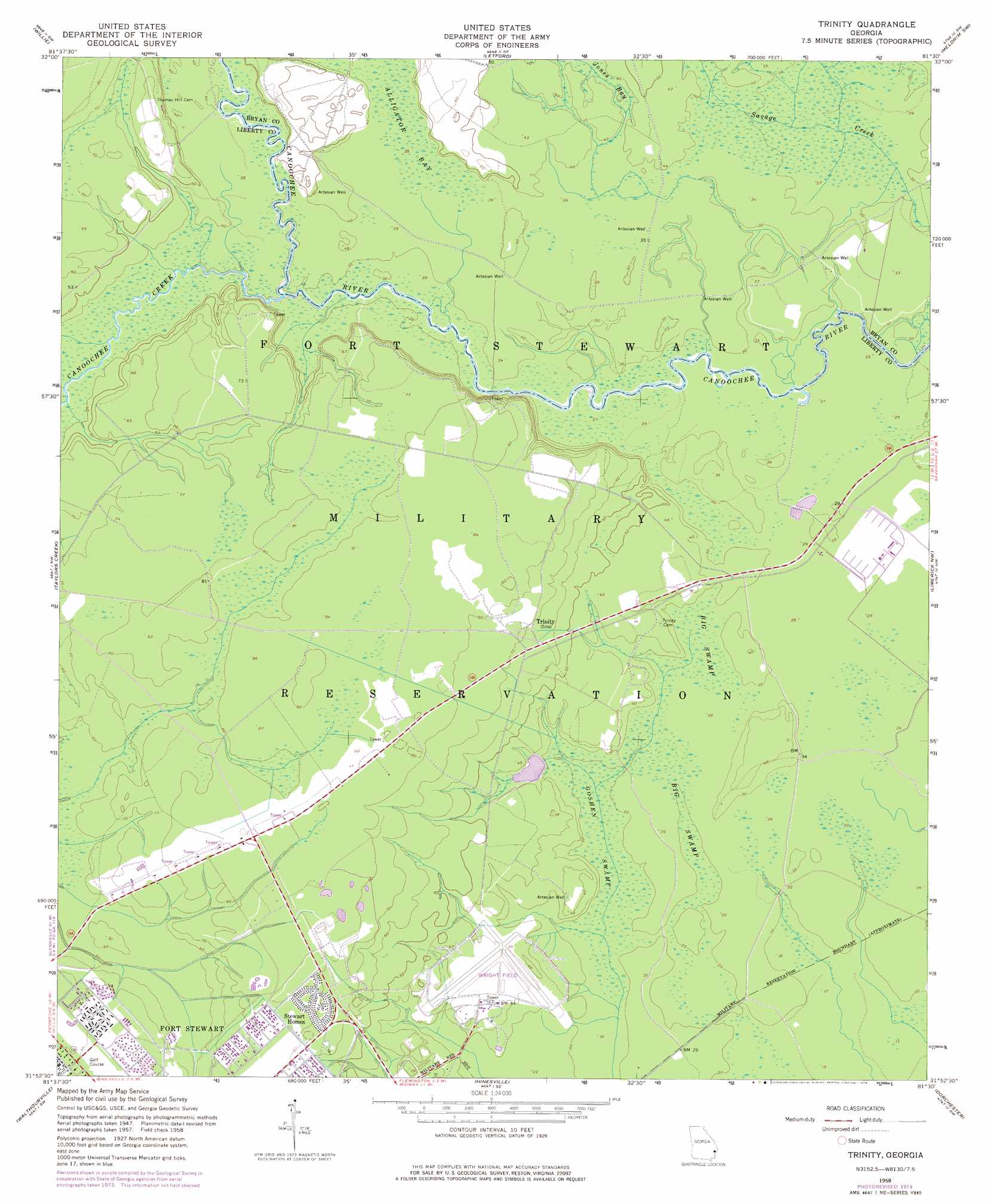
USGS Topo Quad 31081h5 - 1:24,000 scale
| Topo Map Name: | Trinity |
| USGS Topo Quad ID: | 31081h5 |
| Print Size: | ca. 21 1/4" wide x 27" high |
| Southeast Coordinates: | 31.875° N latitude / 81.5° W longitude |
| Map Center Coordinates: | 31.9375° N latitude / 81.5625° W longitude |
| U.S. State: | GA |
| Filename: | o31081h5.jpg |
| Download Map JPG Image: | Trinity topo map 1:24,000 scale |
| Map Type: | Topographic |
| Topo Series: | 7.5´ |
| Map Scale: | 1:24,000 |
| Source of Map Images: | United States Geological Survey (USGS) |
| Alternate Map Versions: |
Trinity GA 1958, updated 1961 Download PDF Buy paper map Trinity GA 1958, updated 1969 Download PDF Buy paper map Trinity GA 1958, updated 1976 Download PDF Buy paper map Trinity GA 2011 Download PDF Buy paper map Trinity GA 2014 Download PDF Buy paper map |
1:24,000 Topo Quads surrounding Trinity
Daisy |
Groveland |
Lanier |
Eden |
Meldrim |
Glissons Millpond |
Willie |
Letford |
Meldrim Sw |
Meldrim Se |
Glennville Ne |
Taylors Creek |
Trinity |
Limerick Nw |
Richmond Hill |
Glennville Se |
Walthourville |
Hinesville |
Dorchester |
Limerick Se |
Doctortown |
Ludowici |
East Of Ludowici |
Riceboro |
Seabrook |
> Back to 31081e1 at 1:100,000 scale
> Back to 31080a1 at 1:250,000 scale
> Back to U.S. Topo Maps home
Trinity topo map: Gazetteer
Trinity: Bridges
Butlers Bridge (historical) elevation 11m 36′Trinity: Populated Places
Bryan Village elevation 26m 85′Hallwood Homes elevation 24m 78′
Trinity elevation 20m 65′
Trinity: Streams
Canoochee Creek elevation 9m 29′Trinity: Swamps
Big Swamp elevation 7m 22′Goshen Swamp elevation 6m 19′
Trinity digital topo map on disk
Buy this Trinity topo map showing relief, roads, GPS coordinates and other geographical features, as a high-resolution digital map file on DVD: