Prentiss East Topo Map Mississippi
To zoom in, hover over the map of Prentiss East
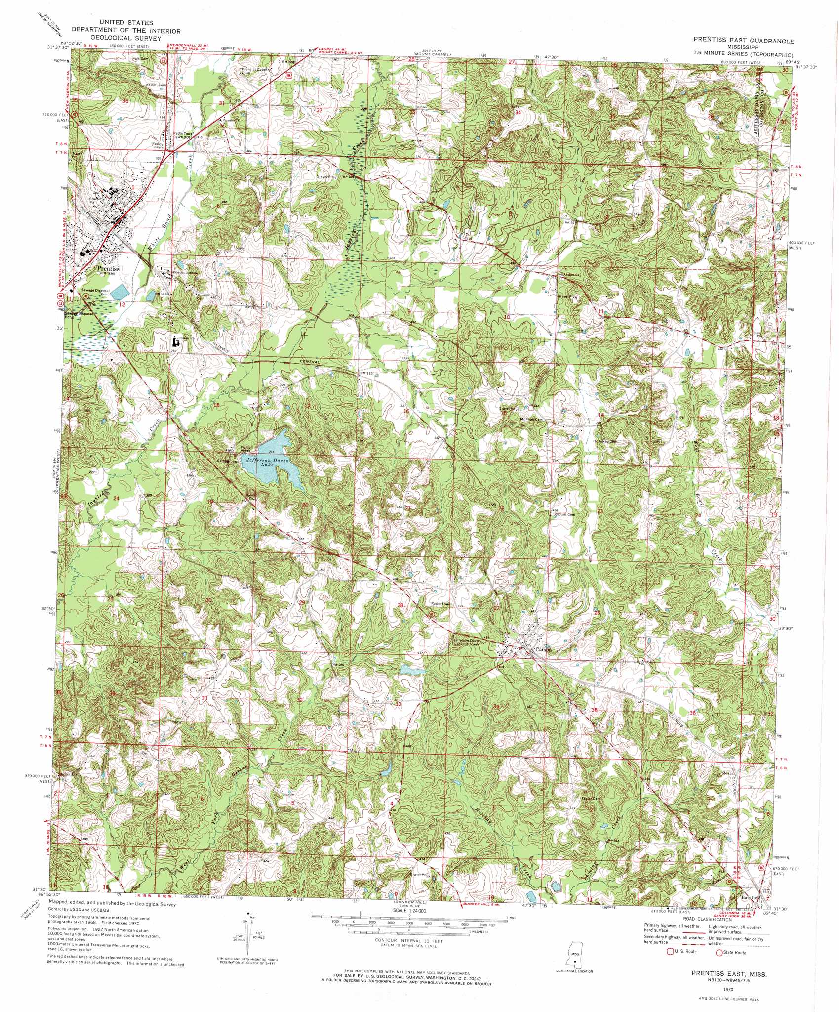
USGS Topo Quad 31089e7 - 1:24,000 scale
| Topo Map Name: | Prentiss East |
| USGS Topo Quad ID: | 31089e7 |
| Print Size: | ca. 21 1/4" wide x 27" high |
| Southeast Coordinates: | 31.5° N latitude / 89.75° W longitude |
| Map Center Coordinates: | 31.5625° N latitude / 89.8125° W longitude |
| U.S. State: | MS |
| Filename: | o31089e7.jpg |
| Download Map JPG Image: | Prentiss East topo map 1:24,000 scale |
| Map Type: | Topographic |
| Topo Series: | 7.5´ |
| Map Scale: | 1:24,000 |
| Source of Map Images: | United States Geological Survey (USGS) |
| Alternate Map Versions: |
Prentiss East MS 1970, updated 1972 Download PDF Buy paper map Prentiss East MS 2012 Download PDF Buy paper map Prentiss East MS 2015 Download PDF Buy paper map |
1:24,000 Topo Quads surrounding Prentiss East
Schley |
Shivers |
Mendenhall Se |
Magee South |
Mize |
Monticello Ne |
New Hebron |
Mount Carmel |
Lone Star |
Collins |
Monticello |
Prentiss West |
Prentiss East |
Lake Mike Connor |
Williamsburg |
Tilton |
Oak Vale |
Bunker Hill |
Bassfield |
Sumrall |
Darbun |
Morgantown |
Columbia North |
Improve |
Oloh |
> Back to 31089e1 at 1:100,000 scale
> Back to 31088a1 at 1:250,000 scale
> Back to U.S. Topo Maps home
Prentiss East topo map: Gazetteer
Prentiss East: Dams
J A Magee Lake Dam elevation 108m 354′Jefferson Davis Lake Dam elevation 105m 344′
Jim Fagan Lake Dam elevation 120m 393′
Kyle Parkman Lake Dam elevation 114m 374′
M V Spights Lake Dam elevation 107m 351′
Ottis Garner Lake Dam elevation 133m 436′
Prentiss Lagoon Dam elevation 93m 305′
Prentiss Sewage Lagoon Dam elevation 94m 308′
Robert Riley Lake Dam elevation 88m 288′
Prentiss East: Parks
Lions Club Park elevation 95m 311′Prentiss East: Populated Places
Carson elevation 153m 501′Haw Pond (historical) elevation 147m 482′
Prentiss elevation 101m 331′
Prentiss East: Reservoirs
Jefferson Davis Lake elevation 101m 331′Prentiss East digital topo map on disk
Buy this Prentiss East topo map showing relief, roads, GPS coordinates and other geographical features, as a high-resolution digital map file on DVD:
Gulf Coast (LA, MS, AL, FL) & Southwestern Georgia
Buy digital topo maps: Gulf Coast (LA, MS, AL, FL) & Southwestern Georgia
 & Southwestern Georgia map DVD")