Mount Carmel Topo Map Mississippi
To zoom in, hover over the map of Mount Carmel
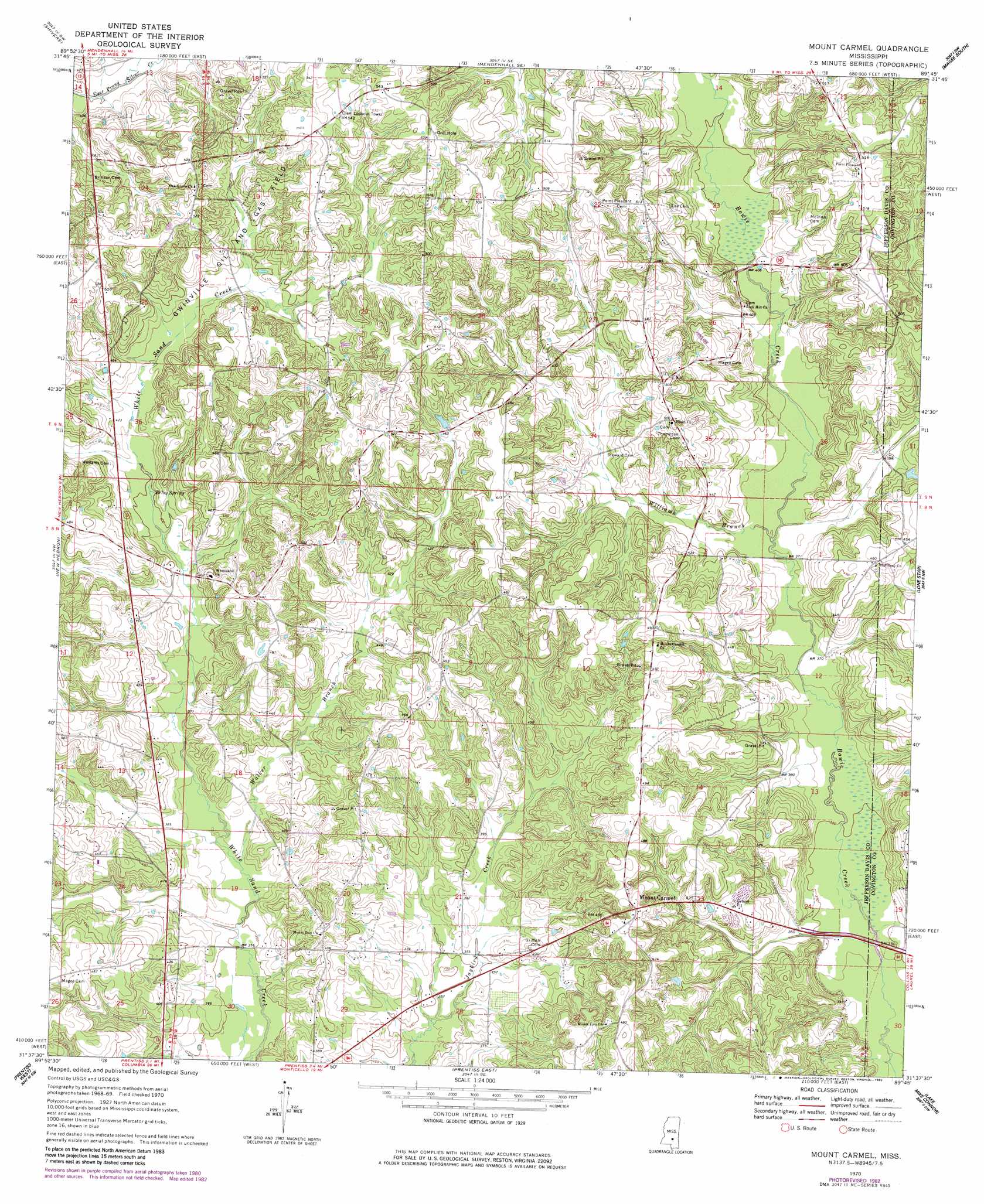
USGS Topo Quad 31089f7 - 1:24,000 scale
| Topo Map Name: | Mount Carmel |
| USGS Topo Quad ID: | 31089f7 |
| Print Size: | ca. 21 1/4" wide x 27" high |
| Southeast Coordinates: | 31.625° N latitude / 89.75° W longitude |
| Map Center Coordinates: | 31.6875° N latitude / 89.8125° W longitude |
| U.S. State: | MS |
| Filename: | o31089f7.jpg |
| Download Map JPG Image: | Mount Carmel topo map 1:24,000 scale |
| Map Type: | Topographic |
| Topo Series: | 7.5´ |
| Map Scale: | 1:24,000 |
| Source of Map Images: | United States Geological Survey (USGS) |
| Alternate Map Versions: |
Mount Carmel MS 1970, updated 1972 Download PDF Buy paper map Mount Carmel MS 1970, updated 1982 Download PDF Buy paper map Mount Carmel MS 2012 Download PDF Buy paper map Mount Carmel MS 2015 Download PDF Buy paper map |
1:24,000 Topo Quads surrounding Mount Carmel
Harrisville |
Mendenhall West |
Mendenhall East |
Magee North |
Cohay |
Schley |
Shivers |
Mendenhall Se |
Magee South |
Mize |
Monticello Ne |
New Hebron |
Mount Carmel |
Lone Star |
Collins |
Monticello |
Prentiss West |
Prentiss East |
Lake Mike Connor |
Williamsburg |
Tilton |
Oak Vale |
Bunker Hill |
Bassfield |
Sumrall |
> Back to 31089e1 at 1:100,000 scale
> Back to 31088a1 at 1:250,000 scale
> Back to U.S. Topo Maps home
Mount Carmel topo map: Gazetteer
Mount Carmel: Oilfields
Gwinville Oil and Gas Field elevation 139m 456′Mount Carmel: Populated Places
Clem elevation 152m 498′Mount Carmel elevation 149m 488′
Mount Carmel: Springs
Betsy Spring elevation 121m 396′Mount Carmel: Streams
Walker Branch elevation 109m 357′Williams Branch elevation 113m 370′
Mount Carmel digital topo map on disk
Buy this Mount Carmel topo map showing relief, roads, GPS coordinates and other geographical features, as a high-resolution digital map file on DVD:
Gulf Coast (LA, MS, AL, FL) & Southwestern Georgia
Buy digital topo maps: Gulf Coast (LA, MS, AL, FL) & Southwestern Georgia
 & Southwestern Georgia map DVD")