Tilton Topo Map Mississippi
To zoom in, hover over the map of Tilton
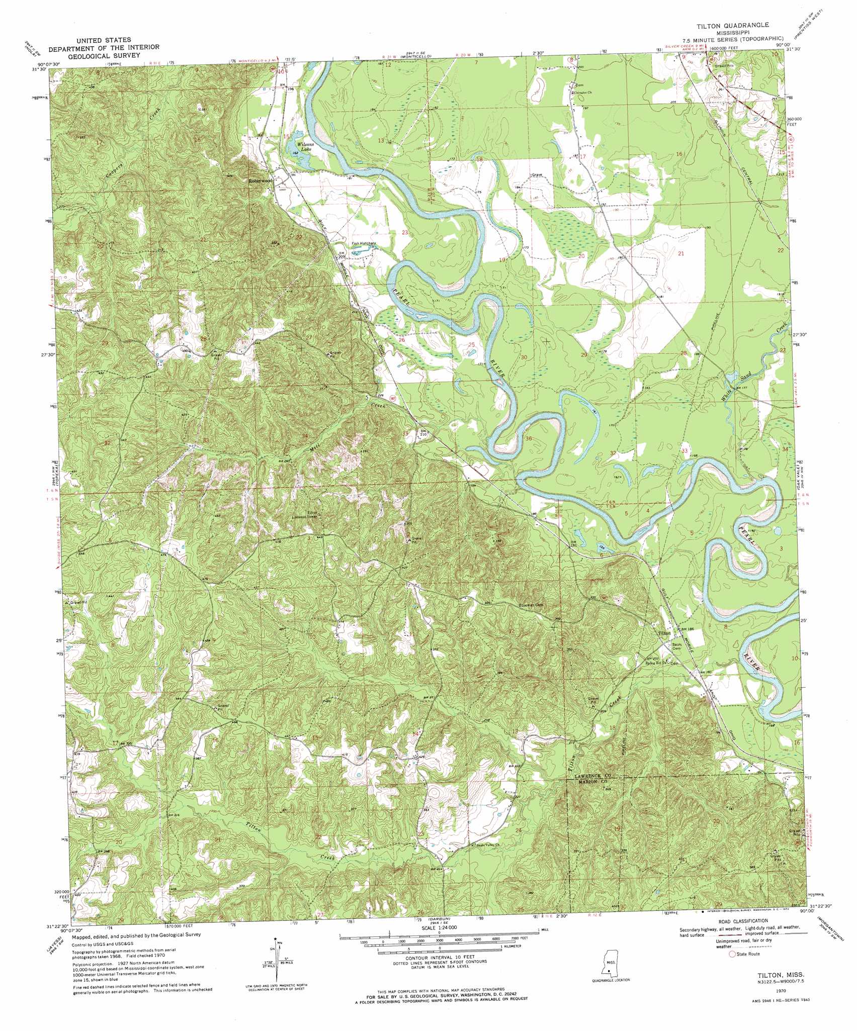
USGS Topo Quad 31090d1 - 1:24,000 scale
| Topo Map Name: | Tilton |
| USGS Topo Quad ID: | 31090d1 |
| Print Size: | ca. 21 1/4" wide x 27" high |
| Southeast Coordinates: | 31.375° N latitude / 90° W longitude |
| Map Center Coordinates: | 31.4375° N latitude / 90.0625° W longitude |
| U.S. State: | MS |
| Filename: | o31090d1.jpg |
| Download Map JPG Image: | Tilton topo map 1:24,000 scale |
| Map Type: | Topographic |
| Topo Series: | 7.5´ |
| Map Scale: | 1:24,000 |
| Source of Map Images: | United States Geological Survey (USGS) |
| Alternate Map Versions: |
Tilton MS 1970, updated 1972 Download PDF Buy paper map Tilton MS 2012 Download PDF Buy paper map Tilton MS 2015 Download PDF Buy paper map |
1:24,000 Topo Quads surrounding Tilton
Stronghope |
Oma |
Monticello Ne |
New Hebron |
Mount Carmel |
Fair Oak Springs |
Nola |
Monticello |
Prentiss West |
Prentiss East |
Ruth |
Topeka |
Tilton |
Oak Vale |
Bunker Hill |
Pricedale |
Jayess |
Darbun |
Morgantown |
Columbia North |
Holmesville |
Mesa |
Kokomo |
Sandy Hook Nw |
Columbia South |
> Back to 31090a1 at 1:100,000 scale
> Back to 31090a1 at 1:250,000 scale
> Back to U.S. Topo Maps home
Tilton topo map: Gazetteer
Tilton: Lakes
Wilsons Lake elevation 50m 164′Tilton: Populated Places
Robinwood elevation 65m 213′Tilton elevation 57m 187′
Tilton: Streams
Mill Creek elevation 49m 160′Tilton Creek elevation 44m 144′
White Sand Creek elevation 44m 144′
Tilton digital topo map on disk
Buy this Tilton topo map showing relief, roads, GPS coordinates and other geographical features, as a high-resolution digital map file on DVD: