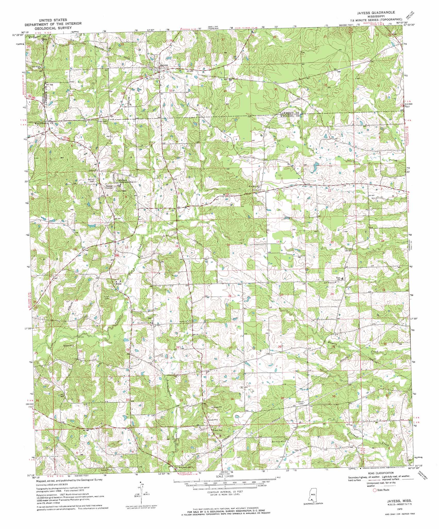
Jayess Topo Map Mississippi
To zoom in, hover over the map of Jayess
USGS Topo Quad 31090c2 - 1:24,000 scale
| Topo Map Name: | Jayess |
| USGS Topo Quad ID: | 31090c2 |
| Print Size: | ca. 21 1/4" wide x 27" high |
| Southeast Coordinates: | 31.25° N latitude / 90.125° W longitude |
| Map Center Coordinates: | 31.3125° N latitude / 90.1875° W longitude |
| U.S. State: | MS |
| Filename: | o31090c2.jpg |
| Download Map JPG Image: | Jayess topo map 1:24,000 scale |
| Map Type: | Topographic |
| Topo Series: | 7.5´ |
| Map Scale: | 1:24,000 |
| Source of Map Images: | United States Geological Survey (USGS) |
| Alternate Map Versions: |
Jayess MS 1970, updated 1972 Download PDF Buy paper map Jayess MS 2012 Download PDF Buy paper map Jayess MS 2015 Download PDF Buy paper map |
1:24,000 Topo Quads surrounding Jayess
Brookhaven |
Fair Oak Springs |
Nola |
Monticello |
Prentiss West |
Bogue Chitto |
Ruth |
Topeka |
Tilton |
Oak Vale |
Mccomb North |
Pricedale |
Jayess |
Darbun |
Morgantown |
Mccomb South |
Holmesville |
Mesa |
Kokomo |
Sandy Hook Nw |
Osyka |
Progress |
Tylertown |
Tylertown Se |
Dexter |
> Back to 31090a1 at 1:100,000 scale
> Back to 31090a1 at 1:250,000 scale
> Back to U.S. Topo Maps home
Jayess digital topo map on disk
Buy this Jayess topo map showing relief, roads, GPS coordinates and other geographical features, as a high-resolution digital map file on DVD: